National Enhanced Elevation Assessment
Assessment of the Business Requirements and Benefits of Enhanced National Elevation Data
National Enhanced Elevation Questionnaire.12.1a-2010docx
National Enhanced Elevation Assessment
OMB: 1028-0099
National Enhanced Elevation Questionnaire
Annotation: This section will provide general instructions for navigating through the questionnaire. The respondents will have the option of completing the questionnaire in one sitting or saving the completed sections and returning at another time to complete and submit the final responses.
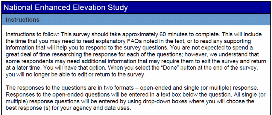 This
section will also explain the availability of tutorials and their
content. Because some of the terms used in this questionnaire will
be new to many of the respondents we are providing a supplemental
link that will contain definitions of terms and accepted industry
responses to a list of currently known Frequently Asked Questions
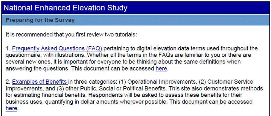
(FAQs). The respondents will be directed to the FAQ by highlighted
text in the questionnaire. Once they have finished with the text they
will be redirected back to the original question. A second tutorial
pertains to example benefits of digital elevation data, and methods
for estimating cost benefits.
PAPERWORK
REDUCTION ACT STATEMENT:
A Federal agency may not conduct or sponsor, and a person is not
required to respond to a collection of information unless it
displays a currently valid OMB control number. We estimate that it
should take about 1 hour to complete this survey. This includes the
time for reviewing instructions and completing the form. Please
direct any comments regarding this collection to Phadrea Ponds, USGS
Information Collection Officer, U.S. Geological Survey, 2150-C,
Center Avenue, Fort Collins, CO 80525. Control
Number: 1028-XXXX Expiration Date: XX/XX/XXXX
PRIVACY
ACT STATEMENT:
You are not required to provide your personal contact information in
order to submit your survey. However, if you do not provide contact
information, we may be unable to contact you for additional
information to verify your responses. If you do provide contact
information, this information will only be used to initiate
follow-up communications with you and will be deleted from our files
immediately afterwards. The records for this collection will be
maintained in the appropriate Privacy Act System of Records
identified as Computer Registration System. (INTERIOR/USGS-20)
published at 74 FR 23430 (May 19, 2009).
 Part
1: Your contact information
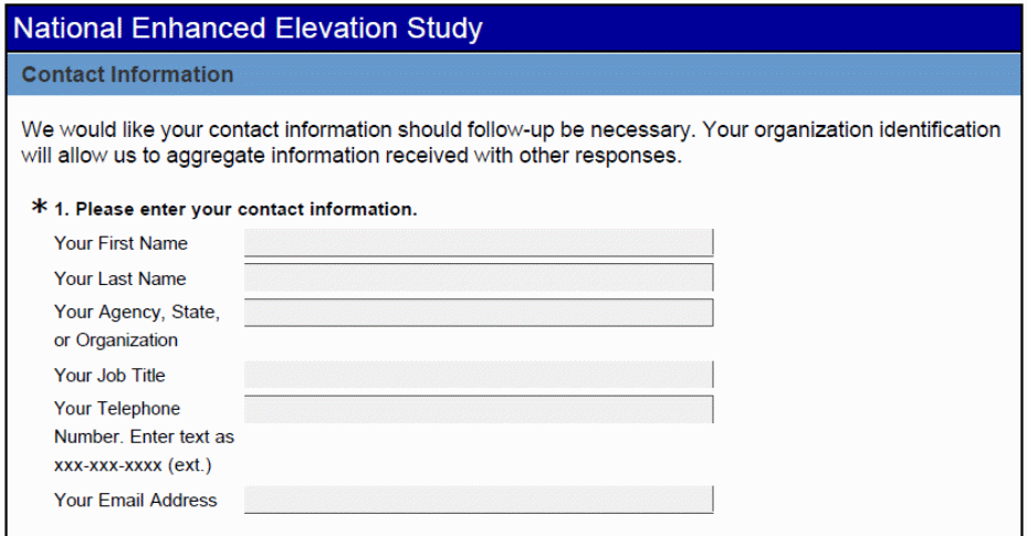
Annotation: In this section of the survey we will ask the respondents to provide contact information. This information will only be used should clarification be needed for responses to specific questions. We will also ask for user group information which will be used to analyze the results by user group.
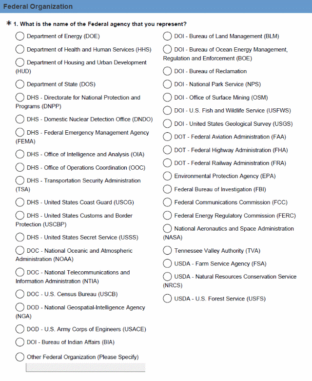 Part
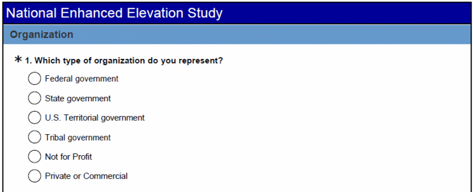
2: Your organization

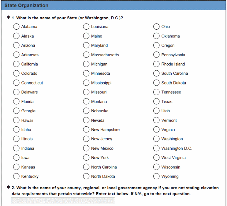


Part 3: Business Use and Functional Activity Requirements for Enhanced Elevation Data
Annotation: In this section of the survey, the respondents will identify their “mission critical” elevation data requirements, by geographic areas, for their Business Uses and Functional Activities. For the purpose of this survey, “mission critical” is defined as: indispensable for mission accomplishment and/or essential for effective/efficient operations in accomplishing the core mission of the organization.
This information is needed to identify “mission critical” requirements for enhanced elevation data at specified quality levels for user-defined geographic areas, to support user-defined Functional Activities for the pre-defined Business Use that most closely approximates the core mission of the organization stating the requirement.
Identification of Business Use and Functional Activity
Annotation: At this point the respondents will initially enter their primary Business Use and Functional Activity. The loop at the end of the survey will return here for entry of secondary and/or tertiary Business Uses and Functional Activities with different Quality Level and/or geographic area requirements. If there are no secondary or primary activities the respondents will move directly to the following section of the survey.
Business Use and
Functional Activity
In this part of the
questionnaire, we would like to learn about your Business Uses and
Functional Activities, supporting your Business Uses that require
enhanced elevation data. Your
first pass through this questionnaire will document your primary
Business Use and Functional Activity. You will be allowed to repeat
the questionnaire for secondary and tertiary Business Uses and/or
Functional Activities, if applicable.
Functional Activity: an
activity or process that uses some form of digital elevation data.
Including elevation derivatives and point cloud, to accomplish a
Business Use. Example: Farm pond design is an example of Functional
Activities for the Natural Resources Conservation Business Use.
Business Use: the
ultimate use of services or products from Functional Activities to
accomplish an organizational mission. Example: Natural Resource
Conservation.
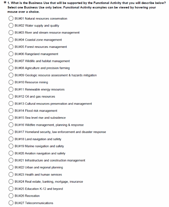

The table below is an example of the Functional Activities that the respondents will view when they hover the mouse over each Business Use listed above.
The following example Functional Activities can be viewed when hovering the mouse over each Business Use listed above.
Business Uses |
Examples of Functional Activities |
BU#01 Natural resources conservation |
Soils and wetland conservation; erosion control; rainfall penetration. Modeling of biological and ecological systems. |
BU#02 Water supply and quality |
Watershed assessment for protected water supplies. Runoff into streams, sedimentation analysis. Non-point source pollution modeling. |
BU#03 River and stream resource management |
Stream channel analysis and mapping. Stream bank erosion analysis. |
BU#04 Coastal zone management |
Analysis of coastal erosion and inundation. Hurricane storm surge and wind damage modeling and assessment. |
BU#05 Forest resources management |
Forest health assessment. Determination of standing inventory of forest resources. Analysis of carbon stocks for trade. Harvest systems planning. |
BU#06 Rangeland management |
Assessment of rangeland health. Mapping for soil erosion potential due to grazing. |
BU#07 Wildlife and habitat management |
Determination of wildlife habitat conditions based on forest stand profile and vegetation structure. |
BU#08 Agriculture and precision farming |
Farm pond design. Irrigation system design. Detailed site analysis to support precision farming. Analysis of farm sedimentation and runoff. |
BU#09 Geologic resource assessment & hazards mitigation |
Geologic mapping and analysis. Seismic fault analysis. Landslide hazard mapping and assessment. |
BU#10 Resource mining |
Open mine volume computations. Stockpile analysis. Environmental impact assessment and site restoration. |
BU#11 Renewable energy resources |
Assessment of roof tops for solar energy potential. Analysis of wind energy potential and planning of turbine placement on wind farms. Low head power potential for hydropower. |
BU#12 Oil and gas resources |
Site selection for wells and facilities. Construction planning. Pipeline routing. Environmental impact assessment and mitigation. |
BU#13 Cultural resources preservation and management |
Discovery and analysis of Native American and other historical cultural sites. Site protection and preservation planning. |
BU#14 Flood risk management |
Flood risk modeling and mapping of riverine and coastal areas. Dam/dike/levee safety analysis. |
BU#15 Sea level rise and subsidence |
Modeling the effects of sea level rise or subsidence. |
BU#16 Wildfire management, planning & response |
Determination of forest fuel and fire susceptibility. Fire behavior modeling to support wildfire suppression activities. Wildland/urban interface building identification. Post fire analysis to determine landslide prone areas. |
BU#17 Homeland security, law enforcement and disaster response |
Line of sight analysis in urban areas. Flood risk analysis resulting from acts of terrorism. Landslide risk assessment in urban areas. |
BU#18 Land navigation and safety |
Route selection for new roads. Slope analysis for smart cars. GPS navigation visualization. |
BU#19 Marine navigation and safety |
Nautical charting. Bathymetric measurements of near-shore submerged coastal topography. |
BU#20 Aviation navigation and safety |
Determination of in-flight hazards and path obstructions. Aeronautical charting. Runway construction and repair. |
BU#21 Infrastructure and construction management |
Water, sewer and powerline planning and analysis. Stormwater modeling. Cut and fill analysis for earth-moving. Building site analysis. Road infrastructure; dams, reservoirs and levees. |
BU#22 Urban and regional planning |
Park design and planning. Zoning. Building footprint mapping. Regional transportation planning. Virtual city creation. |
BU#23 Health and human services |
Malarial epidemiology based on standing water and terrain conditions. |
BU#24 Real estate, banking, mortgage, insurance |
Risk assessment for flood insurance. Building permit compliance. |
BU#25 Education K-12 and beyond |
Development of 3-D visualizations to help students understand the Earth they live on. |
BU#26 Recreation |
Trail and vista site planning. Orienteering. Golf course planning. Ski slope modeling/analysis. Recreational lake design. Hiking maps and guides. |
BU#27 Telecommunications |
Telecommunication tower site selection. Design of radio and radar systems. Interference analysis. Path profiles. |
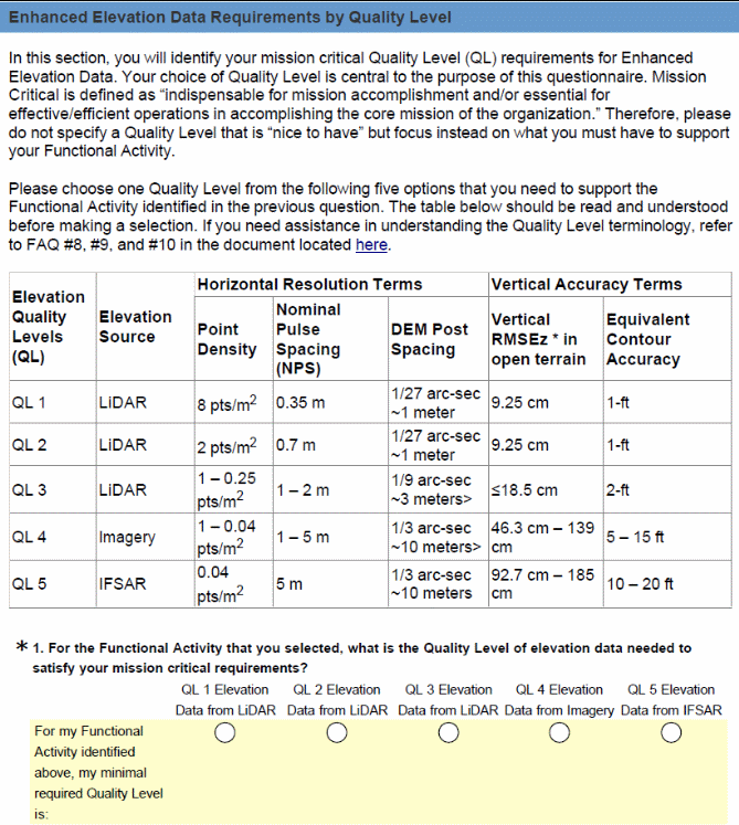
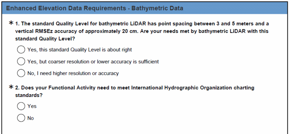
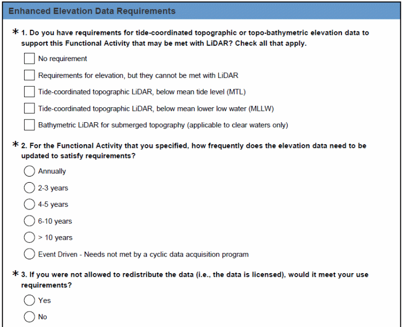
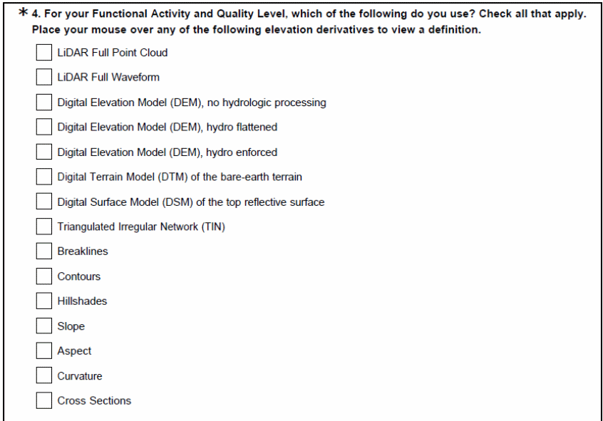
Identification of Quality Level Requirements
 Annotation:
Knowing mission critical requirements by Quality Level is central to
the purpose of this survey. This information will be used by the
USGS to determine elevation data density, DEM post spacing, nominal
pulse spacing and vertical accuracy needed to satisfy Functional
Activities and Business Uses. The frequency of elevation data updates
needed to satisfy requirements is important to know because of the
need to plan for maintenance of any elevation dataset that becomes
obsolete with age.

Identification of Geographic Area Requirements
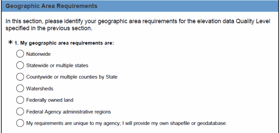 Annotation:
Because digital geospatial data uses shapefiles or geodatabases
to define polygons for geographic areas of interest, we need to
better understand geographic area requirements for elevation data at
the Quality Levels specified. The following question allows users to
submit their own shapefiles or geodatabases for geographic areas for
which their elevation Quality Level requirements pertain. For
inexperienced users, we also provide alternative means for explaining
geographic area requirements.
NOTE: The response to this question will lead directly to the appropriate follow-on examples below.
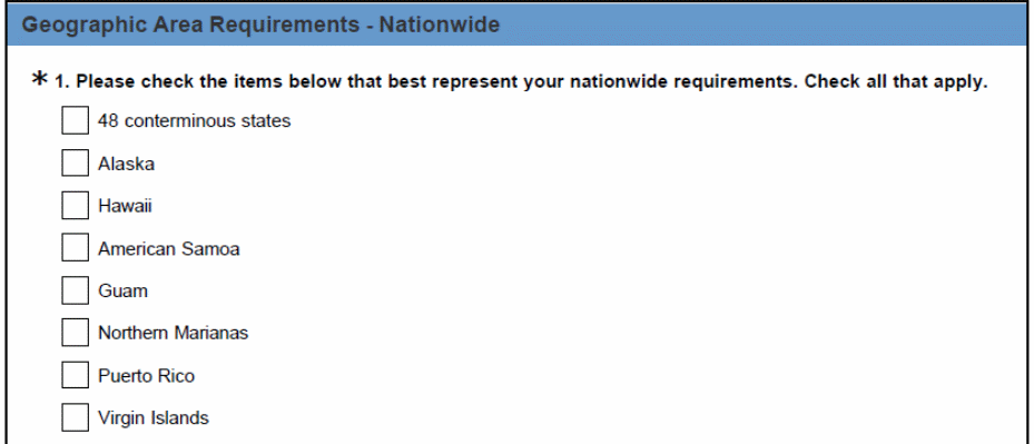 Geographic
Area Requirements – Nationwide
NOTE: At this point, if the respondent selects 48 conterminous states, for example they will be directed to the list of state below. Once they choose the state they will be directed to choose the counties within state for which elevation data is required.
NOTE: At this point, if the respondent selects Alabama, for example they will then be directed to the next screen where they will be able to choose the counties within Alabama for which elevation data is required. The screen shot below depicts an expanded list of counties in Alabama. This list would be similar for all other states in the sample; however, for the purpose of this demonstration we are using Alabama as an example.
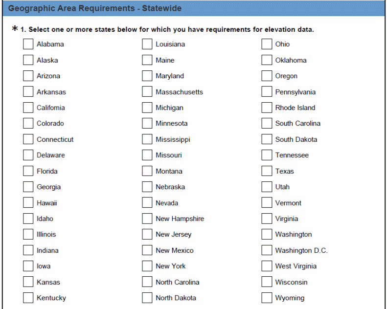
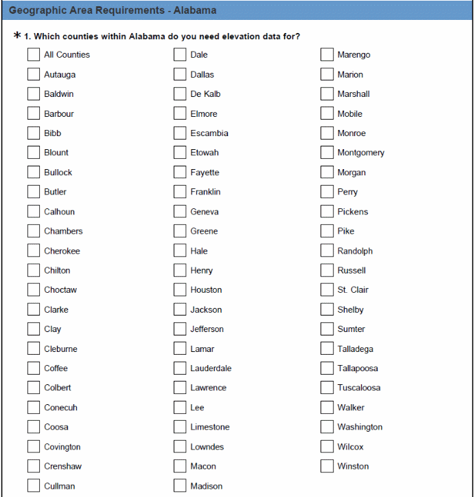 NOTE:
At this point, if the respondent selects Alabama, for example they
will then be directed to the next screen where they will be able to
choose the counties within Alabama for which elevation data is
required. The screen shot below depicts an expanded list of counties
in Alabama. This list would be similar for all other states in the
sample; however, for the purpose of this demonstration we are using
Alabama as an example.
NOTE: A user may now select counties within another state. The survey will continue to follow a looping pattern until the respondent selects “NO” to this question. Once the respondent selects “NO” the looping pattern will be broken and the respondent will be automatically directed to the question below.

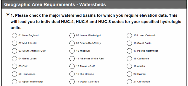 Geographic
Area Requirements – Watersheds
Note: If the respondent checks New England, for example, they will be taken to a list of hydrologic units for this watershed basin (shown in the list on the next page).
The respondents will be allowed to choose more than one watershed location per geographical area. If additional major watershed basins are selected, the respondents will follow a looping pattern similar to the one described above for the state and county locations. Once the looping pattern is complete the respondents will be automatically directed to the questions in the next section.
For the purpose of this demonstration, the expanded list of hydrologic units in all other major watershed basins has been removed to shorten this version of the questionnaire.
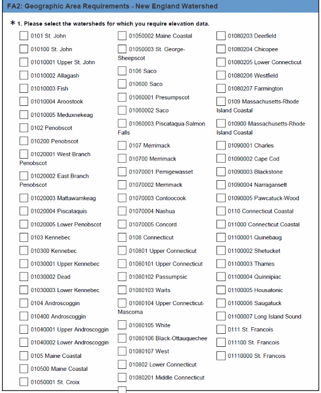
NOTE: The responded may now select an additional watershed. The survey will continue to follow a looping pattern until the respondent selects “NO” to this question. Once the respondent selects “NO” the looping pattern will be broken and the respondent will be automatically directed to the section.

Geographic Area Requirements – Federal Lands
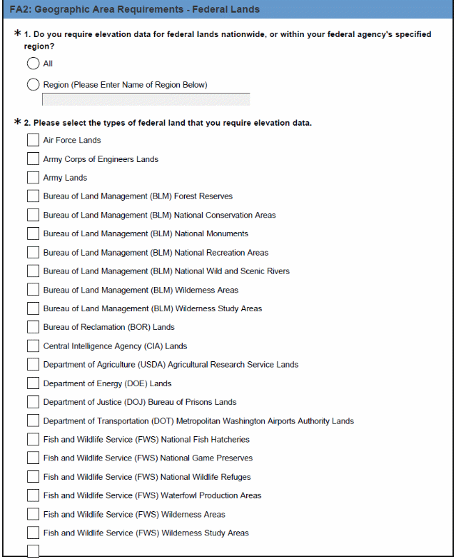

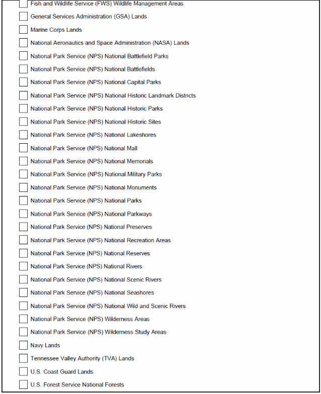
Geographic Area Requirements – Federal Agency Region

Geographic Area Requirements – Unique

Part 4: Benefits of Enhanced Elevation Data
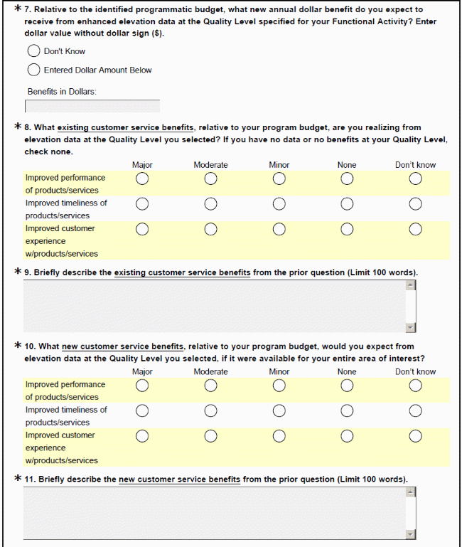
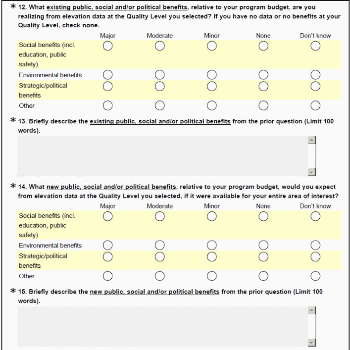
Annotation: The following questions will be used to collect information concerning the programmatic benefits for elevation data in three major benefit categories: (1) operational benefits, (2) customer service benefits, and (3) other public, social and/or political benefits. The distinction is made between current and future benefits at the specified Quality Level because cost-benefit analysis must distinguish between benefits currently being realized from existing elevation data and future benefits to be derived from enhanced elevation data.
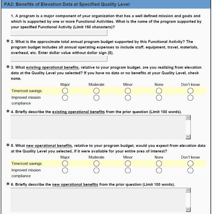
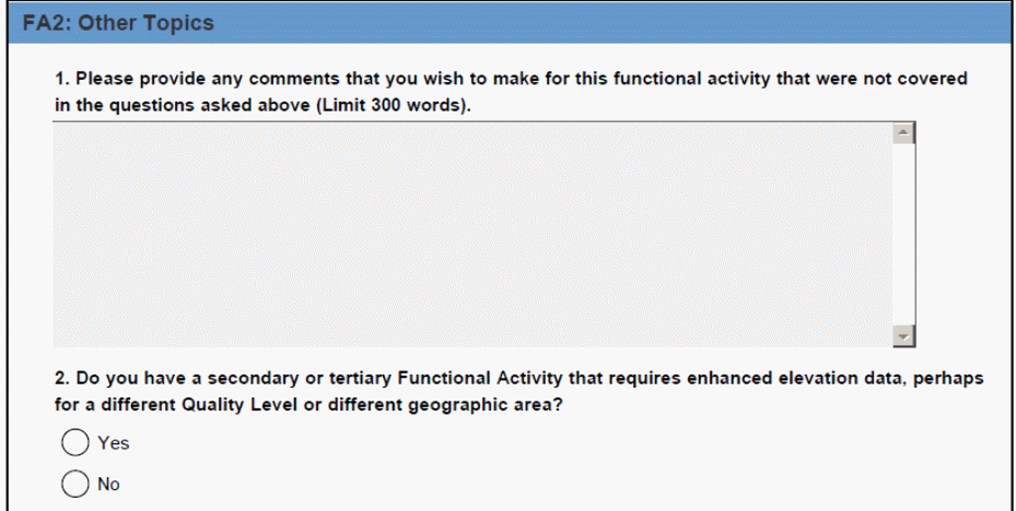
If “Yes,” the respondent is returned to a secondary or tertiary Business Use or to the same Business Use having a different Functional Activity with different Quality Level and/or geographic area requirements.
If “No,” the respondent is notified that the survey is complete.

| File Type | application/vnd.openxmlformats-officedocument.wordprocessingml.document |
| Author | pondsp |
| File Modified | 0000-00-00 |
| File Created | 2021-02-01 |
© 2026 OMB.report | Privacy Policy