Draft FRA Guide for Preparing U.S. DOT Crossing Inventory Forms
Draft Revised Crossing Inventory Guide 10-10-2012.doc
National Highway-Rail Crossing Inventory Reporting Requirements
Draft FRA Guide for Preparing U.S. DOT Crossing Inventory Forms
OMB: 2130-0017
DRAFT
FRA Guide for Preparing
U.S. DOT Crossing Inventory Forms
October 2012
U.S. Department of Transportation
Federal Railroad Administration
Office of Railroad Safety
DOT/FRA/RRS-23
Published: XXXX
Effective: XXX
MAIL INVENTORY SUBMISSIONS TO:
FRA Project Office
2600 Park Tower Drive, Suite 1000
Vienna, VA 22180
Please refer to http:// for “Changes in Inventory Reporting” for updated information.
Table of Contents
I. Introduction 1
II. Instructions for Completing the U.S. DOT Crossing Inventory Form 2
1. Header Information: 2
2. Part I – Location and Classification Information 6
3. Part II – Railroad Information 21
4. Part III – Highway Traffic Control Device Information 26
5. Part IV – Physical Characteristics 37
6. Part V – Public Highway Information 42
APPENDIX A – U.S. DOT Crossing Inventory Form A-1
APPENDIX B – Crossing Inventory Responsibility Table B-1
APPENDIX C – Reporting Crossings that have Multiple Operating Railroads C-1
APPENDIX D – Definitions D-1
APPENDIX E – Frequently Asked Questions (FAQs) E-1
APPENDIX F – High Speed Rail ID Corridor Designations and Codes F-1
I.Introduction
This Guide is intended to provide guidance to States and railroads on completing the U.S. DOT Crossing Inventory Form (Inventory Form) for public, private, and pathway crossings.
The type of crossing will dictate which parts of the Inventory Form must be completed by railroads for the initial reporting of new and previously unreported public, private, and pathway crossings. The Inventory Form will be considered “completed”, if the following parts of the Inventory Form are completed:
Public Highway-Rail Crossing: Complete entire Inventory Form;
Private Highway-Rail Crossing: Complete Header, plus Part I of the Inventory Form and the Submitter Information data field;
Pathway Crossing: Complete Header, plus Part I of the Inventory Form as appropriate and the Submitter Information data field;
Grade-separated Crossing: Complete Header, plus Part I of the Inventory Form and the Submitter Information data field.
Hard Copy Submission
Hard copies of completed Inventory Forms should be mailed to:
Inventory Crossing Updates
FRA Project Office
ActioNet Inc.
2600 Park Tower Drive, Suite 1000
Vienna, VA 22180
Electronic Submission
Completed Inventory Forms may also be submitted electronically to the U.S. DOT National Highway-Rail Crossing Inventory. Detailed instructions for the electronic submission of Inventory Forms can be found in the Electronic Submission Instructions.
II.Instructions for Completing the U.S. DOT Crossing Inventory Form
All Header data must be entered by the Reporting Agency

Figure 3-1: U.S. DOT-FRA Crossing Inventory Form Heading
Instructions
A brief set of instructions has been provided at the top of the Form.
A. Revision Date:
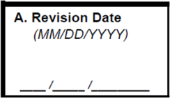
Figure 3-2: U.S. DOT-FRA Crossing Inventory Form Heading, Item A
Enter the date that the revision is being submitted in MM/DD/YYYY format. Example: July 23, 2010 would be entered as 07/23/2010.
B. Reporting Agency:
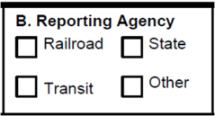
Figure 3-3: U.S. DOT-FRA Crossing Inventory Form Heading, Item B
Enter a check mark in the appropriate box to indicate the type of agency that is submitting the update or the establishment of a new crossing.
C. Reason for Update:

Figure 3-4: U.S. DOT-FRA Crossing Inventory Form Heading, Item C
Check only one box to indicate the primary reason for the change.
The ten check box selections account for the various reasons for submitting an update. These include the following:
Change in Data – Any change in any of the data elements associated with crossings contained in the National File.
New Crossing – An active crossing that is not currently in the National File. This could be either a new crossing or one that was previously unreported.
Closed – A location where a crossing has been physically removed, or where rail operations, pathway traffic, or highway traffic is not possible.
Abandoned – A crossing located on a segment of track that has been abandoned by the railroad pursuant to authority granted by the Surface Transportation Board.
Out-of-Service/Inactive – A crossing through which trains no longer operate or which is no longer maintained for train traffic.
Re-Open – A closed crossing that has been placed into active service again.
Date Change Only – An update to indicate that all the current information is still correct.
Operating RR Transfer – Any change in operating railroad responsibility.
Admin. Correction – A correction to data that is currently contained in the National File. This box should be checked for corrections of data previously submitted in error.
Quiet Zone Update – Any change to the quiet zone status for that crossing.
D. DOT Crossing Inventory Number

Figure 3-5: U.S. DOT-FRA Crossing Inventory Form Heading, Item D
Enter a valid Inventory Number (6-digits followed by an alpha character). Please refer to Appendix A for an explanation about how to obtain Inventory Numbers for new and previously unreported crossings.
For new or previously unreported crossings, the assignment of an Inventory Number occurs when the number is placed on a completed Inventory Form by the responsible railroad and the completed Inventory Form is submitted for inclusion in the U.S. DOT National Highway-Rail Crossing Inventory.
Note: Once assigned, the Inventory Number stays with that location forever. If the crossing is eventually closed, the Inventory Number and data at the time of closure remains in the File. If the crossing is reopened at the same location, the same Inventory Number must be used again.
Inventory Number Assignment:
Only one Inventory Number may be assigned to a crossing even if the individual tracks belong to more than one Railroad Company or track owner.
Crossing on Multi-lane roads:
A crossing on a multi-lane roadway shall be reported as a single crossing and there shall only be one Inventory Number assigned even if a railroad track moves diagonally across a highway/highway intersection.
Crossings on Private Company or Railroad Property:
Where there is more than one crossing in a railroad yard or an area belonging to a private company, a port, or a dock area, one Inventory Number may be assigned to include all crossings within the private property limits. In addition, one Inventory Number may be used for multiple pathway crossings contained within a railway station.
Diagonal Crossing through a Highway-Highway Intersection:
When the railroad tracks run diagonally through a highway-highway intersection, thus bisecting the two roadways, only one Crossing Inventory Number is to be
assigned and the names of both roadways are to be identified in the Street/Road Name data field, if they will fit (26 characters).
Highway Bridge Grade-Separated Crossings:
When roadways have highway bridge structures that are grade-separated crossings (usually two separate bridges each used for highway traffic in opposite directions), assign one number to each structure if the bridge structures are separated by 100 feet or more. If the bridge structures are less than 100 feet apart, one or two numbers may be assigned in accordance with State policy. Assign only one Crossing Inventory Number for bridge structures that are connected or considered to be one structure for both directions of highway traffic.
Conversion of an At-Grade Crossing to Grade-Separated:
When an at-grade crossing is replaced with a grade separation, the at-grade crossing shall be closed and a new crossing inventory number assigned to the grade separation. In the Narrative, it is advisable to indicate something like “Replaces at-grade crossing with DOT Number ######X.
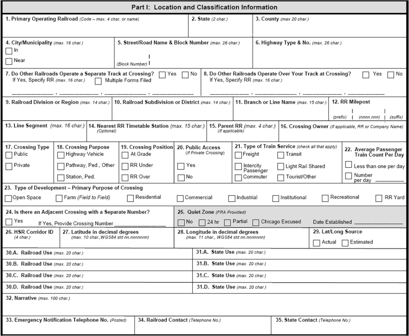
Figure 3-6: U.S. DOT-FRA Crossing Inventory Form Part I, Location and Classification Information
Primary Operating Railroad

Figure 3-7: U.S. DOT-FRA Crossing Inventory Form Part I, Item 1
Enter the valid, railroad code (up to four letters) for the "Primary Operating Railroad” company.
The primary operating railroad may or may not own and maintain the roadbed, tracks,
and signal system controlling the crossing. If the primary operating railroad company is not the owner of the track, enter the owner's name in Item 16, Crossing Owner.
A plant railroad is not required to submit inventory records; however, if it chooses to do so, then it is the Primary Operating Railroad.
Note:
Valid railroad codes are assigned by FRA. If the valid Railroad or Company Code is not known, the initiator should contact FRA to obtain the correct code, or to have a new code assigned for a new Railroad or Company. In the latter case, the complete railroad company name, address, telephone number, and a contact person are required. To contact FRA about Railroad or Company codes, send an e-mail to: [email protected].
State

Figure 3-8: U.S. DOT-FRA Crossing Inventory Form Part I, Item 2
Enter the two-character United States Postal Service (USPS) abbreviation for the State where the crossing is located.
If the crossing is located on a State boundary so that parts of the crossing lie in two or
more States, agreement must be made between the two States as to which will claim the crossing for inventory record purposes and that State’s abbreviation must be shown. When a crossing is located on a State line, it is suggested that the crossing be inventoried by, and shown as in, the State that is geographically south or east of the crossing.
County

Figure 3-9: U.S. DOT-FRA Crossing Inventory Form Part I, Item 3
Enter the first 20 characters of the name of the county (or parish) where the crossing is located. The county must be in the state identified in Part I, Item 2.
If the crossing is on a county line so that parts of the crossing lie in two or more counties, a decision must be made to place it in only one county. When a crossing is
located on a county line, it is suggested that the crossing be shown as in the county that
is geographically south or east of the crossing.
City/Municipality

Figure 3-10: U.S. DOT-FRA Crossing Inventory Form Part I, Item 4
Enter a check mark to indicate if the crossing is located “In” or “Near” the specified city.
If the crossing is not within the boundaries of a city, town, or village, enter a check mark in the box for “Near.” If “Near” is checked, the City must be in the State identified in Item 2, but it does not have to be in the County identified in Item 3. County.
If the crossing is located within the boundaries of a city, town, or village, enter the name of the city, town, or village in which the crossing is located (maximum of 16 characters). The city must be in the county identified in Part I, Item3.
If parts of the crossing lie in two or more cities, identify only one city. When a crossing is located between two cities, it is suggested that the crossing be shown as located in the City that is geographically south or east of the crossing.
Street / Road Name and Block Number

Figure 3-11: U.S. DOT-FRA Crossing Inventory Form Part I, Item 5
The block number field is optional. In order to complete this field, enter the block number (up to 6 characters) of the street or road where the crossing is located in the left side of the box. For example, if the closest building has an address of “4285,” then the block number is “4200.”
On the right side of the box, enter the first 26 characters of the street or road name.
If the roadway is private and it has a name, enter the name of the road or the owner's name. Otherwise, if such information is unknown, enter "private."
Highway Type and Number

Figure 3-12: U.S. DOT-FRA Crossing Inventory Form Part I, Item 6
Enter the type and number of highway or roadway, such as Interstate (I), U.S. numbered routes (US), State roadways (ST or SH), county roads (C) or (CR), local city streets (L or LS), local roads (LR), toll roads (TL), state loop/spur (SL), farm to market (FM) etc., and the number. Abbreviate, as I-95, US-1, ST-234, C-2096, etc. The number of the highway should be posted on the highway and found on State or county maps. If there is more than one number, enter the most important route, or all the numbers separated by a comma.
Do Other Railroads Operate a Separate Track at Crossing?

Figure 3-13: U.S. DOT-FRA Crossing Inventory Form Part I, Item 7
Enter a check mark in the appropriate box to indicate if another railroad operates a separate track at the crossing. If “Yes,” enter the FRA railroad code for all railroads that operate a separate track within the same pair of warning devices at the crossing. A total
of four railroad codes may be entered with up to four characters each in this field.
Enter a check mark in the box for “Multiple Forms Filed” if multiple railroads have agreed to file their own separate inventory information for the crossing.
Do Other Railroads Operate Over Your Track at Crossing?

Figure 3-14: U.S. DOT-FRA Crossing Inventory Form Part I, Item 8
Enter a check mark in the appropriate box to indicate if another railroad operates over the reporting railroad’s track at the crossing. If “Yes,” enter the FRA railroad code for all railroads that operate trains over the track at the crossing. A total of four railroad codes may be entered with up to four characters each in this field.
Railroad Division or Region

Figure 3-15: U.S. DOT-FRA Crossing Inventory Form Part I, Item 9
Enter the name of the division, region, or major district, if the railroad system is divided into such groups. Otherwise, leave blank.
Railroad Subdivision or District

Figure 3-16: U.S. DOT-FRA Crossing Inventory Form Part I, Item 10
Enter the name of the subdivision or other classification, if the railroad system is divided into such groups. Otherwise, leave blank.
Branch or Line Name

Figure 3-17: U.S. DOT-FRA Crossing Inventory Form Part I, Item 11
Enter the name of the branch or line used by the railroad to describe this segment of track. For example, if the track is an industry lead, industry spur, yard lead, or wye, enter the name of the track or the name of the industry. If the Branch/Line does not have a specific name, leave this Item blank.
RR Milepost

Figure 3-18: U.S. DOT-FRA Crossing Inventory Form Part I, Item 12
Enter the railroad milepost number in miles and thousandths of miles (5.3 feet is approximately 1/1000 mile). Enter the number with the decimal point in the following format: (nnnn.nnn). If this accuracy is not attainable, then enter the milepost in miles and hundredths of miles (53 feet is approximately 1/100 mile). Enter the prefix or suffix identified with the milepost if it has one or both.
Line Segment ID

Figure 3-19: U.S. DOT-FRA Crossing Inventory Form Part I, Item 13
Enter the railroad identification number for the line segments if the railroad has such a system. If the crossing has an identification number other than the DOT number, such as a State agency number (e.g., a Public Utility Commission (PUC) assigned number), that number may be entered here or in one of the “State Use” fields (Items 31. A - D). This field is optional.
Nearest RR Timetable Station

Figure 3-20: U.S. DOT-FRA Crossing Inventory Form Part I, Item 14
Enter the name of the nearest timetable station for the primary operating railroad company. This field is optional.
Parent RR
Figure 3-21: U.S. DOT-FRA Crossing Inventory Form Part I, Item 15
If applicable, enter the code for the parent railroad or the company that is parent to the operating railroad entered in Part I, Item 1, Primary Operating Company. The entry must be a valid railroad or company code, which can be obtained from FRA. This field is optional.
Crossing Owner

Figure 3-22: U.S. DOT-FRA Crossing Inventory Form Part I, Item 16
If applicable, enter the code for the crossing owner (maximum of four characters), that is, the name of the entity that actually owns the property. The entry must be a valid railroad, company, or agency code. If unknown, it can be obtained from FRA. This field is optional.
Crossing Type
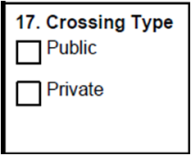
Figure 3-23: U.S. DOT-FRA Crossing Inventory Form Part I, Item 17
If this crossing is a public crossing, check the “Public” box. If the crossing is private, check the “Private” box.
Crossing Purpose
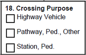
Figure 3-24: U.S. DOT-FRA Crossing Inventory Form Part I, Item 18
If the crossing is primarily for motor vehicles, check the “Highway Vehicle” box. If the crossing is primarily for pedestrians, bicycles, and other non-highway traffic, check the “Pathway, Ped., Other box”. If the crossing is within a railway station, check the “Station, Ped. Box”.
Crossing Position
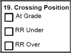
Figure 3-25: U.S. DOT-FRA Crossing Inventory Form Part I, Item 19
If the crossing is at the same level as the road or pathway, check the “At Grade” box. If the railroad passes under the roadway or pathway, check the “RR Under” box. If the railroad passes over the roadway or pathway, check the “RR Over” box.
Public Access at Private Crossing
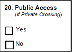
Figure 3-26: U.S. DOT-FRA Crossing Inventory Form Part I, Item 20
Public Access means that the primary purpose of the crossing is to provide access to facilities, either public or privately owned. Examples of such facilities include shopping centers, fairgrounds, parks, schools, libraries, hospitals, clinics, airports, bus terminals, beaches, piers, boat launching ramps, and recreational areas.
Enter a check in the box to indicate “Yes” if there is public access at the private crossing or “No” if there is not.
Type of Train Service
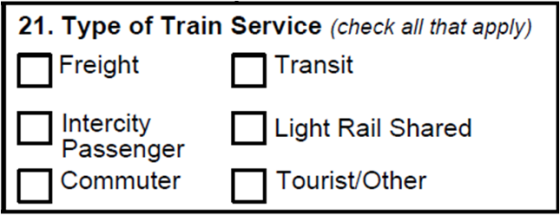
Figure 3-27: U.S. DOT-FRA Crossing Inventory Form Part I, Item 21
Check each box that describes the type of rail service that uses the crossing. Check all that apply. The types included are:
Freight
Intercity Passenger
Commuter – a local or regional rail system providing passenger service mostly during the morning and evening peak periods on the general rail system.
Transit – a local rail system providing passenger service within an urban area that is not connected to the general rail system
Light Rail Shared – a local light rail system providing passenger service on the general rail system, typically through temporal separation
Tourist/Other – tourist, scenic, historic, or excursion operations that carry passengers with the conveyance of the passengers to a particular destination not being the principal purpose.
Average Passenger Train Count Per Day
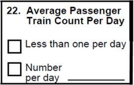
Figure 3-28: U.S. DOT-FRA Crossing Inventory Form Part I, Item 22
Enter the average number of total passenger trains using this crossing, per day, on a typical operating day. Intercity passenger, commuter, transit and light rail shared trains are all included in determining the average number for this field. The value may not exceed the sum of the total train count in Part II, Item 1, Estimated Average Number of Daily Train Movements. If the average passenger train count is less than one per day (for example, “three per week”) check the “Less than one per day” box. If “Freight” is the only type of train service that is checked in Part I, Item 21, Type of Train Service, then the average passenger train count per day must be 0.
Type of Development – Primary Purpose of Crossing
![]()
Figure 3-29: U.S. DOT-FRA Crossing Inventory Form Part IV, Item 1
Check the box which best describes the predominant type of land development in the vicinity (a distance of up to 1000 feet) of the crossing based on the following categories:
Open Space (sparsely or undeveloped, lightly populated)
Farm (Agricultural area)
Residential (Built-up residential area)
Commercial (Retail stores and businesses, offices and personal services);
Industrial (Manufacturing, construction, heavy products, factories and warehouses)
Recreational (Playgrounds, parks, swim or golf clubs)
Institutional (Schools, churches, hospitals, military, educational, religious, health, etc., type of facilities).
RR Yard (Self-explanatory).
Is there an Adjacent Crossing with a Separate Number?

Figure 3-30: U.S. DOT-FRA Crossing Inventory Form Part I, Item 23
Enter a check in the “Yes” box to indicate that there is an adjacent crossing with a separate number. If there is, enter the valid crossing number. If there is not an adjacent crossing, then do not make an entry for this item.
Quiet Zone

Figure 3-31: U.S. DOT-FRA Crossing Inventory Form Part I, Item 24
Leave this field blank because FRA will populate this field with information from Notices of Quiet Zone Establishment, or Continuation, that have been received. This item will indicate whether a quiet zone is in effect for the crossing. If a quiet zone is in effect, this item will indicate if it is for 24 hours per day or only a partial day (usually 10 p.m. to 7 a.m.) This item is for public, private, and pedestrian crossings. If the crossing is not located in a Quiet Zone, the No box will be checked. If it is located in a 24-hour Quiet Zone, the “24 hr” box will be checked. If it is located in a partial Quiet Zone, the “Partial” box will be checked. If it is in a “Chicago Excused” area (those crossings in the Chicago area that are currently excused from the Train Horn Rule), the “Chicago Excused” box will be checked. The effective date that was provided in the Notice of Establishment will be in the “Date Established.”
HSR Corridor ID

Figure 3-32: U.S. DOT-FRA Crossing Inventory Form Part I, Item 25
If this is a High Speed Rail (HSR) crossing, enter the four-character HSR Corridor ID as defined in APPENDIX F of this manual. This field is optional.
Note: This field is used to identify the "Section 1010" or “Section 1103" high-speed rail corridor on which the crossing is located. If the crossing is located on such a corridor,
enter the High Speed Rail (HSR) Corridor Identifying Code, a four character code (ABC#) as defined in APPENDIX G to this manual. The corridor may be divided into logical sections by including a numeric number (1 - 9) for the "#" character. If a numeric number is not used, replace "#" with "X". FRA will assign an HSR ID Code for any corridor, or portion thereof that is not currently defined in the Appendix.
Latitude

Figure 3-33: U.S. DOT-FRA Crossing Inventory Form Part I, Item 26
Enter the latitudinal coordinate as measured at the center of the crossing. This field, along with Longitude, is used to identify the crossing location using a standardized GPS (Global Positioning System) location point. The Latitude must be entered in decimal form as (nnn.nnnnnnn), with at least five digits to the right of the decimal point (which is accurate to four feet). We will accept up to seven places to the right of the decimal point.
Actual latitude measurements can be obtained either with a GPS device at the crossing location, or by using an Internet mapping program, such as Google Maps or Bing Maps. To find latitude and longitude on Google Maps, zoom in on the location of the crossing, right click on the crossing and select “What’s Here?” The coordinates will appear in the search bar above the map, with the latitude measurement listed first. In Bing Maps, right click on the crossing and select the gray box that either says “location” or identifies the closest street address. The coordinates will appear under the address to the left of the map, with the latitude listed first.
To convert latitude values from degrees, minutes, seconds to decimal form:
Latitude in Decimal Format = Degrees + (Minutes divided by 60) + (Seconds divided by 3600)
Latitude Coordinate Ranges within the continental United States are from 24 to 49 degrees. Alaska Latitude values range from 50 to 71.
Note: The FRA Office of Safety uses the WGS-84 (World Geodetic System 1984) datum standard. (A datum is the measurement [shape] of the earth's ellipsoid.) The WGS-84 is the international version of the NAD-83 Standard (North American Datum 1983). The standard datum for the United States National Grid (USNG) is the North American Datum 1983 (NAD-83) or its international equivalent, the World Geodetic System 1984 (WGS-84). Federal government mapping agencies have adopted the NAD-83 as the US National Standard. However, many existing maps are still referenced
to the North American Datum 1927 (NAD-27). When it is necessary to identify a point on NAD-27 Standard, the coordinates of a point are designated by "(NAD-27)" after the coordinate. Coordinates in NAD-83 have nothing behind them - NAD-83 is implied. The USNG is identical to the Military Grid Reference System (MGRS) and is designed for use with the WGS-84 over U.S. areas and with NAD-83.
Longitude

Figure 3-34: U.S. DOT-FRA Crossing Inventory Form Part I, Item 27
Enter the longitudinal coordinate as measured at the center of the crossing. This field, along with Latitude, is used to identify the crossing location using a standardized GPS (Global Positioning System) location point. The Longitude must be entered in decimal form as (nnn.nnnnnnn), with at least five digits to the right of the decimal point (which is accurate to four feet). We will accept up to seven places to the right of the decimal point.
Actual longitude measurements can be obtained either with a GPS device at the crossing location, or by using an Internet mapping program, such as Google Maps or Bing Maps. To find latitude and longitude on Google Maps, zoom in on the location of the crossing, right click on the crossing and select “What’s Here?” The coordinates will appear in the search bar above the map, with the longitude measurement listed second. In Bing Maps, right click on the crossing and select the gray box that either says “location” or identifies the closest street address. The coordinates will appear under the address to the left of the map, with the longitude listed second.
To convert longitude values from degrees, minutes, seconds to decimal form:
Longitude in Decimal Format = Degrees + (Minutes divided by 60) + (Seconds divided by 3600)
Longitude Coordinate Ranges within the continental United States are from -66to -124 degrees. Alaska Longitude values range from -165to -132.
Note: The FRA Office of Safety uses the WGS-84 (World Geodetic System 1984) datum standard.
Lat/Long Source

Figure 3-35: U.S. DOT-FRA Crossing Inventory Form Part I, Item 28
Enter a check in the appropriate box to indicate the source, “Actual” or “Estimated,” for the Latitude and Longitude coordinate values being provided.
Actual values are those where GPS measurements are taken at the crossing or determined by a positive identification method. Latitude and Longitude values, in general, should be measured at the center of the highway-rail crossing. Google or Bing maps may be used to obtain the values, which have been shown to be accurate enough to be considered as ACTUAL.
Otherwise, the values are indicated as Estimated. Any values provided after [INSERT EFFECTIVE DATE OF FINAL RULE] must be actual values.
Railroad Use

Figure 3-36: U.S. DOT-FRA Crossing Inventory Form Part I, Item 30
The railroad may enter any text or data of its choice in these fields. No editing will be performed on these fields. These fields are optional.
State Use

Figure 3-37: U.S. DOT-FRA Crossing Inventory Form Part I, Item 31
The State may enter any text or data of its choice in these fields. No editing will be performed on these fields. If a State has a separate PUC number for a crossing, the State may wish to use one of these fields for this purpose. (For those States that have used the RR I.D. field for this in the past, FRA will move that data to Item 31.A. if requested.) These fields are optional.
Narrative
![]()
Figure 3-38: U.S. DOT-FRA Crossing Inventory Form Part I, Item 32
Enter any narrative comments desired in this field. No editing will be performed on this field. This field is optional.
Emergency Notification Telephone No. (Posted)
![]()
Figure 3-39: U.S. DOT-FRA Crossing Inventory Form Part I, Item 33
Enter the telephone number (area code and phone number using only numeric values) for the Emergency Notification System (ENS) Contact (e.g., usually Railroad Police, Dispatch Center, or other Railroad Emergency Contact) associated with the crossing. Normally, this will be the ENS telephone number used by the railroad and posted at the crossing and publicizes for the reporting of emergencies, malfunctions, and problems at crossings. This posting is now required by 49 CFR Part 234 Subpart E. This field can be mass updated by contacting the FRA.
Primary Railroad Contact (Telephone No.)

Figure 3-40: U.S. DOT-FRA Crossing Inventory Form Part I, Item 34
Enter the telephone number (area code and phone number using only numeric values) of the primary operating railroad point of contact associated with the crossing. This field can be updated in mass by contacting the FRA.
State Contact (Telephone No.)

Figure 3-41: U.S. DOT-FRA Crossing Inventory Form Part I, Item 35
Enter the telephone number (area code and phone number using only numeric values) of the State highway contact associated with the crossing. This would normally be the State Inventory Contact or the State DOT Engineering Contact (such as the Section 130
State Contact) responsible for crossing improvement projects. This field can be updated in mass by contacting the FRA.

Figure 3-42: U.S. DOT-FRA Crossing Inventory Form Part II, Items 1-6
Estimated Average Number of Daily Train Movements

Figure 3-43: U.S. DOT-FRA Crossing Inventory Form Part II, Items 1A-1E
1A. Total Day Thru Trains (6 AM to 6PM)
Enter the total of the number of through (thru) trains per day (daylight 6 am - 6 pm) that operate through the crossing during normal railroad operating periods. Through Trains are trains whose primary responsibility is to operate over a route with defined beginning and end points. Include the total number of train movements for all railroads that are operating through the crossing unless there is joint reporting by multiple operating railroads. If there is joint reporting by multiple operating railroads, enter only the total number of trains for the reporting railroad.
1B. Total Night Thru Trains (6 PM to 6AM)
Enter the total of the number of through trains per night (6 pm - 6 am) that operate through the crossing during normal railroad operating periods. Through Trains are trains whose primary responsibility is to operate over a route with defined beginning and
end points. Include the total number of train movements for all railroads that are operating through the crossing unless there is joint reporting by multiple operating
railroads. If there is joint reporting by multiple operating railroads, enter only the total number of trains for the reporting railroad.
1C. Total Day Switching Trains (6 AM to 6PM)
Enter the number of total day switching trains through the crossing per day (6 a.m. to 6 p.m.). “Switching Trains” are those trains whose movements primarily involve the pickup and set-out of cars for various industries and/or rail yards.
Each movement in one direction counts as one train movement. All locals, industrial runs and switch engines would be classified as switching movements. However, do not include such trains when they travel over the crossing like a through train to get to their destination to perform their switching operations. Those trains are to be considered as thru trains. Include the total number of train movements for all railroads that are operating through the crossing unless there is joint reporting by multiple operating railroads. If there is joint reporting by multiple operating railroads, enter only the total number of trains for the reporting railroad.
1D. Total Night Switching Trains (6 PM to 6AM)
Enter the number of switching trains through the crossing per night ( 6 p.m. to 6 a.m.). “Switching Trains” are those trains whose movements primarily involve the pickup and set-out of cars for various industries and/or rail yards.
Each movement in one direction counts as one train movement. All locals, industrial runs and switch engines would be classified as switching movements. However, do not include such trains when they travel over the crossing like a through train to get to their destination to perform their switching operations. Those trains are to be considered as thru trains. Include the total number of train movements for all railroads that are operating through the crossing unless there is joint reporting by multiple operating railroads. If there is joint reporting by multiple operating railroads, enter only the total number of trains for the reporting railroad.
1E. Check if Less Than One Movement Per Day
Check the check box if this crossing averages less than one train movement per day. Enter a count or estimate of the number of trains using this crossing per week. If the operation is seasonal in nature (e.g., fall foliage excursion train), enter an estimated
count of the number of trains using this crossing per week during the normal operating season.
Year of Train Count Data

Figure 3-44: U.S. DOT-FRA Crossing Inventory Form Part II, Item 2
Enter the year that the train count data was collected or last verified.
Speed Of Train At Crossing
![]()
Figure 3-45: U.S. DOT-FRA Crossing Inventory Form Part II, Items 3A – 3B
3 A. Maximum Timetable Speed (mph)
Enter the maximum timetable speed in miles per hour for the type of train service (freight or passenger) over the crossing. Permanent speed restrictions (slow orders) should be entered, if applicable. This field must be greater than or equal to the maximum value in Item 3B, Typical Speed Range Over Crossing.
3B. Typical Speed Range Over Crossing (mph)
Enter the typical minimum speed (“from”) through the crossing in miles per hour (mph). Enter the typical maximum speed(“to”) through the crossing. Neither value can be greater than the maximum timetable speed in Item 3.A.
Type and Number of Tracks

Figure 3-46: U.S. DOT-FRA Crossing Inventory Form Part II, Item 4
Enter the number of “Main” line tracks, and enter the number of any “Other” tracks. If there are no tracks of the type specified, enter “0”. A track is considered Main if through trains operate over the track. If there are “Other” tracks, place a check in the box next to the each type of track present. More than one type of track may be checked.
Other types of track include:
Siding – a section of railroad track used to enable trains on the same line to pass or meet.
RR Yard – A track that is part of a series of railroad tracks for storing, sorting, or loading and unloading railroad cars or locomotives.
Transit – Conveyance of people from one place to another, typically on a local public transportation system that is not part of the general railroad system.
Spur/Lead – A railroad track on which cars are left for loading, unloading, interchange, or storage. It may also be a track leading to one or more industry or yard tracks.
WYE – Triangular shaped arrangement of rail tracks with a switch at each corner.
Storage – Track on which cars are left for undefined periods of time.
Industry – Track belonging to and located on the private property of a non-railroad entity.
Other – Track not belonging to the previously named categories.
Train Detection (Main Track Only)
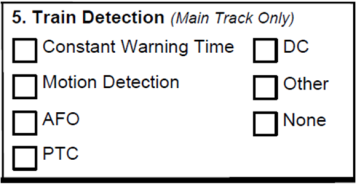
Figure 3-47: U.S. DOT-FRA Crossing Inventory Form Part II, Item 5
Enter a check to indicate the type of train detection used to activate the warning system at the crossing. If the crossing warning devices are not activated upon the arrival of a train, None should be checked.
The types of train detection are:
Constant Warning Time
Motion Detection
DC – Direct Current
AFO – Audio Frequency Overlay
PTC – Positive Train Control
Other – for example when signals are activated manually by a watchman, or by means of other technologies
None
Is Track Signaled?

Figure 3-48: U.S. DOT-FRA Crossing Inventory Form Part II, Item 6
Enter a check in the appropriate box to indicate whether or not the track is equipped with a block signal, cab signal, or train control system to govern train operations.
Monitoring Devices

3-49: U.S. DOT-FRA Crossing Inventory Form Part III, Item 7
Enter a check in the appropriate box to indicate whether an Event Recorder (includes Remote Monitoring and Health Monitoring systems) is installed at the crossing.
All appropriate warning devices may be indicated. However, at a minimum, information related to the highest level of warning device must be provided.
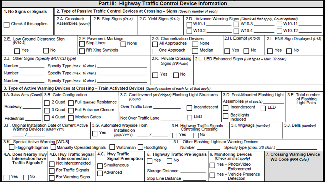
Figure 3-50: U.S. DOT-FRA Crossing Inventory Form Part III, Highway Traffic Control Device Information
No Signs Or Signals
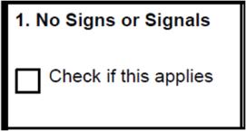
Figure 3-51: U.S. DOT-FRA Crossing Inventory Form Part III, Item 1
Check this box if there are no highway signs or signals at the crossing.
Type of Passive Traffic Control Devices at Crossing – Signs (specify number of each)

Figure 3-52: U.S. DOT-FRA Crossing Inventory Form Part III, Items 2A – 2D.
2A. Crossbuck Assemblies (R15-1)
Enter a count of the number of masts or posts with mounted crossbucks, not a count of the number of crossbuck signs. Two or more crossbucks mounted on a single post are counted as one unit. Include all masts with crossbucks without distinction as to the reflectivity type.
If the crossing has a train activated warning device (flashing lights [cantilevered or mast mounted] and/or gates), do not count the individual number of crossbucks mounted on these devices.
2B. Stop Signs (R1-1)
Enter the number of posts or masts with stop signs, regardless of any other type of warning devices.
2C. Yield Signs (R1-2)
Enter the number of posts or masts with yield signs (MUTCD R1-2) at this crossing regardless of any other type of warning devices.
2D. Advance Warning Signs (check all that apply; count optional)
Enter a check in the box for each type of advance warning sign at the crossing and enter a count for each type of sign.
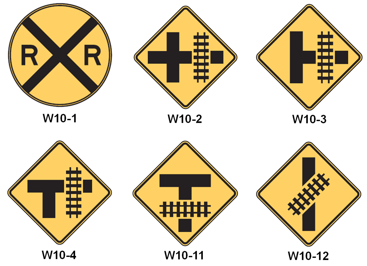
Figure 3-53: Sample Advance Warning Sign Configurations
2E. Low Ground Clearance Sign (W10-5)

Figure 3-54: U.S. DOT-FRA Crossing Inventory Form Part III, Items 2E
Enter a check in the Yes box to indicate that low ground clearance signs are present at the crossing. The standard warning sign for Low Ground Clearance Crossings is identified in the MUTCD as W10-5. Non-standard warning signs or advisories should be listed in “Other Signs” (box 2J). Enter a check in the No box if there are none.
2F. Pavement Markings

Figure 3-55: U.S. DOT-FRA Crossing Inventory Form Part III, Items 2F
Enter a check in the appropriate box for each type of pavement marking present that conforms to the MUTCD. If both Stop Lines and RR crossing symbols are present, check both boxes. If neither Stop Lines nor RR crossing symbols are present, check "None."
2G. Channelization Devices

Figure 3-56: U.S. DOT-FRA Crossing Inventory Form Part III, Items 2G
Check the appropriate box to reflect the location of any channelization or delineator type devices at the crossing, or check None if there are no such devices. Check Median if one or more of the channelization device(s) is a median. Otherwise it will be assumed that the channelization device is a delineator.
2H. Exempt (R15-3)
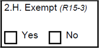
Figure 3-57: U.S. DOT-FRA Crossing Inventory Form Part III, Items 2H
Check the Yes box if the crossing is an Exempt crossing and No if it is not. An Exempt crossing is one where drivers of highway vehicles carrying passengers for hire, school buses carrying students, or highway vehicles carrying hazardous materials are not required to stop except when rail traffic is approaching or occupying the grade crossing, or the driver's view is blocked.
2I. ENS Sign Displayed (I-13)
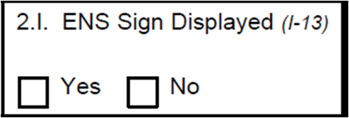
Figure 3-58: U.S. DOT-FRA Crossing Inventory Form Part III, Items 2I
Check the Yes box if there is at least one Emergency Notification System (ENS) sign displayed at the crossing and No if none are displayed.
Signs or numbers on nearby signal bungalows are not considered to be ENS signs since the general public may not clearly understand their meaning.
2J. Other Signs (Specify MUTCD type)

Figure 3-59: U.S. DOT-FRA Crossing Inventory Form Part III, Item 2J
Enter the number and specify the MUTCD type (if applicable) of any other passive signs installed at the crossing. Examples of such signs would be a R15-8 “Look,” W10-9 “No Train Horn,” etc.
2K. Private Crossing Signs
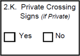
Figure 3-60: U.S. DOT-FRA Crossing Inventory Form Part III, Item 2K
If the crossing is a private crossing, enter a check in the Yes box if there is a private crossing sign installed. Check the No box if there are none.
2L. LED Enhanced Signs

Figure 3-61: U.S. DOT-FRA Crossing Inventory Form Part III, Item 2L
List the types of LED enhanced signs in use. There is a maximum of 32 characters.
Type of Active Warning Devices at Crossing – Train Activated Devices (specify number of each device for all types that may apply)

Figure 3-62: U.S. DOT-FRA Crossing Inventory Form Part III, Items 3A – 3E
3A. Gate Arms (Total Count)
Enter the number of Roadway and Pedestrian gates at the crossing. The total count for each type of gate is required.
Do not count the Post Mounted Flashing Light Assemblies (3D) nor the number of Crossbuck Assemblies (2A) because these devices are considered to be part of the Gate Assembly in the MUTCD.
3B. Gate Configuration
Check the boxes for each type of gate configuration found at the crossing. For full definitions of each type of gate, see the Definitions in Appendix D of this Guide. Check all boxes that apply. The choices are:
2 Quad
3 Quad
4 Quad
Full (Barrier) Resistance
Full Entrance Closure
Median Gates
3C. Cantilevered (or Bridged) Flashing Light Structures
Enter the number of cantilevered (or bridged) flashing light structures that are: (1) Over the traffic lanes, and (2) Not over the traffic lanes. Count the number of structures, not the number of flashing light pairs. Check the appropriate box to indicate whether the flashing lights are Incandescent or LED.
3D. Post Mounted Flashing Light Assemblies (number of posts)
Enter the number of posts that have flashing light assemblies. Count the number of posts, not the number of flashing light pairs. Check the appropriate boxes to indicate whether the flashing lights are Incandescent or LED, and whether backlights are included.
When indicating the presence of Post Mounted Flashing Light Assemblies, do not enter the number of Crossbuck Assemblies (2A) at the crossing because these devices are considered to be part of the Post Mounted Flashing Light Assembly according to the MUTCD.
3E. Total Number of Flashing Light Pairs
Enter the total number of flashing light pairs installed at the crossing.
3F. Original Installation Date of Current Type Active Warning Devices (Month, Year)
![]()
Figure 3-63: U.S. DOT-FRA Crossing Inventory Form Part III, Items 3F – 3J
Enter the month and year when the current type of active warning devices with the highest FRA Warning Device code was first installed. (See Item 7 of this section for a list of FRA Warning Device codes.)
Completion of this data field is not required for active warning devices installed before [INSERT EFFECTIVE DATE OF FINAL RULE].
3G. Automated Wayside Horn
Check the box if the crossing is equipped with an automated Wayside Horn and enter the month and year that the horn or system was installed.
3H. Highway Traffic Signals Controlling Crossing
Enter a check in the Yes box to indicate whether there are highway traffic signals that control highway traffic over the crossing, exclusive of other types of warning devices.
Enter a check in the No box if there are none. Highway signals refer only to train activated red-amber-green signals that control street traffic over the crossing. Do not count highway signals controlling a nearby intersection even if they are interconnected with the crossing warning devices.
3I. Wigwags
Enter the number of wigwags at the crossing. If there are none, leave blank or enter “0.”
3J. Bells
Enter the number of bells (either mechanical or electrical) present at the crossing as part of the warning system. If there are none, leave blank or enter “0.”
3K. Special Active Warning (WD=5)
![]()
Figure 3-64: U.S. DOT-FRA Crossing Inventory Form Part III, Items 3K – 3
Check the appropriate box if there is Flagging or a Flagman (crossing is flagged by a member of the train crew); Manually Operated Signals; Watchman (a person assigned to provide warning that is not a member of the train crew); or Floodlighting at the crossing. Only floodlighting which is distinctive from ordinary street lighting in intensity, light distribution, focus, or color is to be reported.
3L. Other Flashing Lights or Warning Devices
Enter the number and type of any other special warning devices at the crossing. If none are present, leave blank.
Traffic Signals and Preemption

Figure3-65: U.S. DOT-FRA Crossing Inventory Form Part III, Items 4A – 4C
4A. Does Nearby Highway Intersection Have Traffic Signals?
Check either the Yes or No box if a highway-highway intersection within 500 feet has highway traffic signals.
4B. Highway Traffic Signal Interconnection
Check all that apply. If Not Interconnected is checked, do not check the other two choices. For crossings equipped with passive warning systems (e.g., signs), Not Interconnected should be checked.
A crossing is categorized as having Interconnection if there is an electrical connection between the railroad active warning system and the traffic signal controller assembly for the purpose of preemption. Interconnection consists of an electrically connected control circuit at a highway-rail crossing that is designed to have railroad active warning devices utilize a supervised closed circuit which is activated by the approach or presence of a train and is intended to preempt the normal operation of a highway traffic signal.
4C. Highway Traffic Signal Preemption
Check the appropriate box for the type of preemption, if applicable.
Preemption is defined in the MUTCD as the transfer of the normal operation of highway traffic signals to a special control mode.
Preemption is the activity when, as a result of a signal received from the railroad active warning device system, the normal operation of a highway traffic signal is interrupted and transferred to a specific programmed sequence.
Simultaneous Preemption is defined in the MUTCD as notification of approaching rail traffic that is forwarded to the highway traffic signal controller unit or assembly and railroad active warning devices at the same time.
Simultaneous Preemption results in the initiation of the highway traffic signal cycle at the same time the highway-rail grade crossing warning system is activated.
Advance Preemption is defined in the MUTCD as notification of approaching rail traffic that is forwarded to the highway traffic signal controller unit or assembly by the railroad equipment in advance of the activation of the railroad warning devices.
Advance Preemption results in the initiation of the highway traffic signal cycle before the highway-rail grade crossing active warning system is activated.
Highway Traffic Pre-Signals
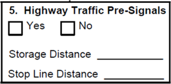
3-66: U.S. DOT-FRA Crossing Inventory Form Part III, Item 5
Check the Yes box to indicate if highway traffic pre-signals are installed. Check the No box if there are none. The Storage Distance and Stop Line Distance fields are optional. Use feet as the measuring unit.
Pre-Signals are used to control traffic approaching a grade crossing in conjunction with the highway traffic control signal faces that control traffic approaching a highway-highway intersection beyond the tracks. Pre-signals may be located on either the near or far side of the railroad tracks, and may be mounted on the same cantilever structures as the railroad’s flashing light warning devices.
Storage Distance is the distance available for vehicle storage as measured six feet from the rail nearest the intersection to the intersection Stop Line or the normal stopping point on the roadway.
Stop Line Distance is the distance between the Stop Line and the Crossing
Gates. This field should be left blank if the crossing is not equipped with gates.
Monitoring Devices
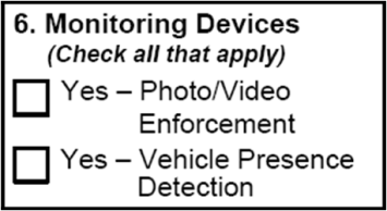
3-67: U.S. DOT-FRA Crossing Inventory Form Part III, Item 6
Check all boxes that apply.
Crossing Warning Device – WD Code (FRA Calc)
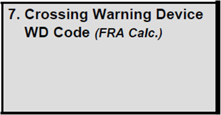
3-68: U.S. DOT-FRA Crossing Inventory Form Part III, Item 7
This item indicates the highest level of traffic control warning device installed at the crossing and is to be left blank as it will be determined by FRA from the information supplied by States and Railroad about the traffic control warning devices placed at the crossing.
Warning Device Code means the FRA classification of warning devices for Public at-Grade Crossings in “Warning Device Categories,” referred to as the “WD CODE.” These Warning Device Categories ONLY apply to Public at-Grade crossings and have an assigned hierarchy based on their level of warning. The WD Codes are as follows:
9 - Four Quad (or full barrier) Gates
8 - Gates (normally Two Quadrant)
7 - Flashing Lights (Standard and Cantilever type units)
6 - Highway Traffic Signals, Wigwags, Bells, or other activated devices
5 - Special Active Warning Devices (usually flagman)
4 - Stop Signs
3 - Crossbucks
2 - Other Signs or signals
1 - No signs or signals
Part IV of the Inventory Form describes the physical characteristics of the crossing and its surroundings.

Figure 3-69: Part IV, Physical Characteristics
Traffic Lanes Crossing Railroad

Figure 3-70: U.S. DOT-FRA Crossing Inventory Form Part IV, Item 3
Enter the number of through traffic lanes crossing the track. Do not include shoulders or lanes that are used for parking. Check the box that best describes the type of roadway.
One-way Traffic: Where highway motor vehicles travel in the same direction over the same roadway.
Two-way Traffic: Where highway motor vehicles travel in two opposite directions over the same roadway.
Divided Traffic: Where highway motor vehicles travel in the same direction over one side of a roadway that is separated by a median of the type considered to separate the entire roadway into two separate roads operating in opposite directions.
Is Roadway Paved?
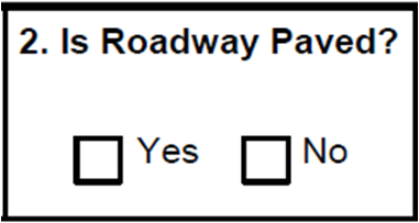
Figure 3-71: U.S. DOT-FRA Crossing Inventory Form Part IV, Item 4
Enter a check in the "Yes" box if the highway is paved with material on which pavement markings can be effectively maintained. Enter a check in the box preceding "No" if the highway surface is gravel, dirt, or has a surface treatment on which pavement markings cannot be maintained. If the entire road is not paved, the roadway pavement through the crossing must extend far enough beyond the railroad tracks to be able to accept railroad pavement markings, nominally about 100 feet, to be considered Yes for this Item. If there are “Pavement Markings,” then this Item must be “Yes”.
Does the Track Run Down a Street?
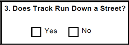
Figure 3-72: U.S. DOT-FRA Crossing Inventory Form Part IV, Item 5
Enter a check in the appropriate box to indicate if the crossing involves a railroad track that is parallel to and within a street or highway. A crossing number is not assigned to the street location where tracks run down the middle of a street. Instead, they are assigned to the locations where streets intersect with the railroad tracks.
Is Crossing Illuminated?

Figure 3-73: U.S. DOT-FRA Crossing Inventory Form Part IV, Item 6
An Illuminated Crossing is defined as having overhead street lighting that provides reasonable illumination of trains present at the crossing and is located within approximately 50 feet of the crossing.
If streetlights are present within 50 feet of the nearest rail, the Yes box should be checked. Since street lamp light-intensity can vary, sufficient lighting may be provided
by streetlights located up to 100 feet from the crossing, in which case, the Yes box may be checked.
Crossing Surface (on Main Track, multiple types allowed)

Figure 3-74: U.S. DOT-FRA Crossing Inventory Form Part IV, Item 7
Enter a check in the box which most closely fits the following descriptions. If there are multiple main line tracks which have different types of surfaces, indicate all types on the Inventory Form.
Timber. Includes Sectional Treated Timber and Full Wood Plank
Sectional Treated Timber consists of prefabricated units approximately 8 feet in length of treated timber individually installed and removable for maintenance and replacement purposes.
Full Wood Plank consists of a timber surface which covers the entire crossing area above the crossties, made of ties, boards, bridge ties, etc.
Asphalt. Asphalt surface over the entire crossing area.
Asphalt and Timber. Asphalt surface in the area between flange timber planks or other material forming flangeway openings which may include the use of rubber.
Concrete. Includes Concrete Slab and Concrete Pavement. Concrete Slab consists of pre-cast concrete sections which are usually individually installed and removable for maintenance and replacement purposes. Concrete Pavement is a concrete surface which is continuous over the track area and is not removable except by destruction of the surface.
Concrete and Rubber. An installed crossing surface which consists of both concrete and rubber materials.
Rubber. Preformed rubber sections which are usually individually installed and removable for maintenance and replacement purposes.
Metal. Metal Sections are sections of steel or other metal which are usually individually installed and removable for maintenance purposes and provide complete coverage of the crossing area within the track.
Unconsolidated. Ballast or other unconsolidated material placed over crossties, with or without planks, on one or both sides of the running rails.
Composite. An engineered material formed from two or more distinct materials generally incorporating a polymer binder with reinforcing fibers and/or fillers to contribute enhanced properties and/or other property modifiers in a polymer matrix, typically post-consumer recycled high-density polyethylene (HDPE).
Other (Specify). Surfaces other than the previously described surfaces and would include structural foam, plastic, ‘high-tech,” etc.
Note: This data field has been assigned to the State for updating. However, if the Railroad installs a new crossing surface, the Railroad must report that change.
Enter the month and year that the crossing surface was originally installed and opened to vehicular traffic in mo/yr format. Also, enter the width of the crossing, and the length of the crossing. These are optional fields.
Width - The width of the crossing surface is measured perpendicular to the railroad tracks and is the distance between the outermost edges of the crossing surface (including multiple tracks if present). In the event that the crossing surface is indistinguishable from the roadway approach the width is the distance between the outermost rails of the crossing plus 4 feet.
Length - Length means the width of the adjoining roadway (including all vehicular traffic lanes) parallel to the railroad tracks, including any adjacent sidewalks or pathways that are part of the specified crossing, measured to the ends of the crossing/pathway surface material. In general, the crossing surface material will extend approximately 3 feet on each side beyond the roadway/pathway.
Intersecting Roadway Within 500 Feet?

Figure 3-75: U.S. DOT-FRA Crossing Inventory Form Part IV, Item 8
Enter a check in the Yes box if the street or highway for this crossing is intersected by another street or highway within 500 feet and indicate the estimated distance from the crossing. Check No when no intersection exists within 500 feet.
Smallest Crossing Angle

Figure 3-76: U.S. DOT-FRA Crossing Inventory Form Part IV, Item 2
Enter a check in the box that most closely describes the smallest angle between the roadway and the track.
Is Commercial Power Available?

Figure 3-77: U.S. DOT-FRA Crossing Inventory Form Part IV, Item 10
Enter a check to indicate whether there is commercial electric power available within 500 feet of the crossing. This field is optional.

Figure 3-78: U.S. DOT-FRA Crossing Inventory Form Part V
Highway System
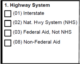
Figure 3-79: U.S. DOT-FRA Crossing Inventory Form Part V, Item 1
Code |
Definition |
Included |
01 |
Interstate National Highway System |
Interstate, rural, and urban |
02 |
Other National Highway System |
Other urban and rural principal arterial, Non-Interstate |
03 |
Federal Aid Highway, Not NHS |
Rural major collector and higher category, or urban collector and higher category, not part of NHS |
08 |
Non-Federal Aid |
Local rural roads, rural minor collectors, and local urban city streets or any other non-Federal-Aid roadway |
Table 3-2: Highway System Codes
Check the box for the correct highway system code.
Functional Classification of Road at Crossing
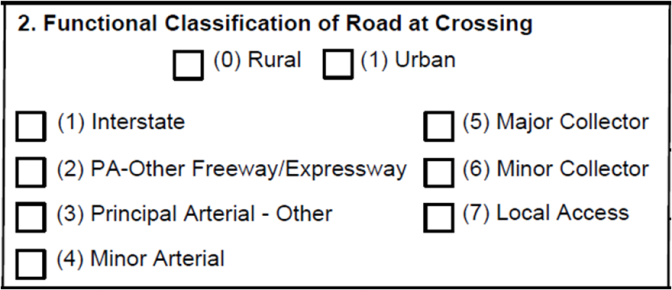
Figure 3-80: U.S. DOT-FRA Crossing Inventory Form Part V, Item 2
Check the box for the appropriate highway Functional Classification Code for Rural or Urban and then check the box for the Roadway Type in accordance with Federal-Aid Highway Program Definitions.
Functional Classification is the grouping of highways, roads, and streets by the character of service they provide and can be applied in planning highway system development. It defines the part that any particular route should play in serving the flow of traffic through a highway network. The details and definitions for classifying systems can be found on FHWA's Website at www.fhwa.dot.gov under "Guidelines for Functional Highway Classification System." These changes were published by FHWA in May 2008.
The “Urban” designation is based on Census urban boundary and a population of more than or equal to 5,000 people.
The abbreviation PA stands for Principal Arterial.
Is Crossing on State Highway System?
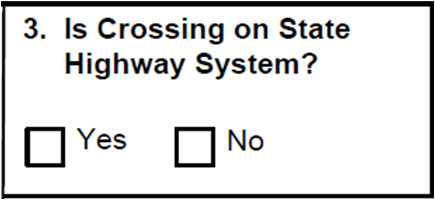
Figure 3-81: U.S. DOT-FRA Crossing Inventory Form Part V, Item 3
Check the appropriate box.
Highway Speed Limit

Figure 3-82: U.S. DOT-FRA Crossing Inventory Form Part V, Item 4
Enter the highway speed limit at the crossing in miles per hour. Select whether the speed limit is posted or statutory.
Linear Referencing System (LRS Route ID)

Figure 3-83: U.S. DOT-FRA Crossing Inventory Form Part V, Item 5
This is an optional field. Enter the 32-character Linear Referencing System (LRS) code. The Linear Referencing System is a set of procedures for determining and retaining a record of specific points along a highway. Typical methods used are kilometerpoint (milepoint), kilometerpost (milepost), reference point, and link-node. The details for the method to use can be found on FHWA’s website at: www.fhwa.dot.gov under “Guidelines for Functional Highway Classification System.”
LRS Milepost

Figure 3-84: U.S. DOT-FRA Crossing Inventory Form Part V, Item 6
This is an optional item. Enter the seven-character LRS milepost designation. Most at-grade highway-rail crossings are on highways without posted mileposts. Leave blank if none is posted.
Estimated Average Daily Traffic (ADT)

Figure 3-85: U.S. DOT-FRA Crossing Inventory Form Part V, Item 7
Enter the calendar year when the Average Daily Traffic (ADT) was determined and the estimated ADT count through the crossing (total both directions) based on available
traffic information. A reasonable estimate of the ADT is acceptable if actual traffic counts are not readily available. When a crossing runs diagonally through a highway-highway intersection, the total ADT should include both streets in both directions.
Estimated Percent Commercial Trucks
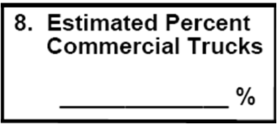
Figure 3-86: U.S. DOT-FRA Crossing Inventory Form Part V, Item 8
Enter the estimated percentage of commercial trucks in the traffic stream.
Regularly Used by School Buses?

Figure 3-87: U.S. DOT-FRA Crossing Inventory Form Part V, Item 9
Check the Yes box if the crossing is regularly used by school buses. “Regularly” means that there is at least a one-way movement, in either direction, by a school bus on a school day.
If the Yes box is checked, the numerical count should be provided to indicated the volume of school bus use which helps quantify the risk of the crossing. Enter the average total number of times that a school bus crosses over the crossing, empty or full, on a normal school day. Back and forth movements count as two passes through the crossing.
Regularly Used by Hazmat Vehicles?

Figure 3-88: U.S. DOT-FRA Crossing Inventory Form Part V, Item 10
Check the Yes box if the crossing is regularly used by highway vehicles carrying hazardous material. Otherwise check the No box.
Regular Emergency Services Route

Figure 3-89: U.S. DOT-FRA Crossing Inventory Form Part V, Item 11
Check the Yes box if the crossing is regularly used by highway vehicles that provide emergency services. Otherwise check the No box.
Submitter Line
![]()
Figure 3-90: U.S. DOT-FRA Crossing Inventory Form Part V, Item 11
Enter the name of the submitter, the organization represented by the submitter, the telephone number, and the date that the Form is being submitted. If the crossing has multiple forms, the information provided in this section should relate to the submitting railroad. This information, Submitted By, Organization, Phone, and Date must be provided on the hardcopy Inventory Form only, and not electronically.
APPENDIX A - U.S. DOT Crossing Inventory Form
Obtaining an Inventory Number
Public, private, and pathway crossings in the United States (both at-grade and grade-separated) must have an assigned U.S. DOT National Highway-Rail Crossing Inventory Number (Inventory Number).
Valid Inventory Numbers can be obtained by submitting an e-mail request to: [email protected].
When submitting an e-mail request for Inventory Numbers, please provide the total number of Inventory Numbers needed and the name, title, company, mailing address, phone and fax of the requestor.
Submission of the Inventory Form
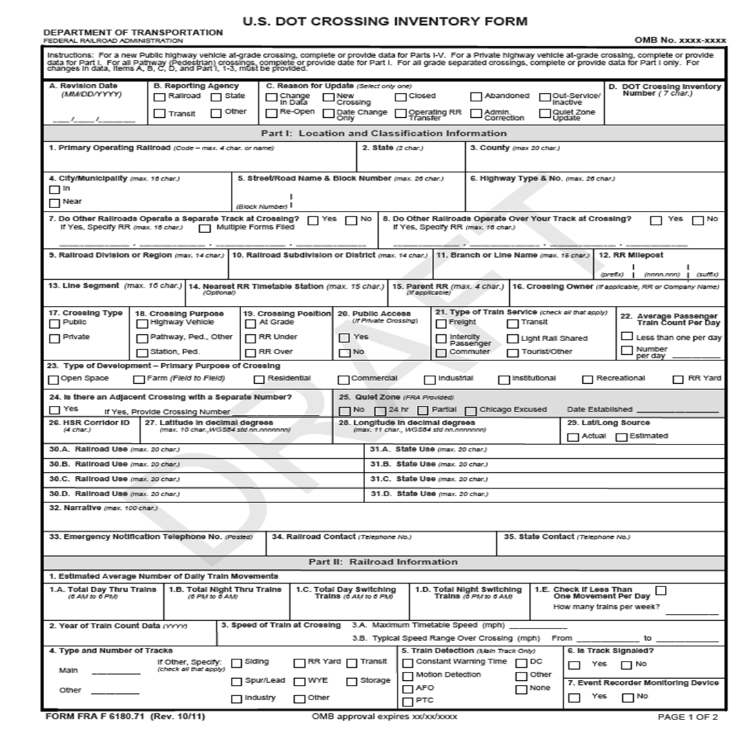
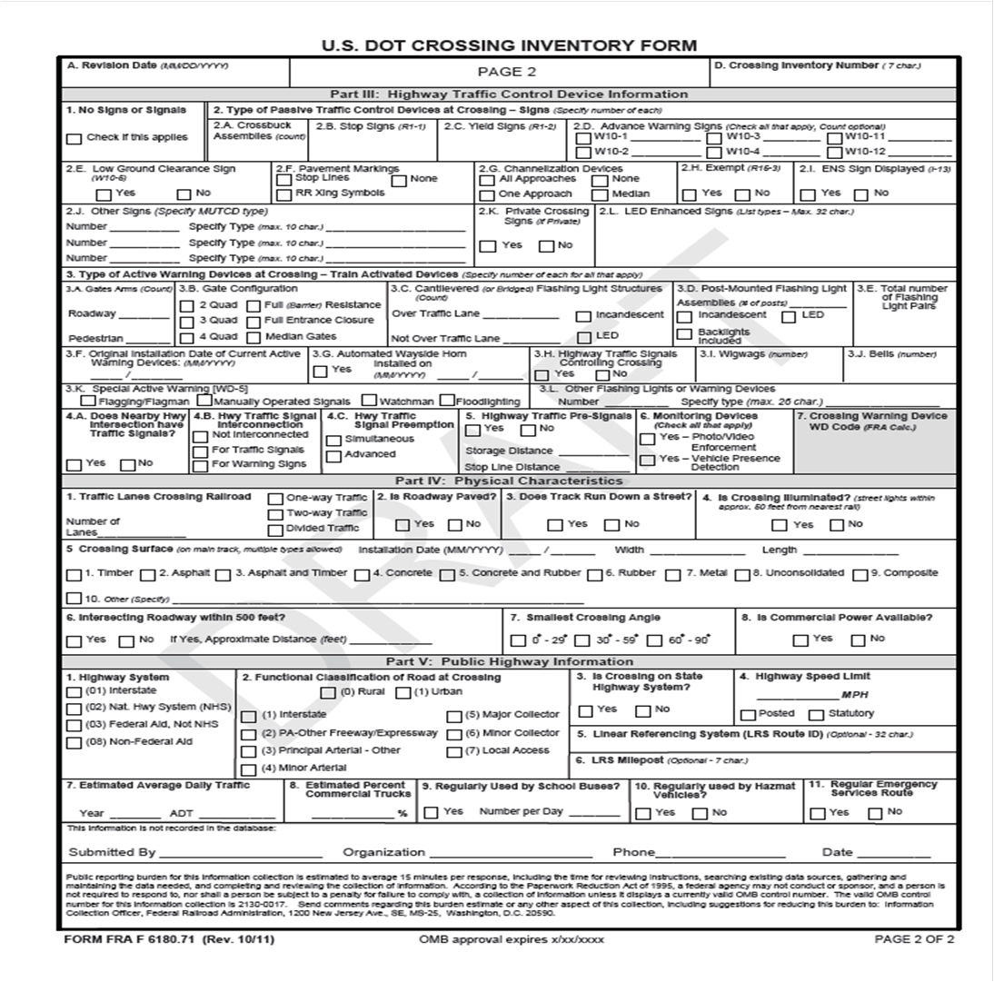
The "U.S. DOT Crossing Inventory Form" (Form), is a two-page, single-sheet, five-part form that provides for easy photocopying and distribution to appropriate parties. The five Parts of the Form include the following categories:
Part I. Location and Classification Information
Part II. Railroad Information
Part III. Highway Traffic Control Device Information
Part IV. Physical Characteristics
Part V. Public Highway Information
As reflected below, the type of crossing will dictate which parts of the Inventory Form must be completed by railroads for the initial reporting of new and previously unreported public, private, and pathway crossings:
Public Highway-Rail Crossing: Complete entire Inventory Form;
Private Highway-Rail Crossing: Complete Header, plus Part I of the Inventory Form and the Submitter Information data field;
Pathway Crossing: Complete Header, plus Part I of the Inventory Form as appropriate and the Submitter Information data field;
Grade-separated Crossing: Complete Header, plus Part I of the Inventory Form and the Submitter Information data field.
For updating purposes, with the exception of a change to Crossing Type, railroads must submit updates to all applicable parts of the Inventory Form listed above, in accordance with the Crossing Inventory Responsibility Table in Appendix B of this Inventory Guide.
For changes to Crossing Type (from Private to Public), railroads must complete the entire Inventory Form with updated information.
Hard Copy Submission
Railroads must complete the Submitter Information data field at the bottom of page 2 of the Inventory Form for all hard copy submissions.
In addition, hard copies of completed Inventory Forms should be mailed to:
Inventory Crossing Updates
FRA Project Office
ActioNet Inc.
2600 Park Tower Drive, Suite 1000
Vienna, VA 22180
Electronic Submission
Completed Inventory Forms may also be submitted electronically to the U.S. DOT National Highway-Rail Crossing Inventory. Detailed instructions for the electronic submission of Inventory Forms can be found in the Electronic Submission Instructions at: http://www.fra.dot.gov/rrs/pages/fp_801.shtml
APPENDIX B – Crossing Inventory Responsibility Table
APPENDIX B – Crossing Inventory Responsibility Table Agency Normally Responsible for Updating Crossing Inventory Data Elements and Required Data Fields |
||||||||
Item No. |
Element Name |
State |
Railroad |
Required (If info. exists) |
||||
MUST PROVIDE THE FOLLOWING DATA FOR ALL CROSSINGS |
||||||||
A. |
Revision Date |
X |
X |
X |
||||
B. |
Reporting Agency |
X |
X |
X |
||||
C. |
Reason for Update |
X |
X |
X |
||||
D. |
DOT Crossing Inventory Number |
X |
X |
X |
||||
Part I: Location and Classification Information |
||||||||
I-1. |
Primary Operating Railroad |
|
X |
X |
||||
I-2. |
State |
X |
|
X |
||||
I-3. |
County |
X |
|
X |
||||
I-4. |
City/Municipality (In or Near) |
X |
|
X |
||||
I-5. |
Street/Road Name |
X |
|
X |
||||
I-5. |
Block Number |
X |
|
|
||||
I-6. |
Highway Type and Number |
X |
|
X |
||||
I-7. |
Do Other Railroads Operate a Separate Track at Crossing? |
|
X |
X |
||||
I-7. |
Multiple Forms Filed? |
|
X |
|
||||
I-8. |
Do Other Railroads Operate Over Your Track at Crossing |
|
X |
X |
||||
I-9. |
Railroad Division or Region |
|
X |
X |
||||
I-10. |
Railroad Subdivision or District |
|
X |
X |
||||
I-11. |
Branch or Line Name |
|
X |
X |
||||
I-12. |
RR Milepost |
|
X |
X |
||||
I-13. |
Line Segment |
|
X |
|
||||
I-14. |
Nearest RR Timetable Station |
|
X |
|
||||
I-15. |
Parent RR |
|
X |
|
||||
I-16. |
Crossing Owner |
|
X |
|
||||
Item No. |
Element Name |
State |
Railroad |
Required (If info. exists) |
||||
I-17. |
Crossing Type |
X |
X |
X |
||||
I-18. |
Crossing Purpose |
X |
X |
X |
||||
I-19. |
Crossing Position |
X |
X |
X |
||||
I-20. |
Public Access at Private Crossing |
|
X |
X |
||||
I-21. |
Type of Train Service |
|
X |
X |
||||
I-22. |
Average Passenger Train Count Per Day |
|
X |
X |
||||
I-23. |
Type of Development – Primary Purpose of Crossing |
X |
X |
X |
||||
I-24. |
Is There an Adjacent Crossing with a Separate Number? |
|
X |
X |
||||
I-25. |
Quiet Zone |
|
|
FRA Will Populate |
||||
I-26. |
HSR Corridor ID |
X |
|
|
||||
I-27. |
Latitude |
X (for Public Crossings) |
X (for Private Crossings) |
X |
||||
I-28. |
Longitude |
X (for Public Crossings) |
X (for Private Crossings) |
X |
||||
I-29. |
Lat/Long Source |
X (for Public Crossings) |
X (for Private Crossings) |
X |
||||
I-30.A--D. |
Railroad Use |
|
X |
|
||||
I-31.A--D. |
State Use |
X |
|
|
||||
I-32. |
Narrative |
X |
X |
|
||||
I-33. |
Emergency Notification Telephone Number |
|
X |
X |
||||
I-34. |
Railroad Contact (Telephone No.) |
|
X |
X |
||||
I-35. |
State Contact (Telephone No.) |
X |
|
X |
||||
Part II: Railroad Information |
||||||||
II-1. |
Estimated Average Number of Daily Train Movements |
|||||||
II-1.A. |
Total Day Thru Trains (6 AM to 6 PM) |
|
X |
X |
||||
Item No. |
Element Name |
State |
Railroad |
Required (If info. exists) |
||||
II-1.B. |
Total Night Thru Trains (6 PM to 6 AM) |
|
X |
X |
||||
II-1.C. |
Total Day Switching Trains (6 AM to 6 PM) |
|
X |
X |
||||
II.1.D. |
Total Night Switching Trains (6 PM to 6 AM) |
|
X |
X |
||||
II.1.E. |
Check if Less Than One Movement Per Day |
|
X |
X |
||||
II-2. |
Year of Train Count Data |
|
X |
X |
||||
II-3. |
Speed of Train at Crossing |
|||||||
II-3.A. |
Maximum Timetable Speed |
|
X |
X |
||||
II.3.B. |
Typical Speed Range Over Crossing (mph) |
|
X |
X |
||||
II-4. |
Type and Number Tracks |
|
X |
X |
||||
II-5. |
Train Detection (Main Line Only) |
|
X |
X |
||||
II-6. |
Is Track Signaled? |
|
X |
X |
||||
II-7. |
Event Recorder Monitoring Devices |
|
X |
X |
||||
Part III: Highway Traffic Control Device Information |
||||||||
III-1. |
No Signs or Signals |
X |
|
X |
||||
III-2. |
Type of Passive Traffic Control Devices at Crossing |
|||||||
III-2.A. |
Crossbuck Assemblies |
X |
|
X |
||||
III-2.B. |
Stop Signs (R1-1) |
X |
|
X |
||||
III-2.C. |
Yield Signs(R1-2) |
X |
|
X |
||||
III-2.D. |
Advance Warning Signs |
X |
|
X |
||||
III-2.E. |
Low Ground Clearance Signs |
X |
|
X |
||||
III-2.F. |
Pavement Markings |
X |
|
X |
||||
III-2.G. |
Channelization Devices |
X |
|
X |
||||
III-2.H. |
Exempt |
X |
|
X |
||||
III-2.I. |
ENS Sign Displayed |
X |
|
X |
||||
Item No. |
Element Name |
State |
Railroad |
Required (If info. exists) |
||||
III-2.J. |
Other Signs |
X |
|
X |
||||
III-2.K. |
Private Crossing Sign |
|
X |
X |
||||
III-2.L. |
LED Enhanced Signs |
X |
|
X |
||||
III-3. |
Type of Warning Device at Crossing - Train Activated Devices |
|||||||
III-3. |
Type of Active Warning Device |
|
X (If Changed) |
|
||||
III-3.A. |
Gate Arms |
X |
|
X |
||||
III-3.B. |
Gate Configuration |
X |
|
X |
||||
III-3.C. |
Cantilevered (or Bridged) Flashing Light Structures |
X |
|
X |
||||
III-3.D. |
Post Mounted Flashing Light Assemblies |
X |
|
X |
||||
III-3.E. |
Total Number of Flashing Light Pairs |
X |
|
X |
||||
III-3.F. |
Original Installation Date of Current Active Warning Device |
X |
|
X |
||||
III-3.G. |
Automated Wayside Horn/Date of Installation |
X |
|
X |
||||
III-3.H. |
Highway Traffic Signals |
X |
|
X |
||||
III-3.I. |
Wigwags |
X |
|
X |
||||
III-3.J. |
Bells |
X |
|
X |
||||
III-3.K. |
Special Active Warning (WD-5) |
X |
|
X |
||||
III-3.L. |
Other Flashing Lights or Warning Devices |
X |
|
X |
||||
III-4. |
Traffic Signals |
|||||||
III-4.A. |
Does Nearby Highway Intersection Have Traffic Signals |
X |
|
X |
||||
III-4.B. |
Highway Traffic Signal Interconnection |
X |
X |
X |
||||
III-4.C. |
Highway Traffic Signal Preemption |
X |
X |
X |
||||
III-5. |
Highway Traffic Pre-Signals |
X |
|
X |
||||
III-6. |
Monitoring Devices |
X |
|
X |
||||
III-7. |
Crossing Warning Device Code |
|
|
FRA Will Determine |
||||
Item No. |
Element Name |
State |
Railroad |
Required (If info. exists) |
|
Part IV: Physical Characteristics |
|||||
IV-1. |
Traffic Lanes Crossing Railroad |
X |
|
X |
|
IV-2. |
Is Roadway Paved? |
X |
|
X |
|
IV-3. |
Does Track Run Down a Street? |
X |
|
X |
|
IV-4. |
Is Crossing Illuminated? |
X |
|
X |
|
IV-5. |
Crossing Surface |
X |
X (If Changed) |
X |
|
IV-6. |
Intersecting Roadway Within 500 Feet? |
X |
|
X |
|
IV-7. |
Smallest Crossing Angle |
X |
|
X |
|
IV-8. |
Is Commercial Power Available? |
X |
|
|
|
Part V: Public Highway Information |
|||||
V-1. |
Highway System |
X |
|
X |
|
V-2. |
Functional Classification of Road at Crossing |
X |
|
X |
|
V-3. |
Is Crossing on State Highway System? |
X |
|
X |
|
V-4. |
Highway Speed Limit |
X |
|
X |
|
V-5. |
Linear Referencing System (LRS Route ID) |
X |
|
|
|
V-6. |
LRS Milepost |
X |
|
|
|
V-7. |
Estimated Average Daily Traffic (ADT) |
X |
|
X |
|
V-8. |
Estimated Percent Commercial Trucks |
X |
|
X |
|
V-9. |
Regularly Used by School Buses? (Number Per Day Optional) |
X |
|
X |
|
V-10. |
Regularly Used by HAZMAT Vehicles? |
X |
|
X |
|
V-11. |
Regular Emergency Services Route |
X |
|
X |
|
Submitted By Line |
|
X |
X |
X |
|
Note: Submitted By information is for reference if there are questions about the submitted data.
Note: Please refer to application sections of this Guide for exceptions to the Crossing Inventory Responsibility Table above.
APPENDIX C – Reporting Crossings that have Multiple Operating Railroads
A highway-rail crossing is defined as any location where one or more railroad tracks intersect with a public highway, road, street, or private roadway, including associated sidewalks and pathways, either at-grade or grade-separated. Only one crossing inventory number is to be assigned to a single crossing location, regardless of how many Operating Railroads operate through the specific crossing location.
If each Operating Railroad were to assign their own crossing inventory number to their tracks at the same crossing location, a major problem would develop when determining the risk with the DOT Accident Prediction Model or any other State accepted risk analysis model. Such models analyze the risk for each individual crossing from the information provided for each crossing inventory number. If there are multiple numbers for the same crossing, some fields on the Inventory Form such as train counts will not reflect an accurate total for the specific crossing location, thus giving an incorrect risk or accident prediction value.
When feasible, one of the Operating Railroads, usually the major railroad, needs to accept responsibility for all the data on behalf of all the railroads operating through the crossing. The Primary Operating Railroad would have the responsibility for updating the shared attributes for both railroads at the crossing. In such cases, however, except for the train counts, the National Crossing Inventory Record will only reflect the territorial location information for the Primary Operating Railroad.
While only one crossing inventory number should be assigned to a specific crossing location, regardless of how many operating railroads operate through the specific crossing location, there may be some locations where this is not practicable or possible. When it is not practicable, or when each operating railroad wants to have its own individual territorial information identified in the Crossing Inventory and wants to update its own crossing information, a check should be placed in the box titled “Multiple Forms Filed” in Part I, Item 7 on the Inventory Form. This will result in each operating railroad being solely responsible for updating its own data.
If the box titled “Multiple Forms Filed” has been checked, each operating railroad will be required to submit their own inventory record and update only those attributes related to their own track (such as train counts, minimum and
maximum operating speeds, milepost or division). The highway type information and physical characteristics, etc., will be the same for all Inventory Forms submitted. The different railroad submittals will have the same crossing inventory number, but a suffix consisting of the railroad code will be added to each crossing record submitted by each railroad. For example 123456X-BNSF, 123456X-GTW, and 123456X-UP would be three records for the same location where there are three Primary Operating Railroads operating through the crossing. The FRA data management system will combine the critical data (such as train counts) to produce a combined Crossing Inventory Record for the crossing for analyzing the risk along with providing the individual records for each of the Operating Railroads. By using the railroad code as a suffix, it will be clear which record belongs to which railroad. The railroad suffix will be obtained from the Primary Operating Railroad field, but the “Multiple Forms Filed” indicator box in Part I, Item 7, must be checked for indicating that multiple inventory records will be filed and updated separately for this specific crossing location.
APPENDIX D - Definitions
Adjacent Crossing means a location where another crossing is in close proximity to the tracks of the crossing listed as the crossing number on the Crossing Inventory Form and where one might consider all tracks in this vicinity as part of one crossing, but where the adjacent crossing has a separate Crossing Inventory Number.
Channelization Device means a traffic separation system made up of a raised longitudinal channelizer with vertical panels or tubular delineators that is placed between opposing highway traffic lanes designed to alert or guide traffic around an obstacle or to direct traffic in a particular direction. - 49 CFR §222.9
Closed Crossing means a location where a highway-rail crossing has been physically removed so that highway traffic is not possible. With regards to pathway crossings, this term means a location where the crossing surface has been physically removed or where it is impossible to use the crossing (due to fencing, for example).
Crossing Inventory means the U.S. DOT National Highway-Rail Crossing Inventory.
Diagonal Crossing means a highway-rail crossing where the railroad tracks run diagonally through the highway-highway intersection, thus bisecting the two roadways. Only one Crossing Inventory Number is to be assigned to such locations.
Gate means an automatically-operated traffic control device that is used to
physically obstruct roadway users such that they are discouraged from proceeding past a particular point on a roadway or pathway, or such that they are discouraged from entering a particular grade crossing.
Two Quadrant Gates means a highway-rail crossing that has at least two automatic gate arms which are designed to block at least 90% of the approaching highway traffic from driving around the gate arms without crossing the roadway centerline. They are positioned on the crossing entrance approach sides of a two-lane highway. When there exists a four-lane or greater divided highway, additional mast-mounted flashing light and gate assemblies may be installed in the median island on the approach side of the highway (these are known as Dual Entrance Gates).
Three Quadrant Gates means a highway-rail crossing that has three gate arms which extend individually across both approach lanes and one exit lane of a two directional highway. These gates, due to roadway design, block highway traffic
from traversing the crossing when in the down position. One of the approach lanes may utilize a median barrier, traffic channelization, or island preventing highway traffic from crossing into the exit lane of the side that does not have the exit gates. When there exists a four-lane or greater divided highway, additional mast-mounted flashing light and gate assemblies may be installed in the median island on the approach side of the highway.(Refer to MUTCD Section 8.D. for appropriate design and operation.)
Four Quadrant Gates means a highway-rail crossing that has four gate arms which extend individually across the approach and exit lanes of a two directional roadway and that totally block highway traffic from traversing the crossing when in the down position. Roadways intersecting the railroad tracks at an angle may utilize median islands between the gates. When there exists a four-lane or greater divided highway, additional mast-mounted flashing light and gate assemblies may be installed in the median island on the approach side of the highway.(Refer to MUTCD Section 8.D. for appropriate design and operation.)
Full (Barrier) Resistance Gates means a highway-rail crossing that has at least one gate arm mechanism designed to physically prevent a highway vehicle from encroaching onto the tracks which, when fully lowered, extends across the roadway to block all approaching highway traffic from traversing the crossing and normally blocks the on-coming traffic. These systems are often used on one-way streets or divided roadways.
Full Entrance Closure Gates means a highway-rail crossing that has at least one gate arm mechanism which, when fully lowered, extends across the roadway to block all approaching highway traffic from traversing the crossing and normally blocks the on-coming traffic. These systems are often used on one-way streets or divided roadways.
Median Gates (Dual Entrance Gates) means a highway-rail crossing with gates mounted in medians, often called Mast Mounted Dual Entrance Gates, that fully extend across the roadway to block all approaching highway traffic from traversing the crossing. The gate assemblies are installed on the highway shoulder side and in the median of the approach lanes. These systems are often used on multi-lane divided highways with raised medians.
Highway-Rail Crossing means, for purposes of the Inventory, the location where one or more railroad tracks intersect with a public highway, road, street, or private roadway, including associated sidewalks, and pathways, either at-grade or grade-separated.
A crossing includes those tracks that lie within the same pair of warning devices. Thus, an intersection of a roadway with 3 tracks (2 mainline and 1 spur) where the mainline tracks have flashing lights and the spur track has crossbucks would be considered two crossings with two separate crossing inventory numbers. One crossing would consist of the mainline tracks with the flashing lights and one crossing would consist of the spur track that has crossbucks.
Inventory Form means the U.S. DOT Crossing Inventory Form (Form FRA F 6180.71).
Inventory Number means the number assigned to a highway-rail crossing or pathway crossing in the Crossing Inventory.
MUTCD means the Manual on Uniform Traffic Control Devices published by the Federal Highway Administration.
Open Crossing means a highway-rail crossing or pathway crossing where both railroad operations and highway or pathway traffic are possible.
Open to Public Travel means that the road section is available (except during scheduled periods, extreme weather or emergency conditions), passable by four-wheel standard passenger cars, and open to the general public for use without restrictive gates, prohibitive signs, or regulation other than restrictions based on size, weight, or class of registration.
Operating Railroad means any railroad that operates one or more trains through a highway-rail crossing or pathway crossing.
Pathway means a path for authorized users, outside the traveled way and physically separated from the roadway by an open space or barrier and either within the highway right-of-way or within an independent alignment. Pathways include shared-use paths, but do not include sidewalks.
Pathway Crossing means a pathway that: (1) is explicitly authorized by a public authority or a railroad; (2) is dedicated for the use of non-vehicular traffic including pedestrians, bicyclists, and others, (3) is not associated with a public highway, road, or street, or a private roadway; and (4) crosses one or more railroad tracks either at grade or grade-separated. However, an area where pedestrians trespass, even routinely, is not considered to be a pathway crossing.
Pathways that are contiguous with, or separate but adjacent to, highway-rail crossings are presumed to be part of the highway-rail crossing and are not considered separate crossings.
Pedestrian Crossing See Pathway Crossing.
Primary Operating Railroad means the operating railroad responsible for submitting and/or updating data in the Crossing Inventory for a highway-rail crossing or pathway crossing.
Private Crossing means a highway-rail crossing which is not a public crossing. Typical types of private crossings include farm crossings, industrial plant crossings, and residential access crossings.
Public Authority means the public entity responsible for traffic control or law enforcement at a highway-rail crossing or the public entity that authorized a pathway crossing.
Public Crossing means a highway-rail crossing where the roadway is under the jurisdiction of and maintained by a public authority and open to public travel. All roadway approaches must be under the jurisdiction of the public roadway authority and no roadway approach may be on private property.
In situations where a State has empowered a public agency (such as a State Department of Transportation, State Highway Department, Public Utility Commission, State Commerce Commission, etc.) to make a determination as to whether crossings are public or private, such determinations will govern for Inventory purposes.
Quiet Zone means a segment of a rail line, within which is situated one or a number of consecutive public highway-rail crossings at which locomotive horns are not routinely sounded.
Sidewalk means that portion of a street between the curb line, or lateral line of a roadway, and the adjacent property line. Sidewalks also include easements on private property that are paved or improved and intended for use by pedestrians.
Temporary Crossing means a highway-rail crossing created to serve a specific activity, such as construction sites, for a temporary time period not to exceed six months. Temporary crossings do not need an inventory number and do not need to be reported to the Crossing Inventory.
Through Trains mean trains whose primary responsibility is to operate over a route with defined beginning and end points.
APPENDIX E - Frequently Asked Questions (FAQs)
Q 1. Which types of crossings must be reported to the Crossing Inventory?
All crossings, Public, Private, and Pathway (Pedestrian), both at-grade and grade-separated, must be reported to the Crossing Inventory, with the exception of temporary crossings. Temporary crossings are crossings that are created to serve a specific activity for a temporary time period not to exceed six months.
An Inventory Number must be assigned to each crossing that is reported to the Crossing Inventory, except for certain crossings that are discussed in more detail in the Inventory Guide.
Q 2. Which operating railroad is responsible for getting Inventory numbers and filing Inventory Forms?
The Primary Operating Railroad has the duty. The Primary Operating Railroad is the operating railroad responsible for submitting data to, and/or updating data in, the U.S. DOT National Highway-Rail Crossing Inventory for a particular highway-rail crossing or pathway crossing. Generally, the primary operating railroad should be the operating railroad that owns the highway-rail crossing (or pathway crossing) or maintains the warning devices at the highway-rail crossing (or pathway crossing).
For a new or previously unreported crossing, the Primary Operating Railroad is responsible for initiating the process, obtaining a valid crossing inventory number, completing a hard copy of the Inventory Form (or an electronic file) for the crossing, and submitting it to FRA for processing.
The Primary Operating Railroad is also responsible for submitting Inventory updates.
Q 3. What if multiple railroads operate through the crossing?
If multiple railroads operate through a crossing, then the railroad that owns the highway-rail crossing (or pathway crossing) or maintains the warning devices at the crossing should assume the Primary Operating Railroad designation.
In the event that there is more than one operating railroad that owns the highway-rail crossing (or pathway crossing) or maintains the warning devices at the highway-rail crossing (or pathway crossing), the largest operating railroad with the most rail traffic over the crossing at issue should accept the Primary Operating Railroad designation.
Q 4. Do I need to get an Inventory Number for a private crossing?
Yes. Railroads must obtain Inventory numbers for private crossings.
This includes crossings that are on private property, such as in a plant area owned by a private corporation, or in the rail yard of the Operating Railroad. However, the railroad may decide whether to assign one Inventory Number for each crossing on private property or for multiple crossings within the private property limits.
Q 5. Where can I get valid Crossing Inventory Numbers?
To acquire crossing numbers from FRA, please send an e-mail to: [email protected].
Q 6. How do I update the Crossing Inventory for my Railroad or State?
Please refer to Appendix B of this Inventory Guide, the Crossing Inventory Responsibility Table, for information related to which data fields on the Inventory Forms need to be updated by railroads and/or the States.
With the exception of Class I railroads who must submit updates to the Crossing Inventory electronically, all non-Class I railroads and States may choose to submit updates to the Crossing Inventory electronically or by mailing updated Inventory Forms to:
Inventory Crossing Updates
FRA Project Office
ActioNet Inc.
2600 Park Tower Drive, Suite 1000
Vienna, VA 22180
Q 7. Can I submit Inventory Forms electronically?
Yes. While Class I railroads are required to file Inventory data electronically, all railroads are encouraged to file data electronically in accordance with the instructions contained in this Inventory Guide.
Q 8. Do I have to submit Inventory Forms electronically?
Class I railroads must file their Inventory Forms electronically. Therefore, Inventory updates, as well as the submission of Inventory data for new and previously unreported crossings, will need to be submitted electronically to the Crossing Inventory by Class I railroads. All other operating railroads and the States may choose to submit Inventory Forms electronically, but are not required to do so.
Q9. Which parts of the Inventory Form must be completed for a new crossing or a previously unreported crossing?
The type of crossing will dictate which parts of the Inventory Form must be completed by railroads for the initial reporting of new and previously unreported public, private, and pathway crossings:
Public Highway-Rail Crossing: Complete entire Inventory Form;
Private Highway-Rail Crossing: Complete Header, plus Part I of the Inventory Form and the Submitter Information data field;
Pathway Crossing: Complete Header, plus Part I of the Inventory Form as appropriate and the Submitter Information data field;
Grade-separated Crossing: Complete Header, plus Part I of the Inventory Form and the Submitter Information data field.
All required data must be provided before a new record can be created. The State may have information pertaining to a number of data elements, in which case, the Railroad will need to communicate with the State Inventory Contact and/or a local highway engineer in order to obtain the information and place it on the Inventory Form before submitting it to FRA.
Q 10. Where do I send hardcopies of completed Inventory Forms?
Completed hardcopy Inventory Forms must be sent to:
Inventory Crossing Updates
FRA Project Office
ActioNet Inc.
2600 Park Tower Drive, Suite 1000
Vienna, VA 22180
(O) 703-204-0090
(F) 703-204-4782
Q 11. If I only need to submit a few Inventory Forms, can I scan them electronically and then submit them to the Crossing Inventory?
Scanning a document for transmittal to the Crossing Inventory is considered a paper submission. This type of transmission does NOT constitute an electronic submission.
Scanned documents can be transmitted to: rxiupdates@frasafety.net. This address goes to FRA’s data processing contractor who will process the submittals in accordance with their workload.
Q 12. Can I update crossing records online at the FRA Safetydata website?
Yes, FRA will provide a new secure web page to allow users to find and update data for public, private, and pathway crossings that have already been entered into the Crossing Inventory.
Q 13. Will use of the GX32 software count as an electronic submission?
The GX32 software will be replaced with a secure web-based application (“Browse and Edit”) that will provide the state/railroad user with similar functionality. However, the crossing data will be current and updates will be made instantaneously (with business rules in place to ensure that only allowable data elements can be changed). The new system will allow for more accurate record keeping and timely submissions providing real-time grade crossing inventory data and the elimination on the reliance of a data set being created and distributed by FRA contracting staff. Use of this new web-based application will constitute electronic submission.
Q 14. What if there is no change in the data that currently exists in the Crossing Inventory?
Even if the railroad has verified that there is no change in the existing data in the Crossing Inventory, the railroad must submit an update to the Crossing Inventory, using Form FRA F 6180.71. In this instance, the Header on the Inventory Form will need to be completed. With respect to item C, “Reason for Update”, in the Header, the box for “Date Change Only” should be checked, in order to signify that the current data in the Crossing Inventory is correct. A closed crossing that has been reported to the Crossing Inventory does not require further updating unless it is reopened.
Q 15. Do we have to use the hardcopy or paper Form FRA F 6180.71 for updating?
Class I railroads must submit updates to the Crossing Inventory electronically. All other railroads are encouraged to submit updates to the Crossing Inventory electronically, but may submit hard copy updates.
Q 16. How long will it take for Inventory updates to appear on FRA’s Website?
FRA’s Crossing Inventory website is currently updated once a month. However, it generally takes between 1 to 3 months before updates will appear on the website. It generally takes about 1 month for electronically submitted data to appear on FRA’s Crossing Inventory website, while hard copy submittals generally take 2 to 3 months to appear on the website.
Q 17. What is the best way to get started updating records for a State or Railroad that has thousands of crossings?
For States and Railroads with a large number of crossings, the best way to get started updating the Crossing Inventory is to first determine which crossings have been entered into the Crossing Inventory. This can be accomplished by verification of the Inventory number in both the Crossing Inventory and the respective State or Railroad File. Compare only the Inventory Numbers, and then resolve the status of those that don’t match (Open or Closed, or non-existent in either file). Next, carry the comparison further by verifying Public versus Private crossing type, and then State or Operating Railroad. Once there is agreement with regards to the existing number of crossings, Open or Closed status, Public or Private crossing type, and in which State or on which Operating Railroad, then the balance of the information can be checked, verified, and updated.
FRA’s Crossing Data Reconciliation Application (CIR) allows States and Railroads to compare primary data fields with the Crossing Inventory to determine which crossings match. This allows States and Railroads to check
their crossing inventory files on a periodic basis to ensure that the Agency’s file and the Crossing Inventory are in agreement, or where they disagree, identify those crossings that need further research and investigation in order to make the proper corrections.
The CIR checks only six (6) coded data fields which must be submitted in an Excel format in the following order: Crossing Number, State, County, Operating Railroad, Crossing Type, and Crossing Position. If the file is received in an incorrect format, an email will be sent explaining the problem and requesting that it be corrected. Otherwise, an email will be sent acknowledging receipt of the file. Usually, within 24hours, the file will be processed and the results returned to the submitting user.
The submitted file will be reconciled in two Phases. Phase I will only compare the Inventory Numbers to determine which crossings match and are in both files, and which do not. Phase II will compare only those crossings that have matching Inventory Numbers and will identify discrepancies for the remaining data fields (i.e., State, County, Operating Railroad, Crossing Type and Crossing Position). None of the data will be used to change or update any records. The submitting State or Railroad will need to submit updates via the standard updating procedures. Only Inventory Numbers for open crossings should be submitted for reconciliation.
More information about the CIR application can be found at: http://safetydata.fra.dot.gov/CIR/.
Q 18. How do I get the most current Crossing Inventory data for our State or Railroad?
The most current Crossing Inventory data is available for download by State (not by Railroad) from FRA’s Safetydata Website at http://safetydata.fra.dot.gov/officeofsafety.
Click on the “Downloads” tab and select “Highway-Rail Crossing Inventory by State” and follow the direction prompts to create a database file that can be imported into Excel.
(Note: A download of the entire Crossing Inventory is also available in three separate downloadable files.)
Q 19. We are planning to develop our own database software for our own crossing inventory file. Are there consultants that have done this before that we can contact, and is there anything specific that we should know or do before we get started?
There are several States and Railroads who have hired consulting firms to develop electronic databases for their crossing inventory records and for managing their crossing improvement program and contracts. You will need to contact the individual States or Railroads to determine which firms have performed in a satisfactory manner. However, if you decide to contract with a firm directly, you should instruct them to develop their data file structure to be compatible with the FRA data file so that data can be directly transferred to FRA without conversion. The consultant should use the Electronic Submission Instructions when developing the software. The Electronic Submission Instructions can be found at [INSERT WEBSITE ADDRESS].
Q 20. Where can I find information regarding the current Format and Description of the Crossing Inventory Data Fields?
Information regarding the current Format and Description of the Crossing Inventory data fields can be found in the Electronic Submission Instructions. The Electronic Submission Instructions can be found at [INSERT WEBSITE ADDRESS].
Q 21. How do I access crossing records and information from FRA’s Website?
Crossing records can be accessed from FRA’s Safetydata Website at http://safetydata.fra.dot.gov/officeofsafetyby clicking on the “Crossing” tab. If the Inventory number is known, enter it in the box and click “Generate Report.” If the Inventory number is not known, or if information related to a group of crossings is desired, the following two searches can be performed:
Query by Location/Railroad: Under “Additional Links,” click on “Query by Location/Railroad,” select the “State,” then the “County” or “City” (if you are sure that the crossing is within the City limits). DO NOT select “Street;” it is too unreliable because of variances in spelling. You can select the “Railroad” if you know the railroad name, and if you think that the crossing has been in the railroad’s name for a long time.
Note: When selecting the Railroad by clicking on the down arrow, you will first obtain a drop down short list of the major railroads and those with many crossings. If you don’t see the railroad name for which you are searching, click on the line below the box for a list of all railroads (about 750), and then click again on the down arrow. You should then find the railroad name and code that
you are seeking. Click on “Generate Report” and a list should be generated of all the crossings per the query.
Query by Crossing Numbers: Under “Additional Links,” click on “Query by Crossing.” A page will appear with two boxes for choosing a crossing range. This query allows the search for a list of crossings without including the alpha check character. Also, it can be any number of digits that you decide, that is, you can chose the series from 768xxx to 769xxx, and you may get all 1000 crossings from 768000 to 769000, or a fewer number depending on how many of these numbers have been assigned to crossings and submitted to the Crossing Inventory.
Normally, a search will involve a smaller number of crossing numbers. Select the range of crossing numbers desired and click on “Generate Report.” You will get a list of the numbers which are in the National File that fall within this range. It may be a complete list, a partial list, or nothing at all, depending on the crossing records existing in the National File. You can find additional information on using the Safetydata website at: http://www.fra.dot.gov/Pages/801.shtmlin the section: “General.”
Q 22. How do I get crossing inventory data and information for my locale?
Crossing records can be accessed from FRA’s Safety Date Website at
http://safetydata.fra.dot.gov/officeofsafety. Click on the “Crossing” tab, and under “Additional Links,” click on “Query by Location/Railroad.” Select the “State,” then the “County” or “City” (if you are sure that the crossing is within the City limits). Then click on “Run Query” and a list will be generated of all the crossings per the query. Once you get the list of crossings for a specific locale, there is a box in the left-hand column. You may check up to ten (10) boxes at a time to print the current inventory record for those ten crossings. Do not pick more than ten or the select/print process will freeze and not work.
Q 23. Who is responsible for closing a crossing in the Inventory and how is it done? Also, if a crossing is closed, can it be reopened?
Closing a crossing in the Inventory is a very simple process. One of the Operating Railroads should assume the responsibility for closing a crossing in the Crossing Inventory, but the State may also close Public crossings if the State does a site visit and finds the crossing closed.
The closing can be accomplished by submitting an Inventory Form and checking “closed” in section C, “Reason for Update”, in the Header of the Inventory Form. The date of the closure should also be shown in section A, “Revision Date”, in the Header of the Inventory Form.
Alternatively, an Excel File or a simple list of the Inventory numbers for crossings to be closed can be provided via email or in a letter. Again, be sure to include the date of the closure. If the actual date is unknown, a reasonable guess is sufficient.
A crossing that is closed remains in the Crossing Inventory forever. The Inventory number remains with that location forever, and the number cannot be reused at a different location. However, a crossing that is closed can be reopened at any time in the future by simply updating the inventory record.
When a Railroad sells or transfers a rail-line with crossings to a different Operating Railroad, it must update the inventory record by indicating the new Operating Railroad. The crossing must not be submitted as closed, even though the Railroad might show the crossing as closed in its own internal inventory file.
With respect to the sale of a rail line that contains one or more crossings, the selling railroad must update the Crossing Inventory within three months of the sale date.
Q 24. Who needs to provided Latitude / Longitude data and in what format?
Both States and Railroads need to provide latitude and longitude data. However, railroads are primarily responsible for providing this data. States should only make corrections when they can provide more accurate information or if the railroad failed to provide the coordinates.
For new or previously unreported crossings, the Primary Operating Railroad is required to obtain and provide this information when submitting the initial Inventory Form to the Crossing Inventory. By design, data cannot be added to the Crossing Inventory without all applicable information being provided for a new or previously unreported crossing.
As reflected in the Crossing Inventory Responsibility Table in Appendix B, railroads must provide and/or update latitude and longitude data for private highway-rail crossings and private pathway crossings when submitting required periodic updates to the Crossing Inventory.
States are expected to provide latitude and longitude data for public highway-rail crossings, including those that are grade-separated, and all public pathway (Pedestrian) crossings.
The FRA Office of Safety uses the WGS-84 (World Geodetic System 1984) datum standard. The Crossing Inventory requires Latitude and Longitude to be submitted in “Degrees.Digital Degrees” (DDD) format. The coordinates are to be
measured at the center of the crossing. The measurement values are to be entered in decimal (DDD) format as (nn.nnnnnnn) for Latitude and as (-nnn.nnnnnnn) for Longitude. The values need to be taken to at least five (5) decimal places, but seven (7) decimal places are preferred. Please refer to the previous Inventory Guide discussion of Part I, Fields 27 and 28 on the Inventory Form, for additional information which includes conversion instructions from the “Degrees.Minutes.Seconds” (DMS) format.
Q 25. How do you determine whether separate Inventory numbers should be assigned to crossings that are located in close proximity to each other?
For purposes of the Crossing Inventory, a highway-rail crossing consists of those railroad tracks that lie between a pair of warning devices. Therefore, each track crossing with its own pair of warning devices must have an Inventory number assigned.
The determination as to whether or not there should be a pair of warning devices covering all tracks or a pair of warning devices for each track should be made as part of an engineering diagnostic study and will depend on a variety of properties such as the storage distances and the type of vehicles using the crossing. Usually, a track separation of 100 feet or more will require separate pairs of warning devices, resulting in separate Inventory numbers.
Q 26. When is a Pathway (Pedestrian) Crossing considered to be separate from a highway-rail crossing?
By definition, a highway-rail crossing includes a location where one or more railroad tracks intersect with a roadway, including associated sidewalks and pathways. For a Pathway (or Pedestrian) crossing to be considered separate from the highway-rail crossing, it must be at least 25 feet from the roadway and not be part of the roadway. Pathway crossings are usually designed and dedicated for the use of non-vehicular traffic, including pedestrians, bicyclists, snowmobiles, and other methods of travel.
Q 27 A crossing that was closed seven years ago is being reopened for highway traffic. Does the crossing need a new inventory number?
No. Inventory numbers stay with the location to which they were originally assigned. You must use the Inventory number that was previously assigned to the crossing.
Q 28. A roadway is being aligned which will result in the closure of an existing crossing and the opening of a new crossing 100 feet down the track. Since the crossing is essentially being relocated, can I use the Inventory number that has already been assigned?
No. Inventory numbers stay with the location to which they were originally assigned. A new, unassigned Inventory number must be assigned to the new crossing.
Q 29. Can a railroad or State change all the fields in an existing Inventory Record?
No. The Crossing Inventory Responsibility Table, in Appendix B of this Guide, lists the data fields for which the railroads and States are responsible for updating. Unless prior written notification has been provided to FRA, if either party attempts to change fields that have not been assigned to it for updating, those changes will be not be implemented. However, with prior written notification provided jointly to FRA, one party can update information on behalf of another party.
Q 30. Can a railroad delegate to another railroad or state its responsibility to update the inventory?
Yes, a railroad may allow another entity to update the inventory on its behalf. However, the primary operating railroad will still be held responsible for timely and accurate submission, regardless of any delegation. Prior notification must be provided jointly to FRA in writing.
Q 31. How often must the Inventory Record be updated?
The crossing inventory record must be updated every 2 ½ to 3 years even if nothing has changed at the crossing. However, any crossing closure, change in crossing surface (e.g., timber to rubber) or change in the type of warning device (e.g., crossbuck to flashing lights and gates) must be reported within three months.
Q 32. Would electronic submission allow a railroad or State to update fields for which it is not responsible?
No. The Railroad only has the ability to update the data fields for which it is responsible. Similarly, the State only has the ability to update the data fields for which the State is responsible, regardless of the method used to provide the update. The submitting entity should only submit updated data for processing for which it is responsible. Exceptions to this policy are, however, permitted when both entities have provided prior written notification to FRA.
Q33. When a crossing is being changed from Private to Public, what data must be provided by the submitting agency?
All of the data fields on the Inventory Form must be updated when a crossing is being changed from public to private. The data processing software is only designed to accept a “change” to Crossing Type if information for all required data fields is provided.
APPENDIX F - High Speed Rail ID Corridor Designations and Codes
Key: “#” Use for Rail-Section Identifier (numeric 1 - 9) or use “X” if numeric not used. For High Speed Rail Corridor Codes for any new corridors that are not listed above, contact the FRA Crossing Inventory Program Manager.
High-Speed Rail Corridor Designations and Codes |
||
Code |
Corridor |
Route |
|
|
|
PNW# |
Pacific Northwest |
Vancouver - Seattle - Portland - Eugene |
|
|
|
CAV# |
California |
San Diego - Los Angeles - Stockton - Sacramento/Bay Area |
CAC# |
|
Los Angeles - Bay Area - Sacramento |
|
||
CMM# |
Chicago Hub |
Chicago - Milwaukee - Minneapolis |
CSK# |
|
Chicago - Springfield - St. Louis - Kansas City |
CIC# |
|
Chicago - Indianapolis - Cincinnati |
CKD# |
|
Chicago - Kalamazoo - Detroit |
CTC# |
|
Chicago - Toledo - Cleveland |
CIL# |
|
Indiana Extension: Indianapolis - Louisville |
|
|
|
CCC# |
Ohio 3 C’s |
Cleveland - Columbus - Cincinnati |
|
|
|
KEY# |
Keystone |
Philadelphia - Harrisburg - Pittsburgh |
|
|
|
EMP# |
Empire |
New York - Albany - Buffalo |
|
|
|
NEP# |
Northern New England |
Boston - Portland |
NEM# |
Northern New England |
Boston - Montreal |
|
|
|
NEC# |
Northeast Corridor |
Washington - Baltimore - Philadelphia - New York - New Haven - Boston |
|
|
|
SER# |
Southeast |
Washington - Richmond - Raleigh |
APPENDIX F - Continued
High-Speed Rail Corridor Designations and Codes |
||
Code |
Corridor |
Route |
SES# |
|
Raleigh - Columbia - Savannah - Jesup - Jacksonville |
SEC# |
|
Raleigh - Durham - Greensboro - Charlotte - Greenville - Atlanta - Macon |
SEV# |
|
Virginia Extension: Richmond - Hampton Roads |
SEG# |
|
Georgia Connection: Macon - Jesup |
|
|
|
FLX# |
Florida |
Miami - Orlando - Tampa |
|
Gulf Coast |
Atlanta - Birmingham - Meridian - New Orleans |
GCB# |
|
Mobile - Biloxi - New Orleans - Houston |
|
|
|
SCA# |
South Central |
Dallas/Ft Worth - Austin - San Antonia |
SCT# |
|
Dallas/Ft Worth - Texarkana - Little Rock |
SCO# |
|
Dallas/Ft Worth - Oklahoma City - Tulsa |
|
|
|
| File Type | application/msword |
| File Modified | 2012-10-18 |
| File Created | 2012-10-18 |
© 2026 OMB.report | Privacy Policy