Commercial fisher survey
Limits of Acceptable Change Study surveys in the Northeast Reserves and Culebra Island, Puerto Rico
2018_12_13 Commercial fisher survey
Commercial fisher survey
OMB: 0648-0775
Commercial fishing operator survey Survey number______ Date________________
Privacy Act Statement
Authority: The collection of this information is authorized under the Coral Reef Conservation Act (P.L. 106-562).
Purpose: Stakeholder use information, as related to frequency and areas of use, views on area conditions, and perceptions concerning congestion are needed to determine limits of acceptable change (LAC) in Puerto Rico’s Northeastern Marine Corridor (Northeast Reserves and Culebra Island), which can be used to strengthen conservation of the area’s coral reef and related ecosystems.
NOAA Routine Uses: NOAA will use this information to gather information from main stakeholders in the Northeast Marine Corridor of Puerto Rico. Disclosure of this information is permitted under the Privacy Act of 1974 (5 U.S.C. Section 552a) to be shared among NOAA staff for work-related purposes. Disclosure of this information is also subject to all of the published routine uses as identified in the Privacy Act System of Records Notices COMMERCE/NOAA-6, Fishermen’s Statistical Data and COMMERCE/NOAA-11, Contact Information for Members of the Public Requesting or Providing Information Related to NOAA's Mission.
Disclosure: Furnishing this information is voluntary; however, failure to participate in the survey will result in less information to support the conservation and management goals of the Coral Reef Conservation Program.
OMB Control No.: 0648-xxxx
Date of expiration: XX/XX/20XX
Public reporting burden for this collection of information is estimated to average 30 minutes/hours per response, including the time for reviewing instructions, searching existing data sources, gathering and maintaining the data needed, and completing and reviewing the collection of information. Send comments regarding this burden estimate or any other suggestions for reducing this burden to (CHRISTOPHER JEFFREY), NOAA NOS, (1305 East West Highway, Rm #9213, N/SCI-1, Silver Spring, MD 20910 USA).
Everything we discuss will be protected. When we complete our interviews and other work, we will write a report that summarizes everything we have learned. We will not use people’s names in our reports, or write about anything that is sensitive.
Notwithstanding any other provisions of the law, no person is required to respond to, nor shall any person be subjected to a penalty for failure to comply with, a collection of information subject to the requirements of the Paperwork Reduction Act, unless that collection of information displays a currently valid OMB Control Number.
Name of operation___________________________
Name of person interviewed___________________
Position of person in operation__________________
Address________________________________
________________________________________
________________________________________
Tel_____________________________________
Email of operation_________________________
What is the principal port of the operation? Please identify the port/marina and city, where applicable. _______________________________
Does the operation have a secondary port? YES NO
If YES, what is the secondary port? ___________________
If YES, then how many months/year does the operation use this port? _____________months
If YES, then which areas are targeted when using the secondary port? __________________________
How many years has the operation been in existence? _____yrs
How many years have you worked with this operation?_____yrs
How many years have you worked in this profession?______yrs
Which of the following includes your age?
What percentage of your household income is derived from commercial fishing?_______%
What percentage of what you catch is consumed at home?__________%
Who else in your family fishes with you in your operation or vessel?______________________________________
How do you pay your crew members?
Shares (types of shares) __________%
Fixed pay (per trip/day) $__________
Vessel characteristics
Number of vessels_____________
Length of vessels _____ft _____ft
Vessel hull type ____________________
Number of engines_______ hp__________
Replacement actual value of vessels $_____________
Replacement actual value of engines $_____________
Replacement actual value of electronic equipment $______________
Replacement actual value of safety equipment $_______________
Fishery equipment (number and replacement actual cost)
Fish traps_______; $__________
Lobster traps______; $_________
Nets________; $_________
Vertical longline (cala/fuete)_______; $_______
Handlines_________; $_______
Dive gear and spearguns; $_________
Gear maintenance (annual)
Vessels and engines $____________
Fishing gear $___________
Other costs $_____________
What are your main fishing gears?
Gear 1____________________
Gear 2____________________
Gear 3____________________
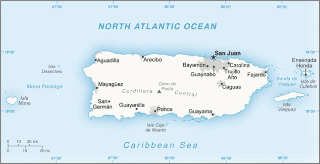
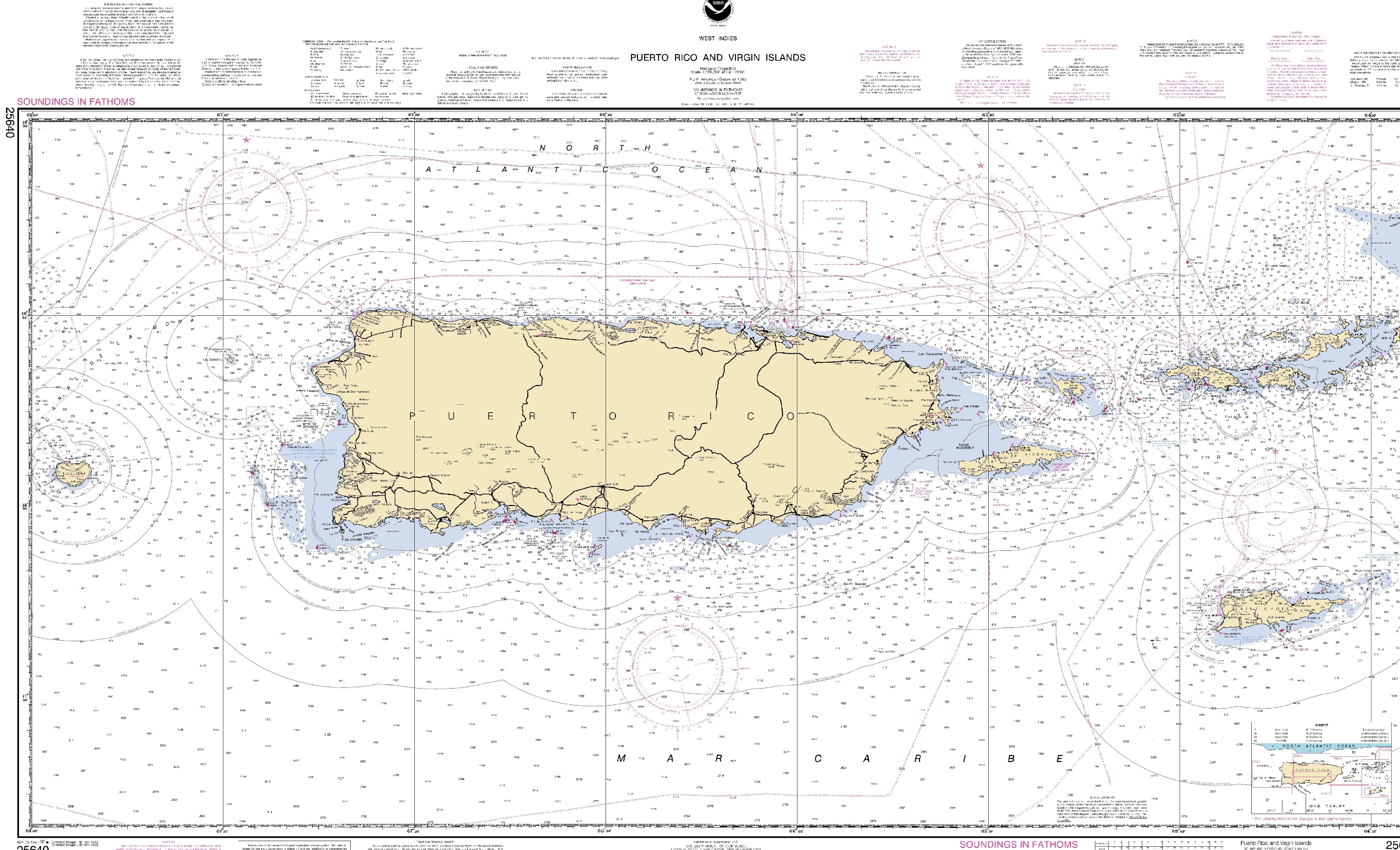
Please provide your best estimate for the trips to fishing areas trip costs, and catches/landings for last year (2018). Also, please refer to the following map for the zones (areas) to provide percentages of trips taken to each area per year.
Area 1 – Aguadilla to Rio Grande
Area 2 – Rio Grande to the northeast, north of Fajardo to Culebra
Area 3 – Rio Grande to the east, including all shallow platform/shelf waters east and south of Culebra
Area 4 – south of Fajardo to Maunabo, including Vieques and other points east
Area 5 – Manuabo to the west to Ponce
Area 6 – Ponce to the west to Cabo Rojo
Area 7 – Cabo Rojo to the north to Aguadilla
1
7
6
5
4
3
2


Gear 1 |
Gear 2 |
Gear 3 |
Total trips (2018) |
1 |
2 |
3 |
4 |
5 |
6 |
7 |
Gear:
|
Gear:
|
Gear:
|
|
|
|
|
|
|
|
|
Species: 1. 2. 3. |
Species: 1. 2. 3. |
Species: 1. 2. 3. |
|
|
|
|
|
|
|
|
|
|
|
|
|
|
|
|
|
|
|
Gear: |
Gear:
|
Gear:
|
|
|
|
|
|
|
|
|
Species: 1. 2. 3. |
Species: 1. 2. 3. |
Species: 1. 2. 3. |
|
|
|
|
|
|
|
|
|
|
|
|
|
|
|
|
|
|
|
Gear:
|
Gear:
|
Gear:
|
|
|
|
|
|
|
|
|
Species: 1. 2. 3. |
Species: 1. 2. 3. |
Species: 1. 2. 3. |
|
|
|
|
|
|
|
|
Table 1
In the table below, please list your typical trip costs. If you took trips in which you used more than one gear type, please list those separately from trips that you took using only one gear or another combination of gear types.
Table 2
Gear 1 |
Gear 2 |
Gear 3 |
Fuel and oil |
Ice |
Bait |
Food and supplies |
Air for tanks |
Crew |
Gear:
|
Gear: |
Gear: |
|
|
|
|
|
|
|
|
|
|
|
|
|
|
|
Gear: |
Gear: |
Gear:
|
|
|
|
|
|
|
|
|
|
|
|
|
|
|
|
Gear: |
Gear: |
Gear:
|
|
|
|
|
|
|
In the table below, please list up to the top five species you harvested in 2018, including the total pounds for each species.
Table 3
Species |
Total pounds (2018) |
Species 1: |
|
Species 2: |
|
Species 3: |
|
Species 4: |
|
Species 5: |
|
How do you decide whether and where to take a fishing trip? Please rank the following factors from 1-5, where is the most important and 5 is the least important factor.
Factor Rank (1-5)
Weather ______
Fuel price ______
Species market price ______
Crowding in an area ______
Preferred habitat/area ______
Number of vessels in the fishing area
What is the maximum number of vessels that you can tolerate around your vessel in your fishing area before you change your fishing location?
Number of vessels ____________
What is the average/usual number of vessels that fish around your vessel in your fishing area?
Number of vessels____________
Please rate the following in terms of how crowding affects your fishing activities, where 1 is least effect and 5 is most effect.
Lower catch 1 2 3 4 5
Lower catch rates 1 2 3 4 5
Use conflicts 1 2 3 4 5
Lack of space/hazards 1 2 3 4 5
Habitat damage 1 2 3 4 5
What is the optimal number of vessels that should operate around you in your fishing area? ___________number of vessels
Please rate the following types of users/vessels that may affect your fishing activities, where 1 is the least impact and 5 is the most impact.
Recreational fishers 1 2 3 4 5
Commercial fishers 1 2 3 4 5
Recreational divers 1 2 3 4 5
Commercial divers 1 2 3 4 5
Large party boats/cats 1 2 3 4 5
Charter boats (6-pack) 1 2 3 4 5
Private vessels 1 2 3 4 5
Please rate the condition of the following coastal and marine resources, where 1 is excellent and 5 is poor.
Fish and fisheries 1 2 3 4 5
Lobster 1 2 3 4 5
Conch 1 2 3 4 5
Coral reefs 1 2 3 4 5
Sea grasses 1 2 3 4 5
Mangroves 1 2 3 4 5
Other rocky bottom 1 2 3 4 5
Water quality 1 2 3 4 5
Please rate the trends in the following coastal and marine resources compared to how these were when you first started fishing in the area, where 1` is much better and 5 is much worse.
Fish and fisheries 1 2 3 4 5
Lobster 1 2 3 4 5
Conch 1 2 3 4 5
Coral reefs 1 2 3 4 5
Sea grasses 1 2 3 4 5
Mangroves 1 2 3 4 5
Other rocky bottom 1 2 3 4 5
Water quality 1 2 3 4 5
Which coastal and marine resources have most declined the most in your area of use and why? What are the reasons for the decline?
________________________________________________________________________________________________________________________________________________________________________________________________________________
In terms of use total, please state whether the following users/vessels should be decreased, remain the same, or be increased in the areas where you fish.
GROUP |
Decrease |
Same |
Increase |
Desired % change |
Commercial fishers |
|
|
|
|
Recreational fishers |
|
|
|
|
Private boaters |
|
|
|
|
Large party boats/cats |
|
|
|
|
Charter boats |
|
|
|
|
Commercial divers |
|
|
|
|
Recreational divers |
|
|
|
|
Water taxis |
|
|
|
|
What coastal or marine resources would you identify as indicators that can be tracked such that if changes were to occur to these indicators, changes in management should take place?
____________________________
____________________________
____________________________
What type of management measures would you prefer to address ongoing resource impacts or to maintain present conditions? Please rate the measures on a scale from 1-5, where is 1 is least preferred, and 5 is most preferred.
No use areas 1 2 3 4 5
No take areas 1 2 3 4 5
Zoned areas, by use 1 2 3 4 5
Education and awareness 1 2 3 4 5
Enforcement 1 2 3 4 5
Limits on total vessel use 1 2 3 4 5
Fishing quotas 1 2 3 4 5
Please use the following map to identify the following:
Current areas of use, by species
Historical areas of use, by species
Areas of high use, congestion
Areas of conflict with other fishers and stakeholder groups

| File Type | application/vnd.openxmlformats-officedocument.wordprocessingml.document |
| Author | Somak Shivlani |
| File Modified | 0000-00-00 |
| File Created | 2021-01-20 |
© 2026 OMB.report | Privacy Policy