Hydro Add Tool - Register, Browse, and Complete Edits
HydroAdd3d
HydroAdd workflow for PRA 2024 v3
Hydro Add Tool - Register, Browse, and Complete Edits
OMB: 1028-0129
OMB Control No: 1028-0129
Expiration Date: XX/XX/XXXX
HydroAdd Workflow
Michael Tinker 11/6/2024
Summary
The Hydrography Addressing Tool (HydroAdd) is a website built by the USGS National Geospatial Program (NGP). It is a platform which allows users to address, or reference, their own data to the National Hydrography Dataset (NHD). HydroAdd allows users to edit the geometry of the features in their web feature service to be coincident with NHD features. Users cannot edit the NHD with HydroAdd; it is only a reference layer for display.
HydroAdd users can be members of the public. Most often, HydroAdd users are federal employees, state or local government employees, or other users with knowledge of GIS.
To login to HydroAdd, users must have an ArcGIS Online (AGOL) or DOI account. First time users of HydroAdd must register a username for their profile. The user’s email is passed to their profile as a secure token from their AGOL or DOI account. The user’s profile is stored in the application database. A user’s profile is visible only to themselves and the HydroAdd administrator. HydroAdd administrators are a limited group of USGS employees.
To use HydroAdd, users share their own data as a web feature service from ArcGIS Online. HydroAdd honors the editing permissions set by the owner of the service. HydroAdd displays the service and provides a mechanism for addressing it to a read-only reference version of the NHD. In this way, a team of users with editing permission can collaborate on common projects with HydroAdd.
Modifications to the HydroAdd tool are currently in development. These modifications include a) allowing HydroAdd to use the latest hydrography product from the USGS 3D Hydrography Program (3DHP), b) use of GeoServer (an open-source hosting service) rather than ArcGIS Online for hosting user data (c) authenticating users with login.gov rather than ArcGIS Online or DOI d) updating some of the underlying logic to speed GIS processing, and d) updating the name of the tool to HydroAdd3d.
Login
Users
log in with an existing ArcGIS Online or DOI account:

User Profile
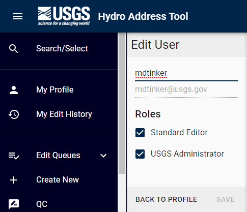
After authentication by ArcGIS Online or DOI, first time users of HydroAdd must select a username for their profile. The recommendation is to use a simple username, but not a full name or email. HydroAdd then automatically assigns the new users to the Standard Editor role.
Standard Editors can view their own profile, but not the profiles of other users.
Standard Editors can view the editing activity of other editors of a shared service but cannot know which users performed the edits.
USGS HydroAdd Administrators can view the profiles of all users.
USGS HydroAdd Administrators are a limited group of the USGS employees.
HydroAdd Administrators must be able to contact users directly in case there are issues with the functioning of HydroAdd that could affect their editing work, issues with their user role assignments, or other issues with HydroAdd.

Workflow for adding the web feature service and editing
HydroAdd allows users to address their own data to the NHD. HydroAdd displays the user’s web feature service as it is shared from AGOL, along with a read-only version of the NHD. Users update their own data with HydroAdd to make their data coincident to the NHD features. Users can only edit their own data as it exists in their own web feature service. Users cannot edit the NHD; it is only a reference layer for display in the HydroAdd.
Add a service layer from ArcGIS Online
User adds a service layer that is shared from AGOL

User’s service layer displays in HydroAdd.

Users select the features in their service they wish to add to an editing queue.

Edit Service Layer
Users then edit the items in the queue.


When the user is done editing with HydroAdd, they can retrieve their data from ArcGIS Online.

Administrator Functions
USGS
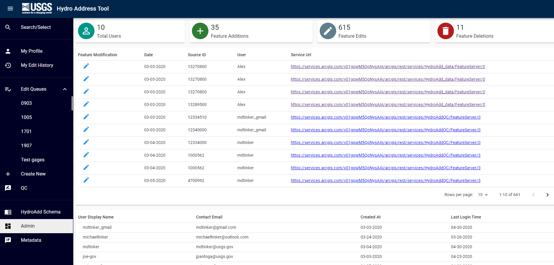
Administrators of HydroAdd can view all user profiles in the Admin
panel, including username, user email, and their associated service
layers.

Administrators can also search for users by username.

Paperwork Reduction Act Statement: We are collecting this information subject to the Paperwork Reduction Act (44 U.S.C. 3501 et seq.). Your response is voluntary, and we will not share your response publicly. We may not conduct, or sponsor and you are not required to respond to a collection of information unless it displays a currently valid OMB Control Number. OMB has reviewed and approved this poll and assigned OMB Control Number 1028-0129.
Estimated Burden Statement: We estimate responses will average 1 minute per response, including time to read instructions and gather information. You may submit comments on any aspect of this information collection to the Bureau Information Collection Clearance Officer, US Geological Survey, 12201 Sunrise Valley Drive MS 159, Reston, VA 20192, or via email at [email protected].
| File Type | application/vnd.openxmlformats-officedocument.wordprocessingml.document |
| Author | Tinker, Michael D |
| File Modified | 0000-00-00 |
| File Created | 2025-01-22 |
© 2026 OMB.report | Privacy Policy