Fallout Map of New Mexico
ATTACHMENT 2 - Fallout map of New Mexico.docx
Study to Estimate Radiation Doses and Cancer Risk From Radioactive Fallout From The Trinity Nuclear Test (NCI)
Fallout Map of New Mexico
OMB:
Document [docx]
Download: docx | pdf
ATTACHMENT 2 – Fallout Map of New Mexico
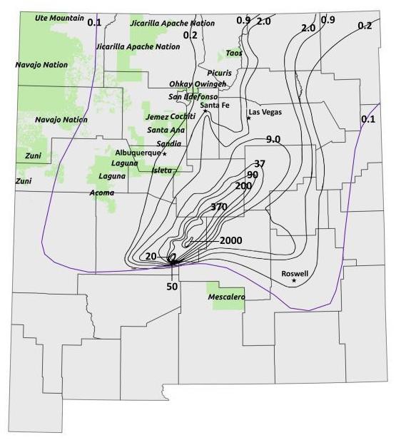
FMap of New Mexico showing county outlines and overlaid with composite of exposure- rate iso-contours based on Quinn (85) and Cederwall and Peterson (86). Green colored areas are Native American pueblos. Trinity ground zero (detonation site) is located at the lower central location were contours converge (northwest of Mescalero Apache pueblo). Note: iso-contours are not indicative of radiation dose but are lines of equal exposure rate (mR/h) from fallout deposited on the ground normalized to 12 hours post-detonation. Data derived from iso-contours are used as input data to radiation dose calculations.
| File Type | application/vnd.openxmlformats-officedocument.wordprocessingml.document |
| Author | Arroyave, Whitney |
| File Modified | 0000-00-00 |
| File Created | 2021-01-23 |
© 2026 OMB.report | Privacy Policy
