Sdis
NOAA Geospatial Metadata
2021_OAP_SDIS_Forms And Instructions
OAR - SDIS
OMB: 0648-0024
OAP Science Data Information System (SDIS)
Forms and Instructions

OMB 0648-0024
Overview
The NOAA Ocean Acidification Program (OAP) Science Data Information System (SDIS) provides a web-based tool to upload scientific data for archival at NCEI. It includes tools to enter and edit metadata, add supplemental documents, and the option to check the data for common data errors.
Request Account
In order to use the SDIS, users must have a login account. To request an account, there is a simple form with a minimum amount of required information, including name, email address, and the user’s organization.
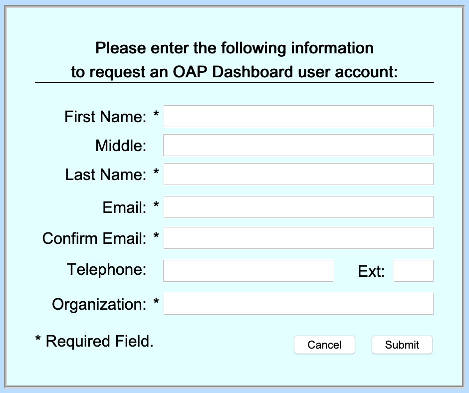
A Federal agency may not conduct or sponsor, and a person is not required to respond to, nor shall a person be subject to a penalty for failure to comply with an information collection subject to the requirements of the Paperwork Reduction Act of 1995 unless the information collection has a currently valid OMB Control Number. The approved OMB Control Number for this information collection is 0648-0024. Without this approval, we could not conduct this information collection. Public reporting for this information collection is estimated to be approximately 2 hours per response, including the time for reviewing instructions, searching existing data sources, gathering and maintaining the data needed, and completing and reviewing the information collection. All responses to this information collection are voluntary. Send comments regarding this burden estimate or any other aspect of this information collection, including suggestions for reducing this burden to the OAR, [email protected]. Geospatial metadata is requested in accordance with Executive Order 12906 and NOAA Administrative Order 212-5.
Login
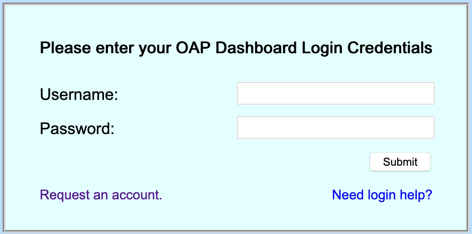
The login dialog with username and password also provides a link to reset a lost or forgotten password or username.
Edit Profile
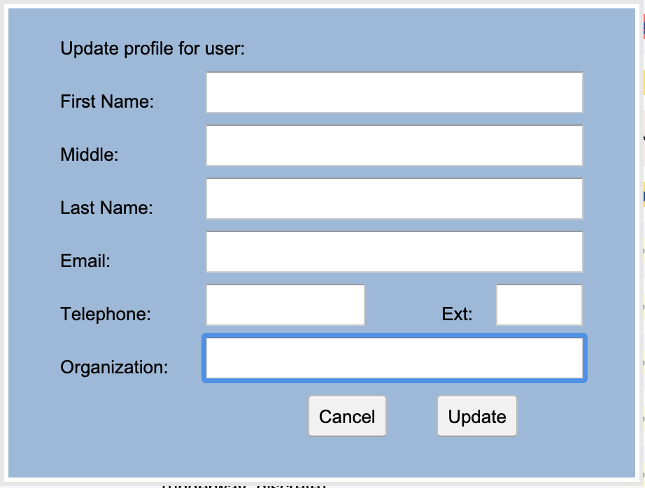
Users can review and update their profile information through the Edit Profile dialog.
Change Password
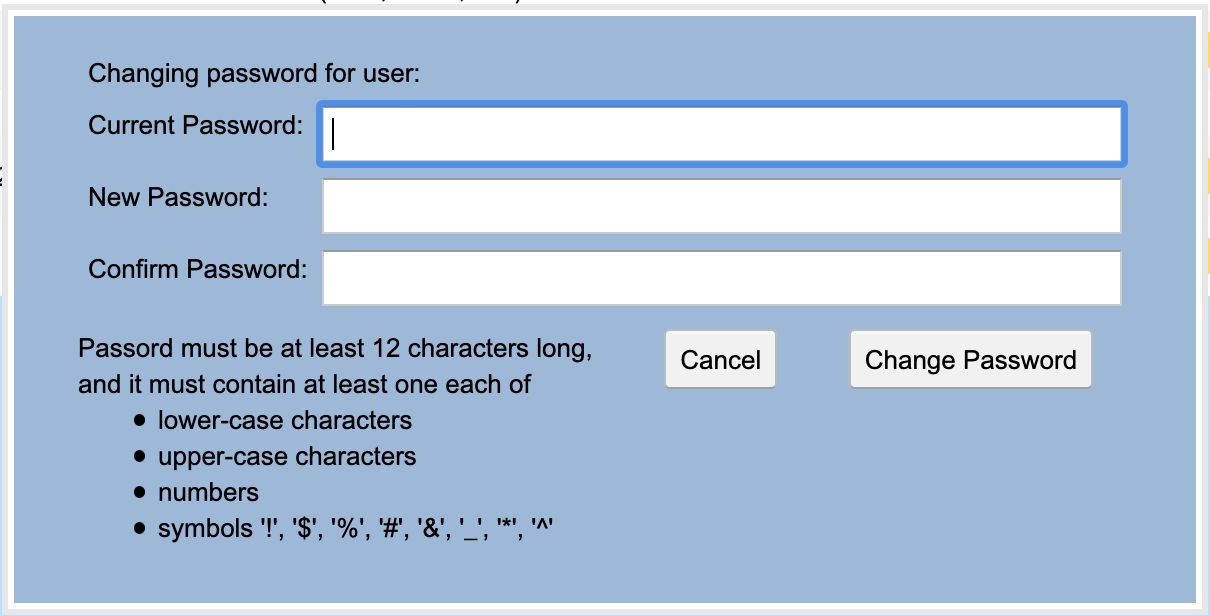
Users can change their password using the Change Password dialog. Passwords must conform to NOAA’s password complexity requirements.
Main Page: Dataset Listing
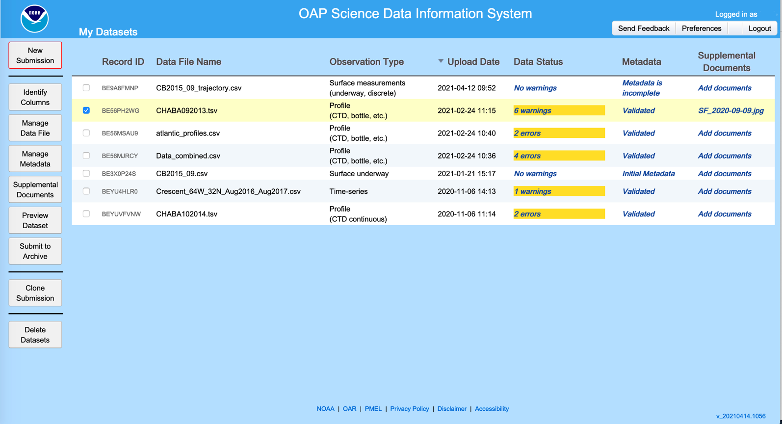
The application main page shows all the datasets that have been uploaded by the user. It will be empty the first time a user logs in to the application. The listing shows various information about the datasets, including the uploaded file name, and the current status of the various steps of the process. It also provides a toolbar on the left for the operations provided by the tool which include creating a new submission record, uploading a data file, entering dataset metadata, and submitting to the archive, as well as the optional steps of identifying the dataset variables, checking the data for common errors, adding supplemental documents, and previewing the data.
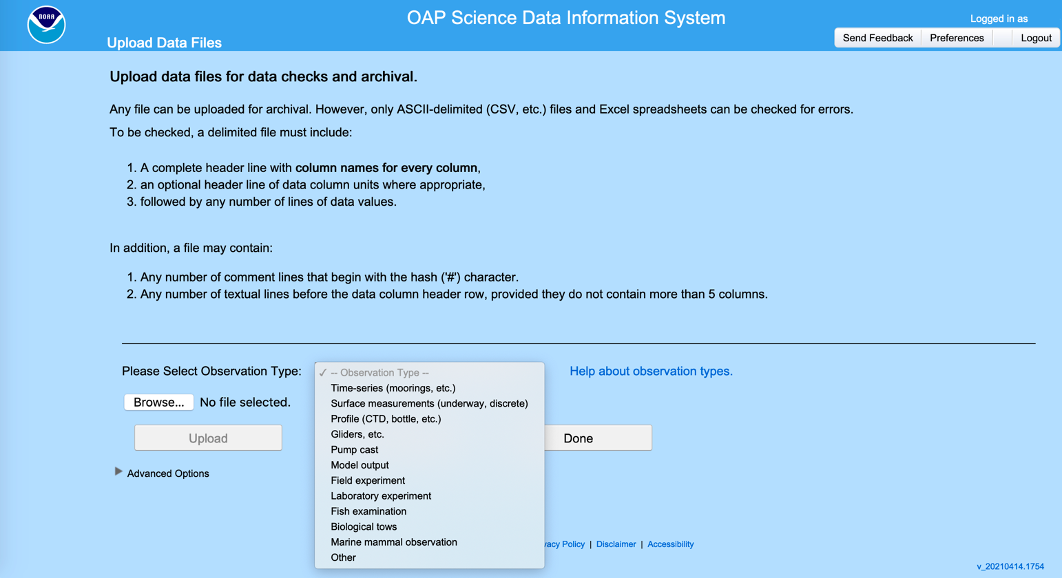
Upload Page
New submission records are created by selecting New Submission and uploading a data file on the Upload Data Files page. Users must specify the observation type, e.g. surface underway, profile, experiment, fish observation, etc.
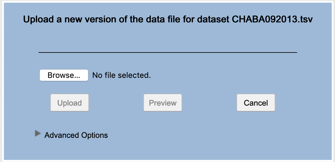
Updates to a data file
If necessary, the user can upload a new data file to replace the previously uploaded file.
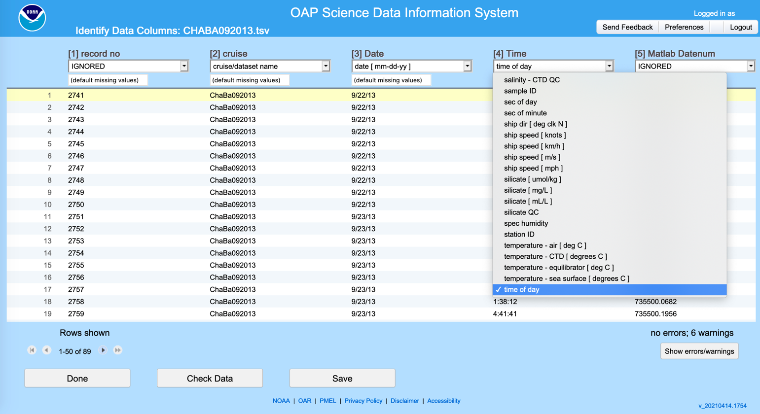
Data Column Identification
In order to use some of the SDIS features, including metadata extraction and checking for data errors, users must identify the observation variables in their dataset by selecting from a drop-down list of standard variables. Once identified, the system will remember a user’s data column mappings, and the user will only have to provide additional mappings in subsequent submissions if their variables change.
After the variables have been identified, the user can then opt to check the dataset for common data errors. The checks performed depend on the observation type and the included variables.
Metadata Entry and Editing
The integrated Metadata Editor allows users to upload and edit metadata for their dataset. Metadata from a previous submission can be uploaded and edited, or a user can create a metadata Template for common information and start from that.
Metadata: Data Submitter
This section provides common information about the person submitting the dataset. The minimum required information is necessary in the event the archive needs to contact the submitter with questions about the submission and to provide updates as to the status of the archiving process. Assuming the user is the Data Submitter, the required fields will be pre-populated from information in the users Profile.
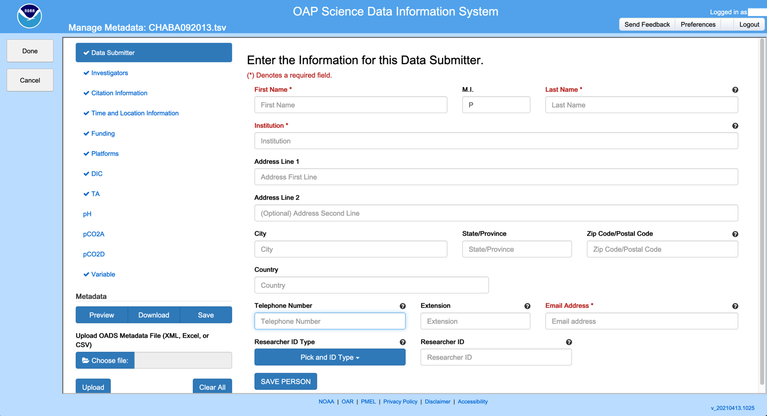
Metadata: Investigators
Information about the Investigators involved is entered in the Investigators section. This form is identical to the Data Submitters for, with the exception that it allows any number of Investigators to be entered.
Metadata: Citation
The Citation section provides fields for Research Title, Abstract, and List of Authors, and general information about the dataset and research project, including the purpose and use limitations of the data, related research projects, ship cruise identifiers if appropriate, scientific references, and any additional information. Only the Title, Abstract, and List of Authors are required.
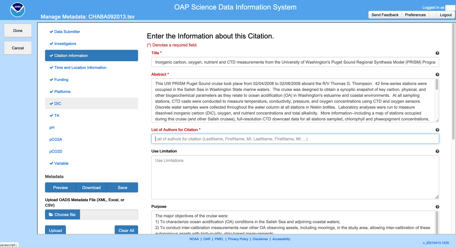
Metadata: Time and Location Information
The Time and Location section includes the spatial and temporal bounds of the data, as well as names of the geographic areas where the data were collected. If the data has been checked by the SDIS, the spatial and temporal bounds will have been extracted from the data and filled in.
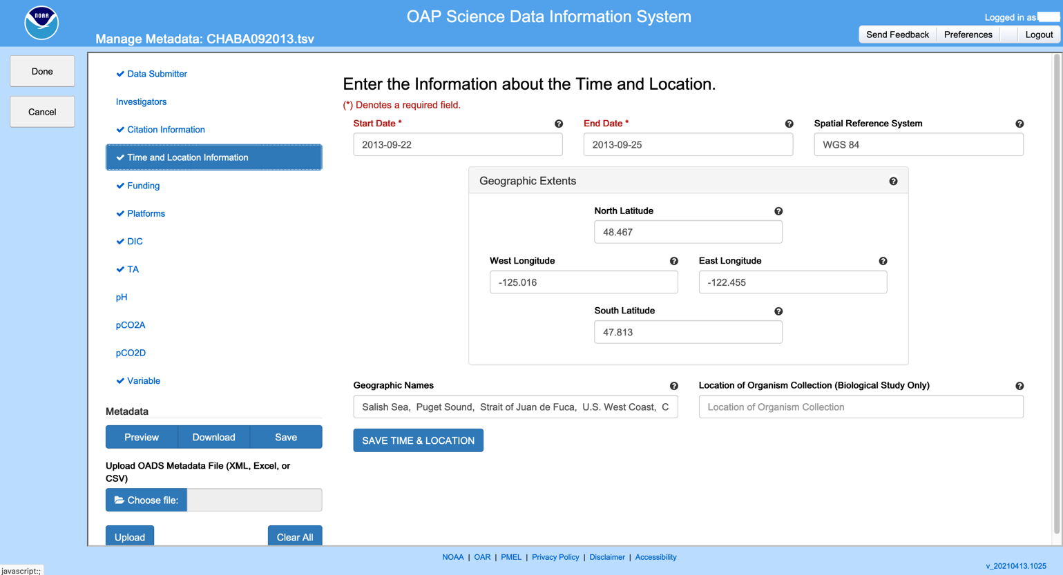
Metadata: Funding
Information about the project funding including Grant Number, Funding Agency, and Project Title. is entered in the Funding section. If the project was funded by NOAA’s Ocean Acidification Program (OAP), the funding details can be filled by selecting the grant number from a drop-down list.
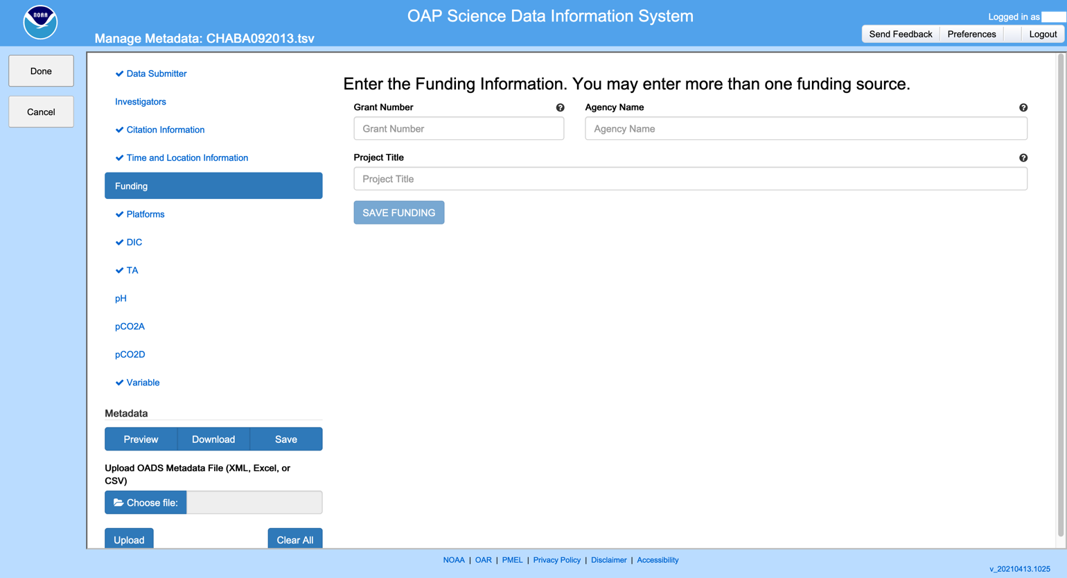
Metadata: Platforms
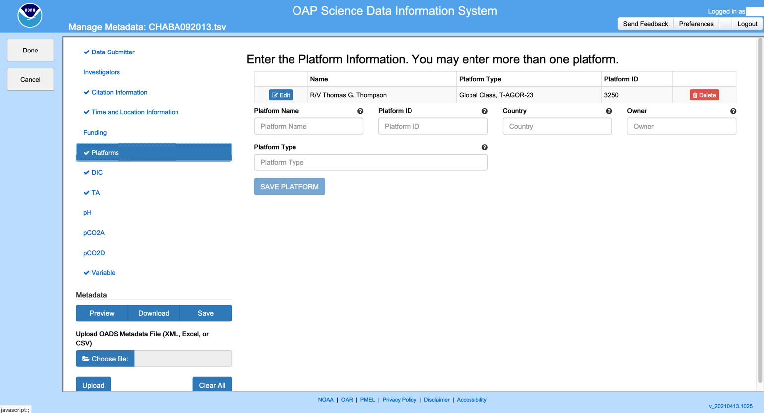
Details about the observation platform(s) used to collect the data including Name, Identifier, Country of Registration, Owner, and Type, are entered in the Platforms section. Multiple Platforms may be entered.
Metadata: Variables
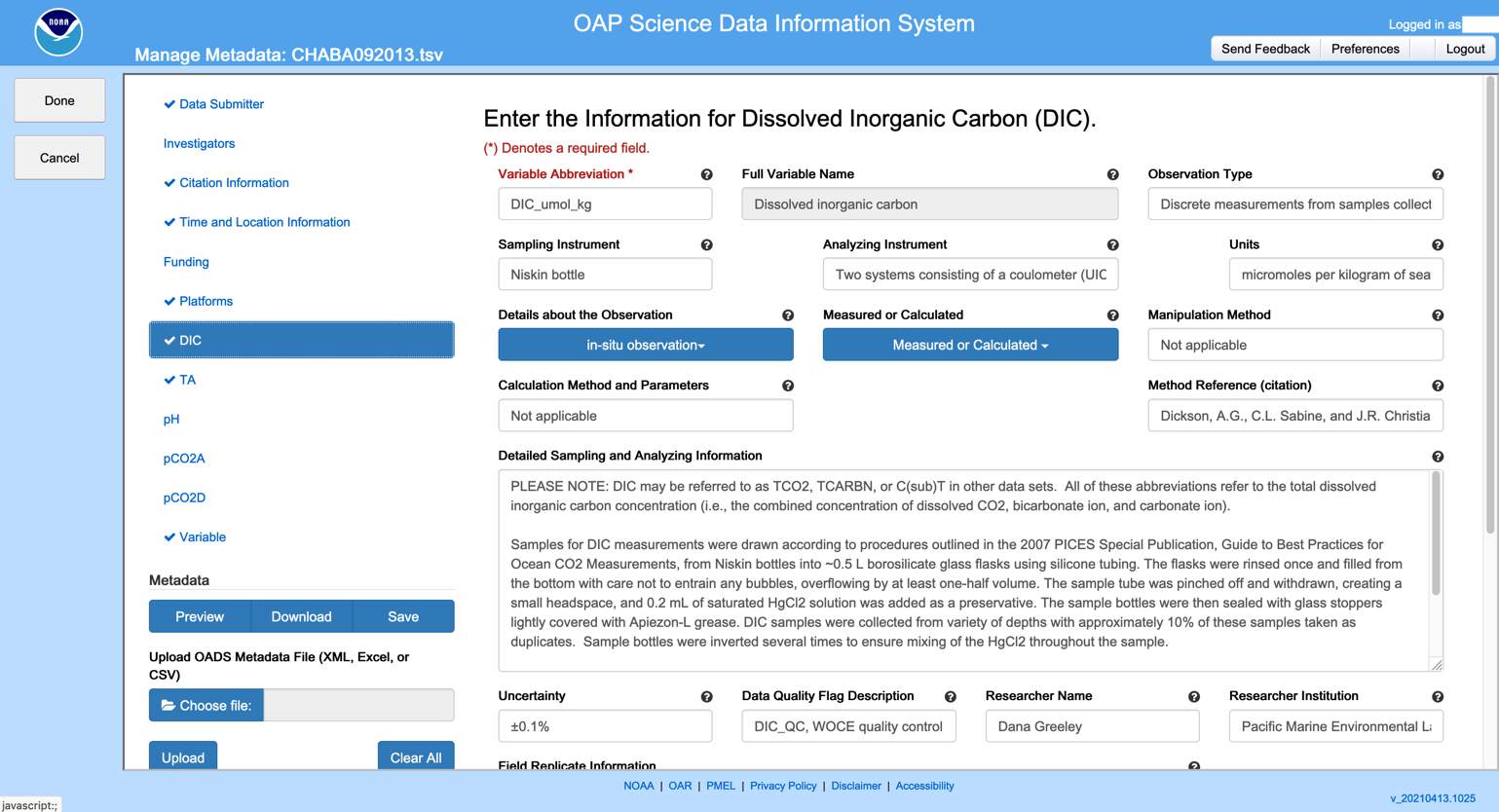
Details about the collection and handling of the observed variables are gathered in the Variables sections. There are five observed variables that are common in OAP observations – Dissolved Inorganic Carbon (DIC), Total Alkalinity (TA), pH, and CO2 measured discretely or continuously – and those variables each have their own section, and then there is a section to add all the other variables that are included in the dataset. All the Variable sections are largely the same, although with slight differences in the specific detailed information gathered for each of the variables with their own section.
The DIC section is shown as exemplary.
Supplemental Documents
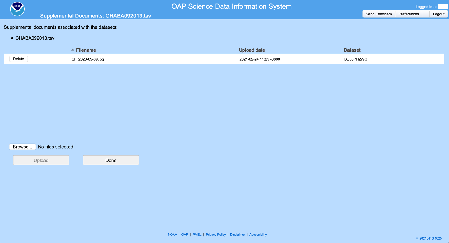
Any additional documents that are to be submitted with the dataset are uploaded on the Supplemental Documents page. Typical supplemental documents include ship or experiment reports, observation images, and the like.
Data Preview Plots
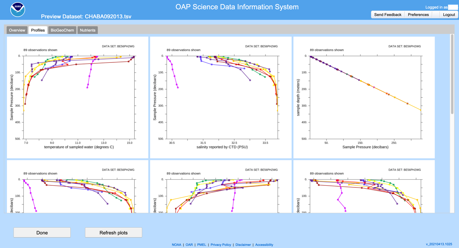
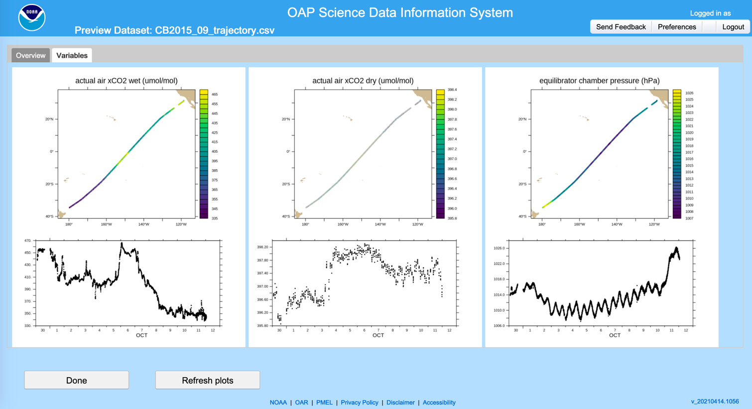
If the user chooses, the SDIS can generate thumbnail preview plots of the data. Shown are example plots for profile and underway observations.
Submit to Archive
When ready, the data is submitted to the Archive on the Submit to Archive page. On this page there is the opportunity to add an optional message for the archival staff, as well as request that a DOI be provided for the submitted dataset. If this is an update of or addendum to a prior submission, the user can select those options and provide the accession number of the prior submission.
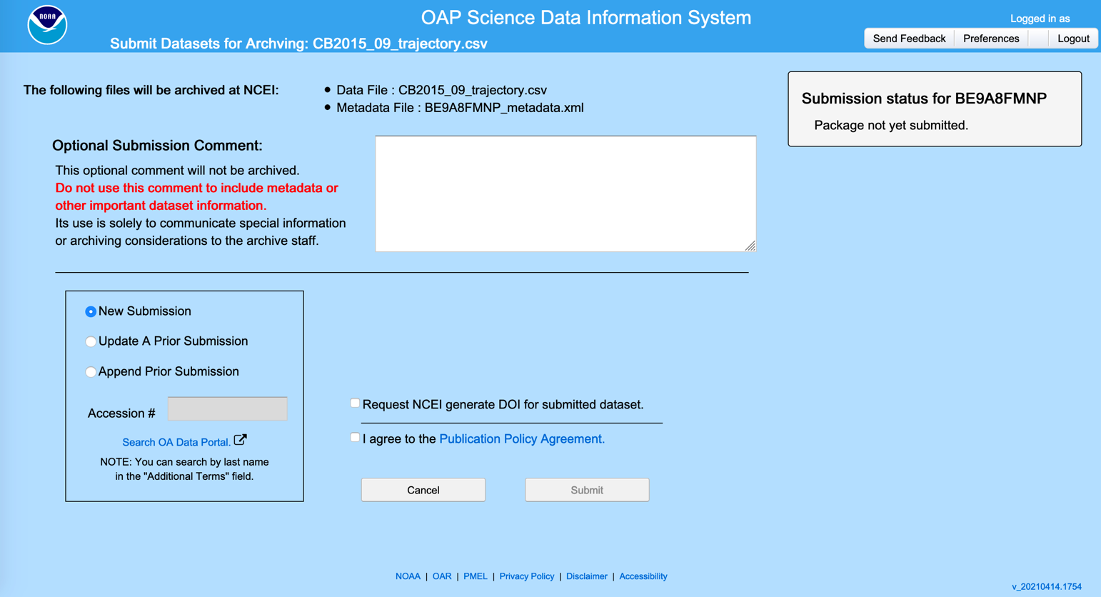
The user must also agree to the Publication Policy Agreement before submitting.

After submission, the status of the archival process will be updated in the status section.
| File Type | application/vnd.openxmlformats-officedocument.wordprocessingml.document |
| Author | Adrienne.Thomas |
| File Modified | 0000-00-00 |
| File Created | 2021-05-08 |
© 2026 OMB.report | Privacy Policy