Ontario Wildfire Smoke Moves East - NASA Science
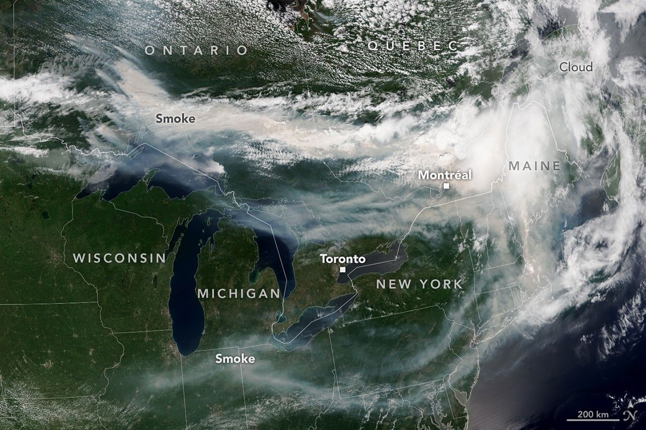
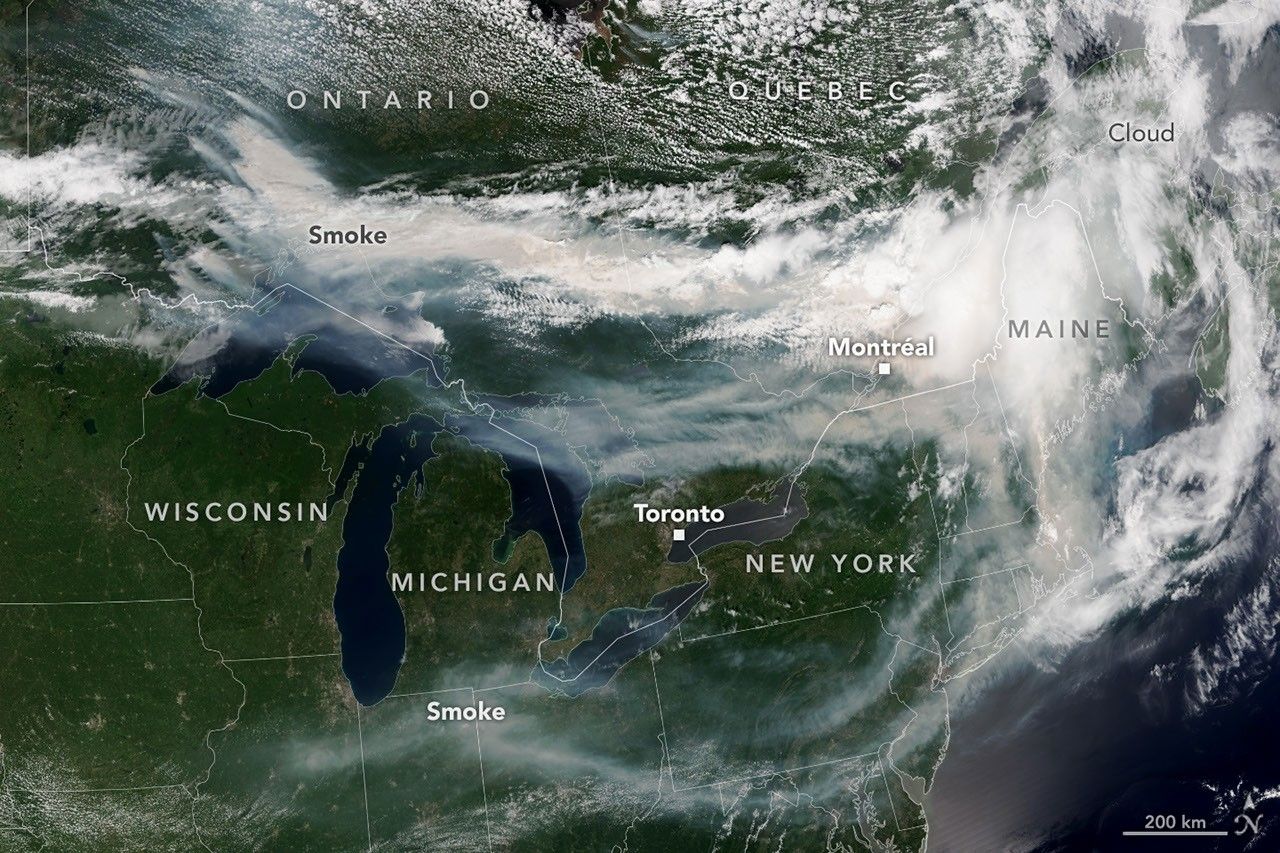
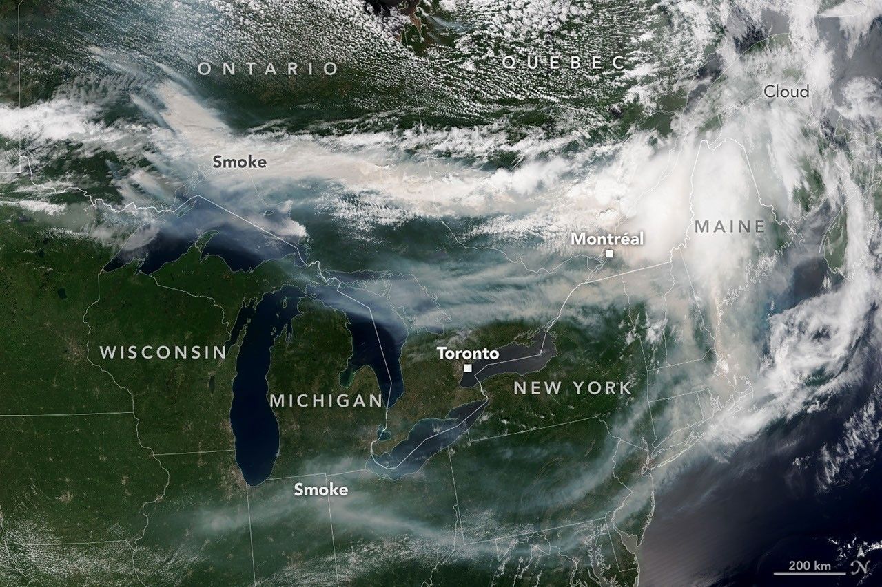
Summary: A satellite image from July 14, 2026, shows smoke from wildfires in Ontario, Canada, drifting southeast over parts of Canada and the United States.
On July 14, 2026, the VIIRS instrument on the NOAA-21 satellite captured imagery of extensive wildfire smoke originating from Northwestern Ontario. The smoke was carried by winds primarily toward the southeast, affecting air quality in regions including Ontario, Quebec, and parts of the U.S. Midwest and Northeast. The event coincided with a heat wave in southern Ontario, and by mid-July, nearly 850 fires were active across Canada, with over 180 located in Ontario.
Document outline
1. Overview of the July 2026 Ontario wildfire event 2. Satellite imagery details (NOAA-21 VIIRS) 3. Meteorological movement of smoke plumes 4. Impact on air quality and public health in Canada and the U.S. 5. Context of the 2026 Canadian fire season statistics