Latest Satellite Imagery
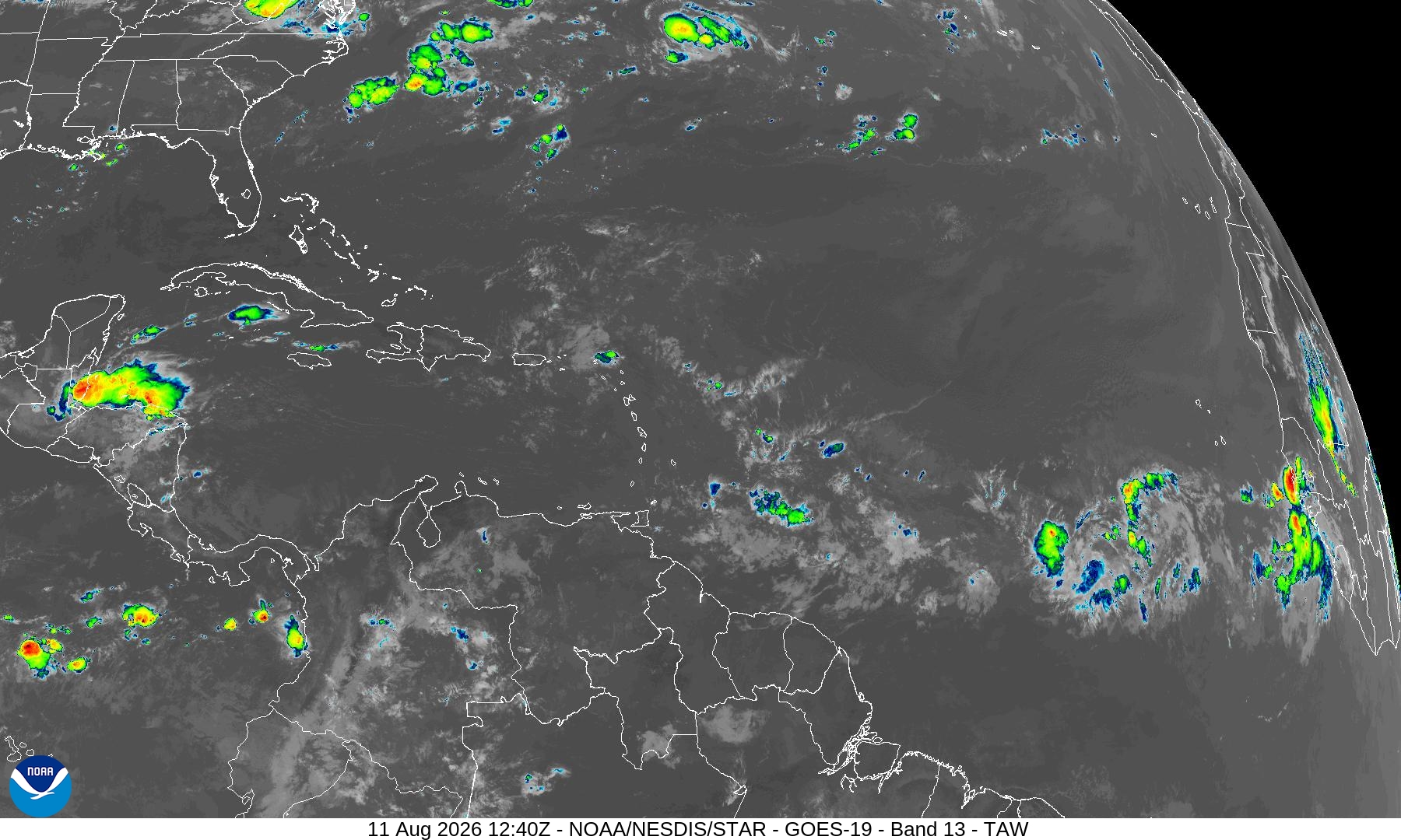
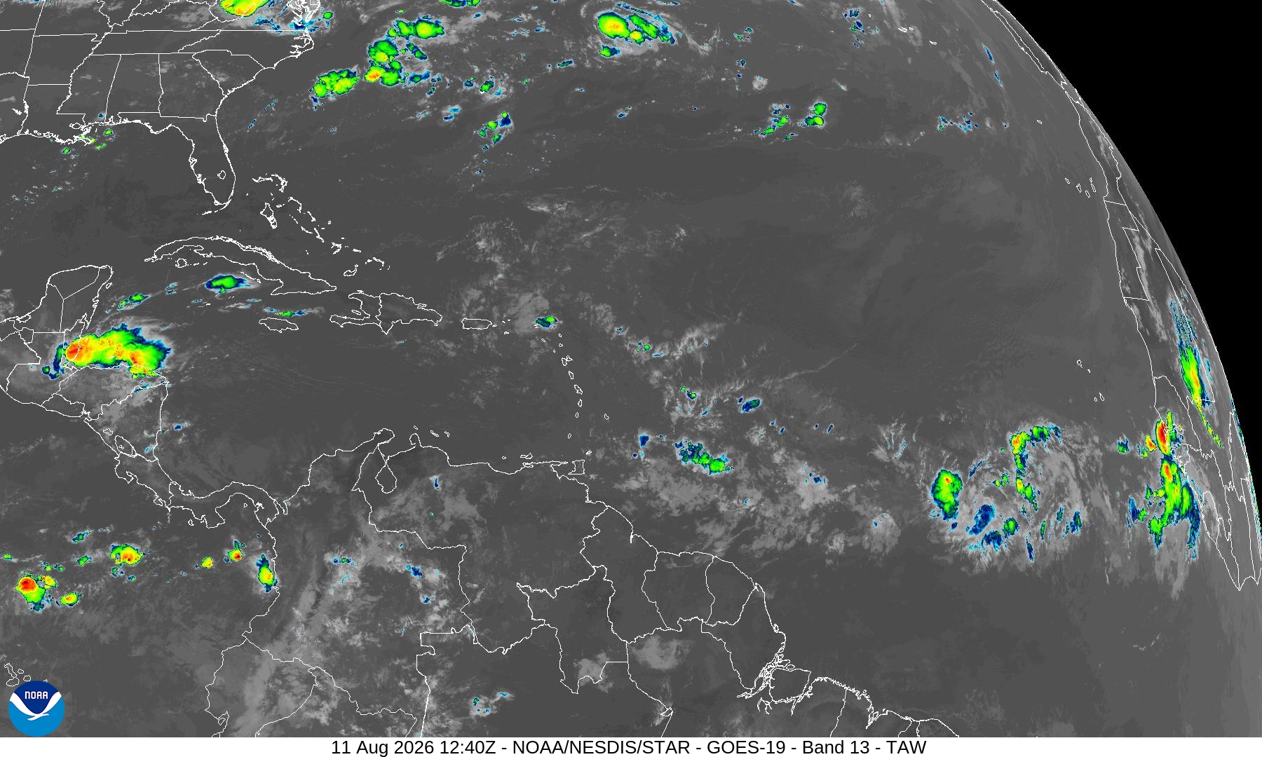
Summary: A GOES-19 Band 13 infrared satellite image showing cloud cover and weather systems across the Tropical Atlantic, Caribbean, and parts of the Americas.
This satellite image, captured by the GOES-19 satellite on August 11, 2026, at 12:40Z, provides a high-resolution view of the Tropical Atlantic and Caribbean regions. Utilizing Band 13 (Clean Infrared), the image displays cloud top temperatures, with brighter colors indicating colder, higher-altitude cloud formations often associated with active convection and tropical weather systems. The view encompasses the Caribbean Sea, the Gulf of Mexico, parts of the United States, and the northern coast of South America.
Document outline
1. Satellite Image Overview 2. Technical Metadata 3. Geographic Coverage 4. Data Source Information
