Latest Satellite Imagery
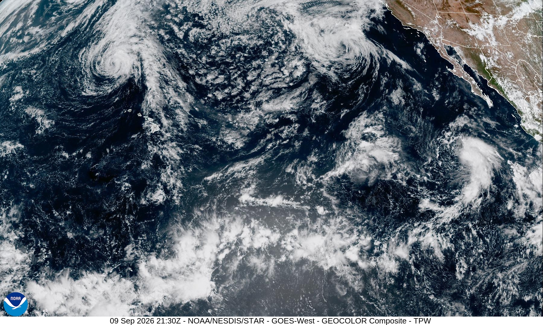
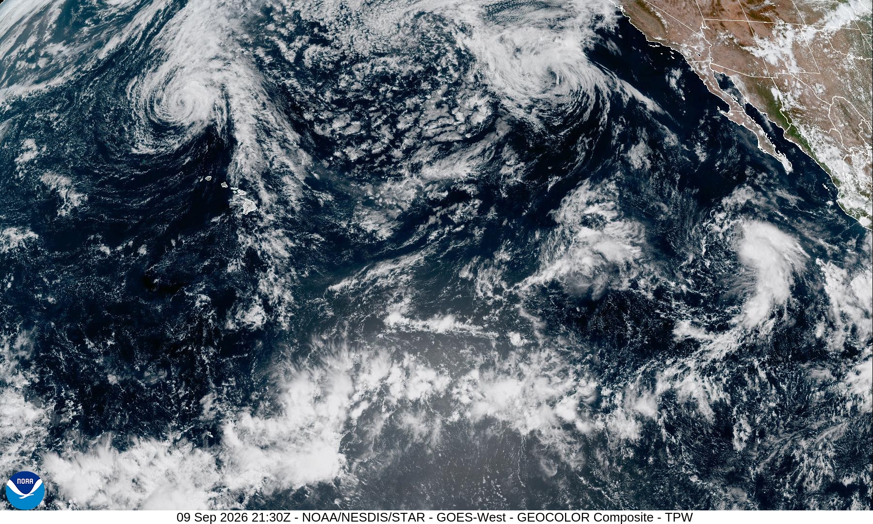
Summary: This GOES-West GeoColor satellite image provides a real-time view of the Pacific Ocean, capturing cloud formations, tropical systems, and the western coast of North America.
This image is a GeoColor composite captured by the GOES-West satellite on September 9, 2026, at 21:30Z. It provides a wide-angle view of the Pacific sector, clearly displaying the Hawaiian Islands, the western coast of North America, and various atmospheric features, including cyclonic cloud patterns over the ocean. The GeoColor enhancement combines visible and infrared data to provide a natural-looking representation of the Earth's surface and cloud cover.
Document outline
1. Image Overview: GOES-West GeoColor Composite 2. Date and Time: September 9, 2026, 21:30Z 3. Geographic Coverage: Pacific Sector, Hawaii, and Western North America 4. Technical Specifications: 1800x1080 resolution, JPEG format 5. Source: NOAA/NESDIS/STAR
