Latest Satellite Imagery
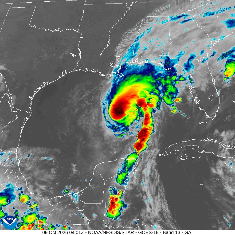
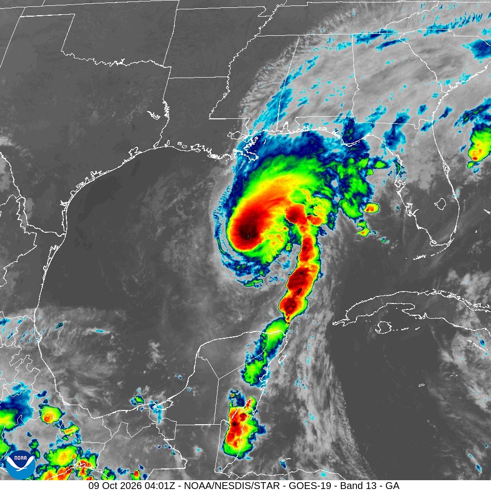
Summary: A GOES-19 infrared satellite image showing a tropical cyclone in the Gulf of Mexico as of October 9, 2026.
This satellite image, captured by the GOES-19 weather satellite on October 9, 2026, at 04:01 UTC, displays the Gulf of America sector. The image uses Band 13 infrared data to highlight cloud top temperatures, showing a distinct tropical cyclone structure with a well-defined center and convective banding extending toward the Yucatan Peninsula and the U.S. Gulf Coast.
Document outline
1. Satellite Image Overview 2. Technical Specifications 3. Meteorological Context 4. Data Source Information
