Elevation-Hydro Survey
DOI Generic Clearance for the Collection of Qualitative Feedback on Agency Service Delivery
NHD Questionnaire
Elevation-Hydro Survey
OMB: 1090-0011
OMB Control #: 1090-0011
Expiration Date: 06/30/2015
We would like your input for expectations of hydro feature extraction from LiDAR/IfSAR datasets and for thoughts on an integrated elevation-hydro data structure prototype. The following questions may help guide future research efforts at the USGS for these topics
Thank you for taking the time to complete this survey. No personal information is collected and all responses will remain anonymous. If you are uncomfortable answering any question for any reason, please feel free to skip it.
What is your primary use of the NHD (choose one)?
Flood risk management
Infrastructure and construction management
Natural resources conservation
Agriculture and precision farming
Water supply and quality (analyses and modeling)
Wildfire management, planning, and response
Geologic resource assessment and hazard mitigation
Forest resources management
River and stream resource management
Aviation navigation and safety
Mapping
Fisheries management
Hydrology
Please rate these NHD features in importance to your work: (most important, important, least important)
-
NHD Feature
Most Important
Important
Least Important
Streams/Rivers with width < 50ft.
Streams/Rivers with width > 50ft.
Canal/Ditch
Lake/Pond
Sea/Ocean
Swamp/Marsh (wetlands)
Engineered features (dams, levees, diversion gates)
Coastline
Bays and Estuaries
Fish passage barriers
For braided stream situations, please rate the following options of representation:
-
NHD Feature
Most Important
Important
Least Important
All individual channels

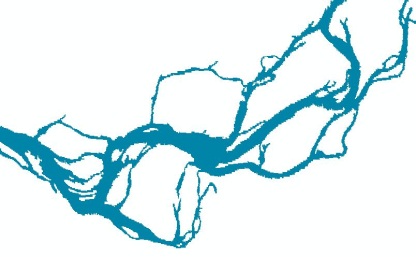
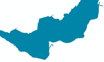
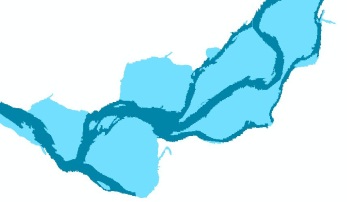
An all-encompassing Complex Channel polygon with a single artificial path

A Complex Channel polygon with major individual channels

What, if any, issues/challenges do you currently encounter working with NHD and NED together?
Do you use the NHDPlus:
Yes or No
If yes, which characteristics do you utilize? (Please check any that apply.)
☐1:100K National Hydrography Dataset (NHD)
☐ 30 meter National Elevation Dataset (NED)
☐ Nationally complete Watershed Boundary Dataset (WBD)
☐ Value added attributes to enhance stream network navigation, analysis and display
☐ Elevation-based catchment for each flowline in the stream network
☐ Catchment characteristics
☐ Headwater node areas
☐ Cumulative drainage area characteristics
☐ Flow direction, flow accumulation and elevation grids
☐ Flowline min/max elevations and slopes
☐ Flow volume & velocity estimates for each flowline in the stream network
☐ Catchment attributes and network accumulated attributes
☐ Gridded data from the hydro-enforcement process (e.g. hydro-enforced DEM)
Is there a need for a new integrated high resolution (1:24,000 or larger scale) product that contains both elevation and hydrography from the USGS?
Yes or No
Please explain your answer above.
Which resolution of a dataset best meets your needs?
1:100,000-scale level of detail
1:24,000-scale level of detail
1:12,000-scale level of detail
1:4,800-scale level of detail
1:2,400-scale level of detail
A multi-scale level of detail
If an integrated high resolution product existed (assuming high-resolution elevation measurement adequate to support the proposed resolution are available), which spatial resolution for the elevation grid would you prefer:
1 meter
3 meter
10 meter
Other (specify)
Is there any other format (DTM, etc) that you would like for the elevation data, besides DEM?
Yes or No
Do you have any use for hydrography delivered as a raster?
Yes or No
Should catchment size in the dataset be:
Variable based on reach
Fixed size
Should stream periodicity (perennial/intermittent/ephemeral) be included in the dataset?
Yes or No
Should derived channels from elevation datasets that are not field-verified be identified differently than known streams in the dataset?
Yes or No
Would you like to have catchments as a part of the NHD?
Yes or No
Please rate the following options for inclusion in a possible integrated dataset: (most important, important, least important)
Option
Most Important
Important
Least Important
Raw elevation (e.g. point clouds, intensity images, etc)
Hydrologically enforced elevation
Flow direction/accumulation grids
Hydrography
Drainage Catchments
Channel Cross-sections
Floodplains
Reach-based channel slope
Hydrography with z-values
Flow volume and velocity
Breaklines (vendor-provided used for hydro-flattening of the elevation data)
If you would like to make any other comments or suggestions, please do so in the box below.
PAPERWORK REDUCTION ACT STATEMENT: A Federal agency may not conduct or sponsor, and a person is not required to respond to a collection of information unless it displays a currently valid OMB control number. Public burden for this survey is estimated to average 7 minutes per response. Comments regarding this collection of information should be directed to the Bureau Clearance Officer, U.S. Geological Survey, 12201 Sunrise Valley Drive, MS 807, Reston, VA 20192.
| File Type | application/vnd.openxmlformats-officedocument.wordprocessingml.document |
| Author | Simley, Jeffrey D. |
| File Modified | 0000-00-00 |
| File Created | 2021-01-31 |
© 2026 OMB.report | Privacy Policy