Latest Satellite Imagery
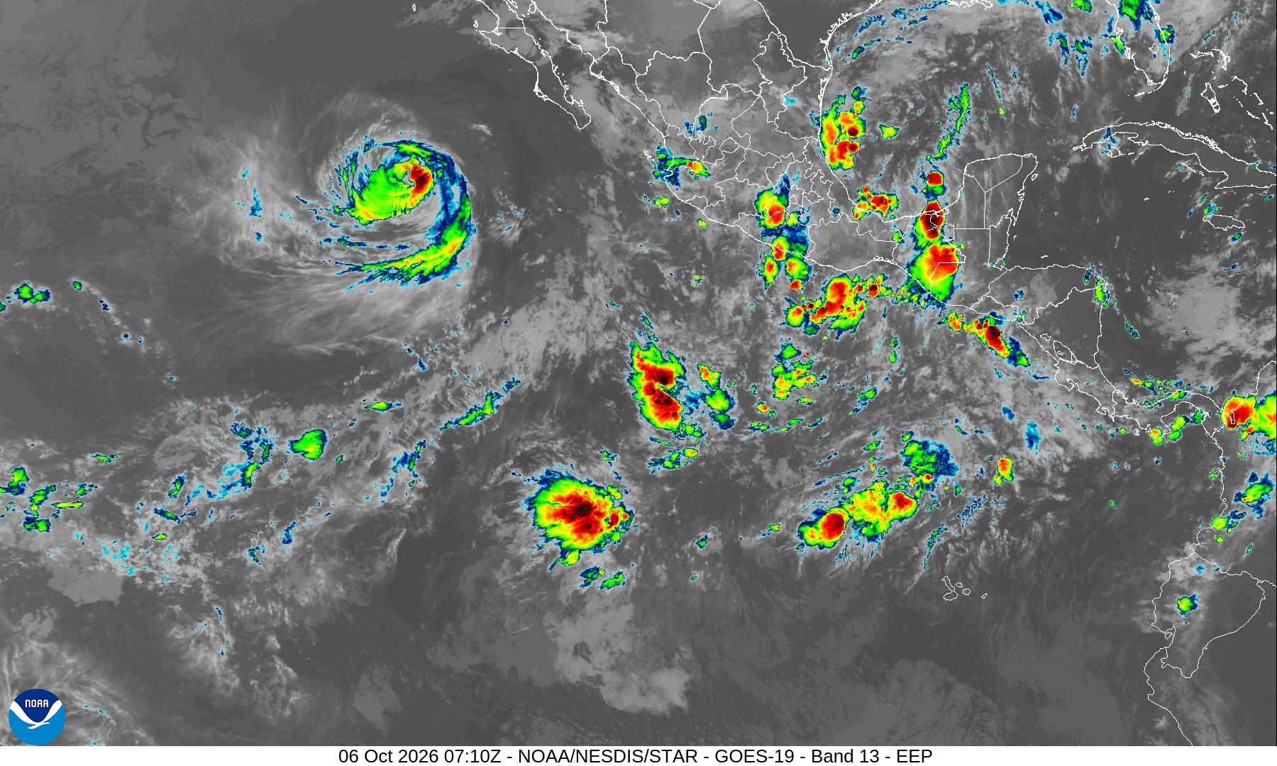
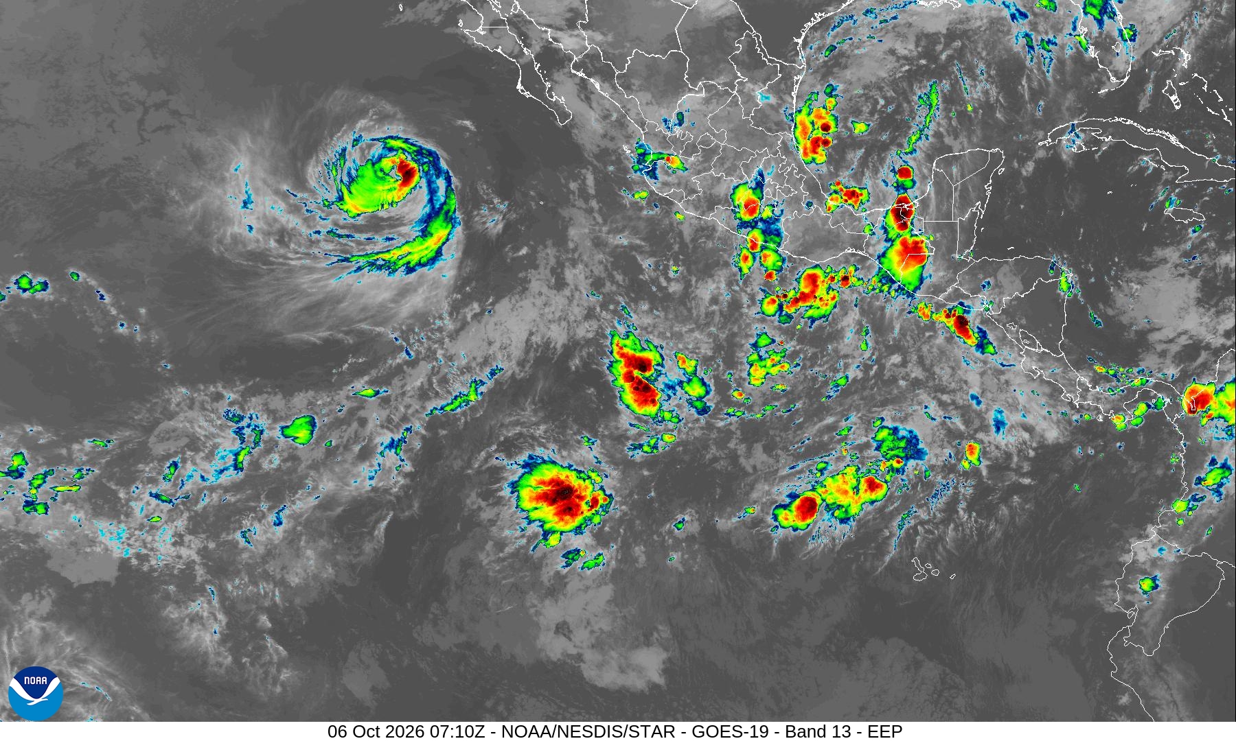
Summary: A GOES-19 satellite image of the East Pacific sector taken on October 6, 2026, using Band 13 infrared data.
This satellite image, provided by NOAA's NESDIS STAR, displays the East Pacific sector as captured by the GOES-19 Advanced Baseline Imager (ABI) on October 6, 2026, at 07:10 UTC. The image utilizes Band 13 (Clean Longwave Infrared), which is commonly used to monitor cloud top temperatures and identify tropical cyclone activity. The visual data shows a distinct cyclonic cloud formation in the upper left, along with various convective clusters over Central America and the surrounding Pacific waters.
Document outline
1. Satellite Image Overview 2. Technical Specifications 3. Geographic Coverage: East Pacific (EEP) 4. Sensor Data: GOES-19 ABI Band 13 5. Timestamp: 2026-10-06 07:10 UTC
