Latest Satellite Imagery
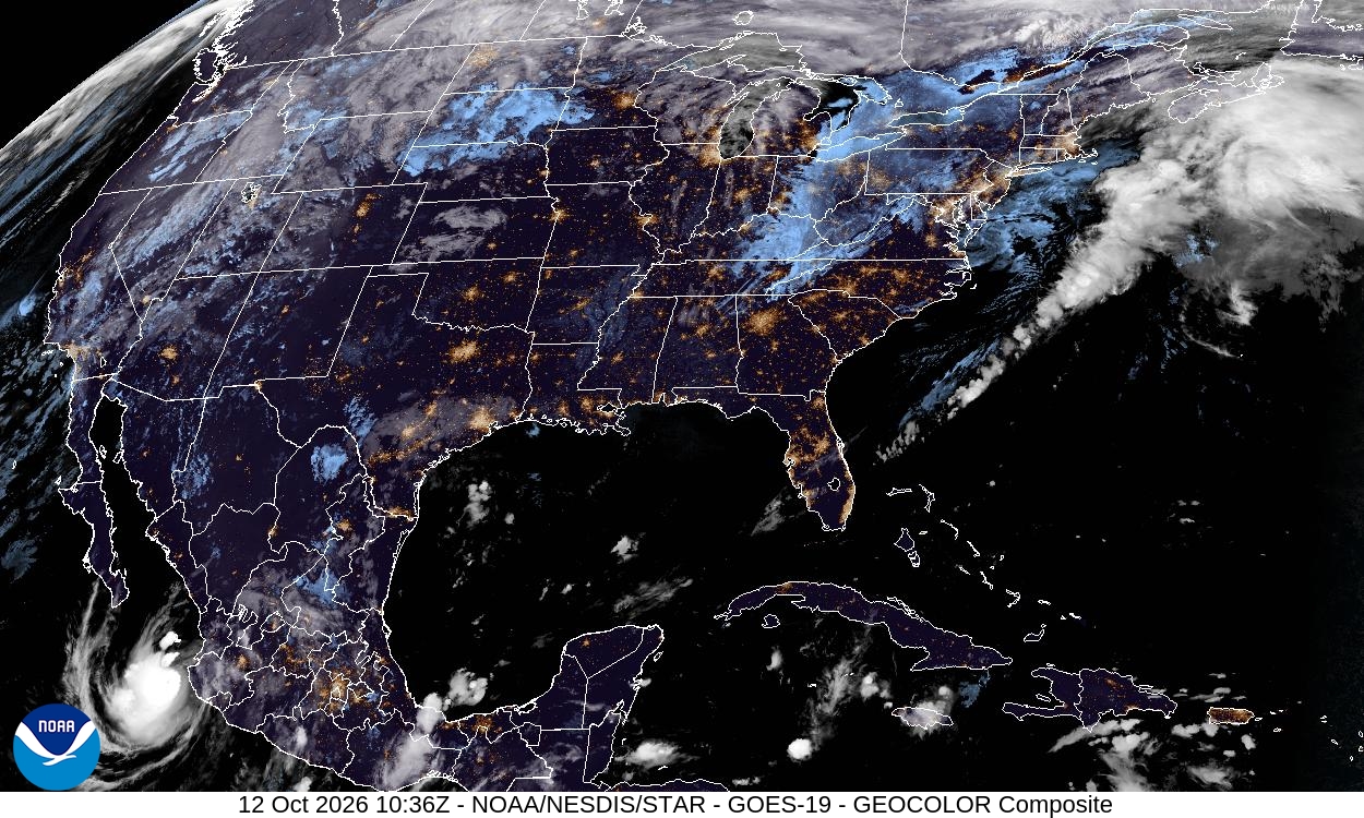
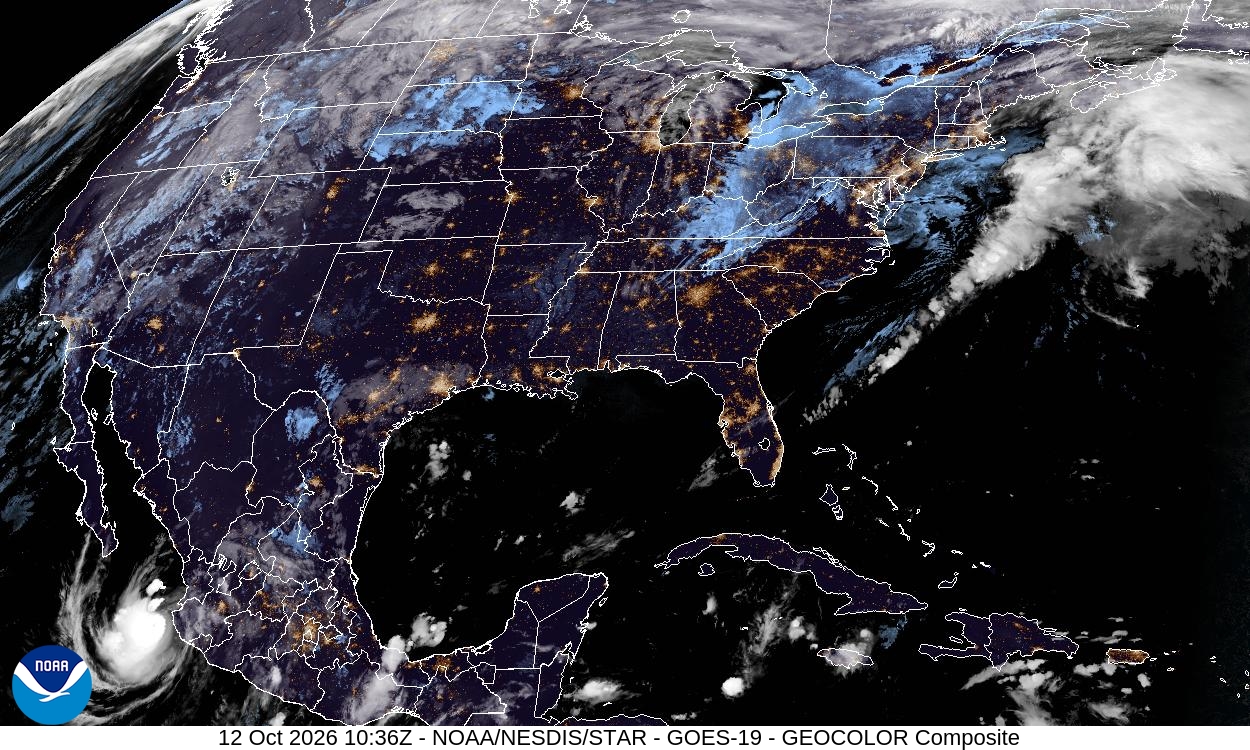
Summary: This image is a GeoColor composite satellite view of the Continental United States, provided by the GOES-19 satellite on October 12, 2026.
This high-resolution GeoColor composite image, captured by the GOES-19 satellite at 10:36Z on October 12, 2026, provides a detailed view of the Continental United States. The GeoColor product combines visible and infrared data to display realistic cloud cover and surface features, including city lights, during nighttime hours. The image is part of the National Hurricane Center's satellite imagery collection, managed by NOAA/NESDIS.
Document outline
1. Satellite Image Overview 2. Technical Specifications 3. Data Source and Attribution 4. Geographic Coverage
